Chapel Street, Liverpool

Last updated

Chapel Street, Liverpool
Chapel Street, Liverpool 2019-1.jpg
Chapel Street, Liverpool
Liverpool Centre map.png
Red pog.svg
Location Liverpool city centre
Postal codeL2
Coordinates 53°24′27″N2°59′46″W / 53.4076°N 2.9961°W / 53.4076; -2.9961
Other
Known for
  • Offices, hotels, bars

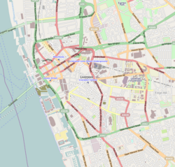
Chapel Street is a road in Liverpool, England. Situated in the city centre, it runs between Tithebarn Street and the Dock Road.

Contents

History

The street was one of the original seven streets that made up the medieval borough founded by King John in 1207, together with Water Street, Old Hall Street, Castle Street, High Street, Tithebarn Street and Dale Street. [1] The street originally contained a chapel by the quayside, known as St. Mary atte Key. [2] The first recorded reference to Chapel Street dates from 1368 on a deed for a burgage plot.

By 1355, the church was deemed too small for Liverpool's growing population and a new church was to be built on land given by the Duke of Lancaster to the burgesses. Known as Church of Our Lady and Saint Nicholas, it took over a century to build.

Over the course of time, parts of the church were demolished and rebuilt. [2] In February 1810, part of the spire collapsed into the knave below, killing 25 people. [3] The church was damaged during World War 2, and rebuilding of the church began 1949, with the new building being consecrated in October 1952.

Chapel Street was home to a boarding house and brothel in the 18th century. [4] The building was shut and converted into the Pig and Whistle pub in 1875. The pub takes its name from the crew bars on ships.

Listed buildings

Chapel Street contains several Grade II listed and buildings, these include:

Related Research Articles

<span class="mw-page-title-main">Queensway Tunnel</span> Road tunnel running under the River Mersey connecting Liverpool and Wirral

The Queensway Tunnel is a road tunnel under the River Mersey, in the north west of England, between Liverpool and Birkenhead. Locally, it is often referred to as the "Birkenhead Tunnel" or "old tunnel", to distinguish it from the newer Kingsway Tunnel (1971), which serves Wallasey and the M53 motorway traffic. At 3.24 kilometres (2.01 mi) in length, it is the longest road tunnel in the UK.

<span class="mw-page-title-main">Prescot</span> Town in England

Prescot is a town and civil parish within the Metropolitan Borough of Knowsley in Merseyside, United Kingdom. It lies about eight miles (13 km) to the east of Liverpool city centre. At the 2001 Census, the civil parish population was 11,184. The population of the larger Prescot East and West wards at the 2011 census totalled 14,139. Prescot marks the beginning of the A58 road which runs through to Wetherby, near Leeds in West Yorkshire. The town is served by Prescot railway station and Eccleston Park railway station in neighbouring Eccleston.

<span class="mw-page-title-main">Liverpool Metropolitan Cathedral</span> Catholic church in Liverpool, England

Liverpool Metropolitan Cathedral, officially known as the Metropolitan Cathedral of Christ the King and locally nicknamed "Paddy's Wigwam", is the seat of the Archbishop of Liverpool and the mother church of the Roman Catholic Archdiocese of Liverpool in Liverpool, England. The Grade II* Metropolitan Cathedral is one of Liverpool's many listed buildings.

<span class="mw-page-title-main">Rayleigh, Essex</span> Town in Essex, England

Rayleigh is a market town and civil parish in the Rochford District in Essex, England; it is located between Chelmsford and Southend-on-Sea, 32 miles (51 km) east of central London. It had a population of 32,150 at the census in 2011.

<span class="mw-page-title-main">Toxteth</span> Human settlement in England

Toxteth is an inner-city area of Liverpool in the county of Merseyside.

<span class="mw-page-title-main">Melling, Merseyside</span> Village in England

Melling is a village and civil parish within the Metropolitan Borough of Sefton, in Merseyside, England. At the 2001 Census the population was recorded as 2,810, rising to 3,493 at the 2011 Census. Melling Rock contains a public house as well as St Thomas and the Holy Rood. The town of Waddicar, of which most of the population of Melling consists, is usually regarded as part of Melling itself and is served by the parish council which is based in the local Melling Primary School.

<span class="mw-page-title-main">Mossley Hill</span> Human settlement in England

Mossley Hill is a suburb of Liverpool and a Liverpool City Council ward. Located approximately 3.5 miles south east of Liverpool City Centre, it is bordered by Aigburth, Allerton, Childwall, Garston and Wavertree. At the 2001 Census, the population was 12,650, increasing to 13,816 at the 2011 Census.

<span class="mw-page-title-main">Church of Our Lady and Saint Nicholas, Liverpool</span> Church in Liverpool, England

The Church of Our Lady and Saint Nicholas is the Anglican parish church of Liverpool. The site is said to have been a place of worship since at least the 1250s. The church is situated close to the River Mersey near the Pier Head. The Chapel of St Nicholas was built on the site of St Mary del Quay, which in 1355 was determined to be too small for the growing borough of Liverpool. It is recorded in the National Heritage List for England as a designated Grade II listed building, and is an active parish church in the diocese of Liverpool, the archdeaconry of Liverpool and the deanery of Liverpool North. It is part of the Greater Churches Group. From 1813 to 1868 the church was the tallest building in Liverpool at 174 feet [53 m], but then surpassed by the Welsh Presbyterian Church in Toxteth.

<span class="mw-page-title-main">St Francis Xavier Church, Liverpool</span> Church in Liverpool, England

St Francis Xavier's Church is a Roman Catholic church in Salisbury Street, Everton, Liverpool, Merseyside, England. The church is recorded in the National Heritage List for England as a designated Grade II* listed building. It is an active parish church in the Archdiocese of Liverpool and the Pastoral Area of Liverpool North.

<span class="mw-page-title-main">Liverpool Cathedral</span> Anglican cathedral in Liverpool, England

Liverpool Cathedral is a Church of England cathedral in the city of Liverpool, England. It is the seat of the bishop of Liverpool and is the mother church of the diocese of Liverpool. The church may be formally referred to as the Cathedral Church of Christ in Liverpool the Cathedral Church of the Risen Christ, Liverpool. It is the largest cathedral and religious building in Britain, and the eighth largest church in the world.

Grade I, Grade II* and notable Grade IIlisted buildings in the metropolitan boroughs of Knowsley, Liverpool, Sefton, St Helens and Wirral in Merseyside.

<span class="mw-page-title-main">Dale Street</span> Street in Liverpool, England

Dale Street is a thoroughfare in Liverpool city centre, England.

<span class="mw-page-title-main">Rushworth and Dreaper</span> English organ builders

Rushworth and Dreaper was a firm of organ builders, and later general instrument suppliers associated with Paul McCartney based in Liverpool. The manufacturer was founded in 1828 by William Rushworth, operating until 2002. Upon its liquidation, its archives were mostly destroyed, and the Victorian clock in the works tower was removed. The premises are now occupied by Henry Willis & Sons.

<span class="mw-page-title-main">Architecture of Liverpool</span> Overview of architecture of Liverpool, England

The architecture of Liverpool is rooted in the city's development into a major port of the British Empire. It encompasses a variety of architectural styles of the past 300 years, while next to nothing remains of its medieval structures which would have dated back as far as the 13th century. Erected 1716–18, Bluecoat Chambers is supposed to be the oldest surviving building in central Liverpool.

<span class="mw-page-title-main">Castle Street, Liverpool</span> Road in Liverpool, England

Castle Street is a road in Liverpool, England. Situated in the city centre, it runs between Water Street and Derby Square, where Liverpool Castle once stood.

<span class="mw-page-title-main">Water Street, Liverpool</span> Road in Liverpool, England

Water Street is a road in Liverpool, England. Situated in the city centre, it runs from Dale Street to the Pier Head at the River Mersey.

<span class="mw-page-title-main">Old Hall Street</span> Road in Liverpool, England

Old Hall Street is a road in Liverpool, England. Situated in the city centre, it runs between Leeds Street and Chapel Street and is part of Liverpool business district.

<span class="mw-page-title-main">High Street, Liverpool</span> Road in Liverpool, England

High Street is a road in Liverpool, England. Situated in the city centre, it runs between Exchange Flags and Dale Street and is part of Liverpool's business district.

<span class="mw-page-title-main">Tithebarn Street</span> Road in Liverpool, England

Tithebarn Street is a road in Liverpool, England. Situated in the city centre, it runs between Chapel Street and the junction of Great Crosshall Street and Vauxhall Road is part of Liverpool's Knowledge Quarter.

References

  1. Bona, Emilia (3 November 2019). "How Liverpool went from seven streets to global superpower". Liverpool Echo. Archived from the original on 28 December 2023. Retrieved 28 December 2023.
  2. 1 2 "BBC - Liverpool Local History -". www.bbc.co.uk. Retrieved 17 May 2024.
  3. Stonehouse, James (aka "A Nonagenarian") (1863). Recollections of Old Liverpool. J. F. Hughes.
  4. Hadfield, Charlotte (6 November 2021). "Liverpool's quirkiest pub that's 'nicer inside' than you think". Liverpool Echo. Retrieved 17 May 2024.