Castro of Cidadelhe

Last updated
Castro of Cidadelhe(Castro de Cidadelhe)
Castro
Official name:Castro de Cidadelhe
Country Flag of Portugal.svg  Portugal
Region Norte
Sub-region Douro
District Vila Real
Municipality Mesão Frio
Location Cidadelhe
 - coordinates 41°10′43″N7°50′40″W / 41.17861°N 7.84444°W / 41.17861; -7.84444 Coordinates: 41°10′43″N7°50′40″W / 41.17861°N 7.84444°W / 41.17861; -7.84444
Owner Portuguese Republic
For public Public
Visitation Closed (Mondays and on 1 January, Easter Sunday, 1 May and 25 December )
Easiest access Estrada Nacional EN108, at the 104 kilometre marker, from Cidadelhe, until the chapel of São Gonçalo
Management Instituto Gestão do Patrimonio Arquitectónico e Arqueológico
Operator DRCNorte (Portaria 829/2009; DR, Série II, 163, 24 August 2009
Status Property of Public Interest
Imóvel de Interesse Público
Listing Decree 26-A/92; DR, Série 1B, 126, 1 June 1992; included in the Alto Douro Vinhateiro - Região Demarcada do Douro (v. PT011701040033)

The Castro of Cidadelhe (Portuguese : Castro de Cidadelhe) is a Portuguese castro in civil parish of Cidadelhe, in the municipality of Mesão Frio.

Portuguese language Romance language that originated in Portugal

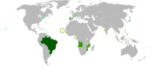
Portuguese is a Western Romance language originating in the Iberian Peninsula. It is the sole official language of Portugal, Brazil, Cape Verde, Guinea-Bissau, Mozambique, Angola, and São Tomé and Príncipe. It also has co-official language status in East Timor, Equatorial Guinea and Macau in China. As the result of expansion during colonial times, a cultural presence of Portuguese and Portuguese creole speakers are also found in Goa, Daman and Diu in India; in Batticaloa on the east coast of Sri Lanka; in the Indonesian island of Flores; in the Malacca state of Malaysia; and the ABC islands in the Caribbean where Papiamento is spoken, while Cape Verdean Creole is the most widely spoken Portuguese-based Creole. A Portuguese-speaking person or nation may be referred to as "Lusophone" in both English and Portuguese.

Portugal Republic in Southwestern Europe

Portugal, officially the Portuguese Republic, is a country located mostly on the Iberian Peninsula in southwestern Europe. It is the westernmost sovereign state of mainland Europe. It is bordered to the west and south by the Atlantic Ocean and to the north and east by Spain. Its territory also includes the Atlantic archipelagos of the Azores and Madeira, both autonomous regions with their own regional governments.

Castro culture archaeological culture

Castro culture is the archaeological term for the material culture of the north-western regions of the Iberian Peninsula from the end of the Bronze Age until it was subsumed by Roman culture. It is the culture associated with the Celtiberians, closely associated to the western Hallstatt horizon of Central Europe.

Contents

History

Cidadelhe was a fortified settlement of a proto-historic nature, later occupied by Roman and Medieval residents. [1]

The settlement belonged to a medieval administrative territory conforming to a Suevic parish, with a royal congregation under the order of Ordoño II of León and part of the territory of Portucale (during the second year of his reign, in 911).

Suebi

The Suebi were a large group of Germanic tribes, which included the Marcomanni, Quadi, Hermunduri, Semnones, Lombards and others, sometimes including sub-groups simply referred to as Suebi.

Ordoño II of León King of León

Ordoño II was a king of Galicia from 910, and king of Galicia and León from 914 until his death. He was an energetic and feisty ruler who submitted only the territories of the kingdom of Leon under his control and fought successfully against the Muslims, who still dominated most of the Iberian Peninsula. His reign marked the tactical and smooth transition of the regnum Asturum to the regnum Legionis, with the royal headquarters already established in the city of León.

Portus Cale was an ancient town and port in current-day northern Portugal, in the area of today's Grande Porto. The name of the town eventually influenced the name of the subsequent country Portugal.

Architecture

The castro is located in an isolated rural environment on a hilltop. [1]

Two lines of walls encircle the castle and roadways/paths, composed of schist rock. [1] In the interior of the ruins are several remains of residences, of a circular design, excavated by recent archaeologists. [1]

Archaeological excavations under the direction of A. Coelho, F. da Silva, A. Baptista Lopes and Manuel Tuna, were attempted into two sectors: one elevated zone, defined by the first series of walls; and the second, lower, new the second series walls. [1]

Related Research Articles

Babe (Bragança) Civil parish in Norte, Portugal

Babe is a Portuguese civil parish in the municipality of Bragança. The population in 2011 was 238, in an area of 25.62 km².

Feteira (Angra do Heroísmo) Civil Parish in Azores, Portugal

Feteira is a rural civil parish in the municipality of Angra do Heroísmo in the Portuguese archipelago of the Azores. The population in 2011 was 1,239, in an area of 5.25 square kilometres (2.03 sq mi).

Vila de São Sebastião Civil Parish in Azores, Portugal

Vila de São Sebastião, commonly shortened to São Sebastião, is a civil parish in the municipality of Angra do Heroísmo, on the island of Terceira in the Portuguese archipelago of the Azores. The population in 2011 was 2,096, in an area of 23.93 square kilometres (9.24 sq mi). It is in the southeastern part of the island of Terceira.

Alandroal Municipality in Alentejo, Portugal

Alandroal is a municipality in the Portuguese district of Évora located on the eastern frontier with Spain along the right margin of the Guadiana River in the Central Alentejo region. It is located 341 metres (1,119 ft) above sea level, northeast of Évora and southeast of Estremoz. The population in 2011 was 5,843, in an area of 542.68 km².

São Domingos de Rana Civil parish in Lisbon, Portugal

São Domingos de Rana is a civil parish of the Portuguese municipality of Cascais, part of the Greater Lisbon subregion. The population in 2011 was 57,502, in an area of 20.36 km². The parish includes the localities Abóboda, Cabeço de Mouro, Caparide, Matarraque, Outeiro de Polima, Polima, Rana, Talaíde, Tires, Trajouce and Zambujal.

Arcos de Valdevez Municipality in Norte, Portugal

Arcos de Valdevez is a municipality along the northern frontier of Portugal and Galicia (Spain). The population in 2011 was 22,847, in an area of 447.60 km². It is the largest municipality in area of the district of Viana do Castelo.

Vila Pouca de Aguiar Municipality in Norte, Portugal

Vila Pouca de Aguiar is a municipality in the district of Vila Real in northern Portugal. The population in 2011 was 13,187, in an area of 437.07 km². The town proper has about 3,456 residents.

São Domingos de Benfica Civil parish in Lisbon, Portugal

São Domingos de Benfica is a Portuguese civil parish (freguesia), located in the municipality of Lisbon. The population in 2011 was 33,043, in an area of 4.29 km².

Ferreiras Civil parish in Algarve, Portugal

Ferreiras is a civil parish in the southern Portuguese municipality of Albufeira. The population in 2011 was 6,406 in an area of 20.13 km².

Citânia de Briteiros building in Guimarãeses, Braga District, Portugal

The Citânia de Briteiros is an archaeological site of the Castro culture located in the Portuguese civil parish of Briteiros São Salvador e Briteiros Santa Leocádia in the municipality of Guimarães; important for its size, "urban" form and developed architecture, it is one of the more excavated sites in northwestern Iberian Peninsula. Although primarily known as the remains of an Iron Age proto-urban hill fort, the excavations at the site have revealed evidence of sequential settlement, extending from the Bronze to Middle Ages.

The Castle of Alcantarilha is a medieval fortress and its remnant walls in Portugal, in the civil parish of Alcantarilha, municipality of Silves, in the Portuguese Algarve region of southwestern Iberia. It is a little-known monument, now in ruins, used for the protection of the people of the village and surrounding area from attacks by north African pirates.

Castro Verde is a former civil parish in the municipality of Castro Verde, Portugal. In 2013, the parish merged into the new parish Castro Verde e Casével. In the 2001, its resident population included 3819 inhabitants.

Castle of Castro Marim building in Castro Marim Municipality, Faro District, Portugal

The Castle of Castro Marim is a medieval castle on a hilltop overlooking the civil parish of Castro Marim, in the municipality of the same name, in the Portuguese Algarve. The castle was part of the defensive line controlled by the Knights Templar, a stronghold used during the Portuguese Reconquista, and adapted during the Restoration War to defend the frontier.

Nossa Senhora do Bispo is a former civil parish in the municipality of Montemor-o-Novo, Portugal. In 2013, the parish merged into the new parish Nossa Senhora da Vila, Nossa Senhora do Bispo e Silveiras. It has an area of 121.83 km², and a population of approximately 5411 inhabitants in 2001 (approximately 44 inhabitants per km².

The Castle of Degebe is a medieval castle located in the civil parish of Reguengos de Monsaraz, in the municipality of Reguengos de Monsaraz, Portuguese district of Évora.

Castle of Vila Nova de Cerveira building in Vila Nova de Cerveira Municipality, Viana do Castelo District, Portugal

The Castle of Vila Nova de Cerveira is a medieval castle located in the civil parish of Vila Nova de Cerveira e Lovelhe, in the municipality of Vila Nova de Cerveira, Portuguese Viana do Castelo.

Castle of Óbidos Medieval Castle in Portugal

The Castle of Óbidos is a well-preserved medieval castle located in the civil parish of Santa Maria, São Pedro e Sobral da Lagoa, in the municipality of Óbidos, Portuguese district of Leiria.

The Tower of Bera is the remains of a medieval watchtower located in the civil parish of Almalaguês, in the municipality of Coimbra, Portuguese Coimbra.

Castro of Monte Mozinho building in Penafiel, Porto District, Portugal

The Castro of Monte Mozinho is a Neolithic fortified settlement, sometimes referred to as the City of the Dead, situated in the civil parish of Oldrões, in the municipality of Penafiel in the Tâmega Subregion of the Portuguese district of Porto.

Castle of Aguiar da Beira

The Castle of Aguiar da Beira, is a Portuguese medieval castle in civil parish of Aguiar da Beira e Coruche, in the municipality of Aguiar da Beira, in the Centro district of Guarda.

References

Notes
  1. 1 2 3 4 5 Sereno, Isabel; Teixeira 1993, Ricardo, SIPA, ed., Castro de Cidadelhe (IPA.00003670/PT011704020006) (in Portuguese), Lisbon, Portugal: SIPA – Sistema de Informação para o Património Arquitectónico, archived from the original on 7 November 2013, retrieved 25 August 2013
Sources