Related Research Articles

Panola County is a county located in the U.S. state of Mississippi. As of the 2020 census, the population was 33,208. Its county seats are Sardis and Batesville. The county is located just east of the Mississippi Delta in the northern part of the state. It is bisected by the Tallahatchie River flowing to the southwest; travel difficulties because of the river resulted in two county seats being established.
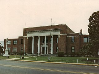
Neshoba County is located in the central part of the U.S. state of Mississippi. As of the 2020 census, the population was 29,087. Its county seat is Philadelphia.

Kiln is an unincorporated community and census-designated place (CDP) in Hancock County, Mississippi, United States. The town is located about 50 miles (80 km) northeast of New Orleans, Louisiana. It is part of the Gulfport-Biloxi Metropolitan Statistical Area. The population was 2,238 at the 2010 census.

The Tombigbee River is a tributary of the Mobile River, approximately 200 mi (325 km) long, in the U.S. states of Mississippi and Alabama. Together with the Alabama, it merges to form the short Mobile River before the latter empties into Mobile Bay on the Gulf of Mexico. The Tombigbee watershed encompasses much of the rural coastal plain of western Alabama and northeastern Mississippi, flowing generally southward. The river provides one of the principal routes of commercial navigation in the southern United States, as it is navigable along much of its length through locks and connected in its upper reaches to the Tennessee River via the Tennessee-Tombigbee Waterway.

The Piney Woods is a temperate coniferous forest terrestrial ecoregion in the Southern United States covering 54,400 square miles (141,000 km2) of East Texas, southern Arkansas, western Louisiana, and southeastern Oklahoma. These coniferous forests are dominated by several species of pine as well as hardwoods including hickory and oak. Historically the most dense part of this forest region was the Big Thicket though the lumber industry dramatically reduced the forest concentration in this area and throughout the Piney Woods during the 19th and 20th centuries. The World Wide Fund for Nature considers the Piney Woods to be one of the critically endangered ecoregions of the United States. The United States Environmental Protection Agency (EPA) defines most of this ecoregion as the South Central Plains.

The Crosby Arboretum is located in Picayune, Mississippi, United States, and is affiliated with Mississippi State University. It contains 64 acres in its interpretive center, plus over 700 acres (2.8 km2) in seven additional natural areas, sheltering over 300 species of indigenous trees and shrubs.
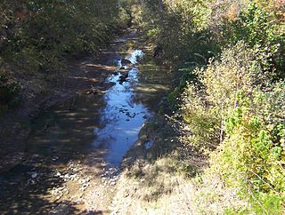
The Yockanookany River is a 78.4-mile-long (126.2 km) river in central Mississippi in the United States. It is a tributary of the Pearl River, which flows to the Gulf of Mexico.
The Mississippi Band of Choctaw Indians is one of three federally recognized tribes of Choctaw people, and the only one in the state of Mississippi. On April 20, 1945, this tribe organized under the Indian Reorganization Act of 1934. Their reservation included lands in Neshoba, Leake, Newton, Scott, Jones, Attala, Kemper, and Winston counties. The Mississippi Choctaw regained stewardship of their mother mound, Nanih Waiya mounds and cave in 2008. The Mississippi Band of Choctaw have declared August 18 as a tribal holiday to celebrate their regaining control of the sacred site. The other two Choctaw groups are the Choctaw Nation of Oklahoma, the third largest tribe in the United States, and the Jena Band of Choctaw Indians, located in Louisiana.
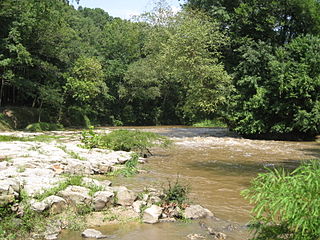
The Strong River is a 95.2-mile-long (153.2 km) river in south-central Mississippi in the United States. It is a tributary of the Pearl River, which flows to the Gulf of Mexico.
The Little River is a 96-mile-long (154 km) tributary of the Ouachita (Black) River in central Louisiana in the United States. Via the Ouachita and Red rivers, it is part of the watershed of the Mississippi River. According to the Geographic Names Information System, the Little River has also been known historically as "Bayou Des Nacitoches," "Catahoula Bayou," and "Catahoula River."
The Nonconnah Creek is a 29.7-mile-long (47.8 km) waterway in southwest Tennessee. It starts in extreme southeastern Shelby County, Tennessee, near the town of Collierville. From there, it flows westward, forming the southern border of Germantown. The creek continues to flow west through Memphis and through Whitehaven. Nonconnah Creek empties into McKellar Lake, an oxbow of the Mississippi River. There are three major expressways that follow most of its route. These are Interstate 55, Interstate 240, and Tennessee State Route 385, formerly named and still locally referred to as "Nonconnah Parkway".
Pearl River Resort is a gaming resort located in Choctaw, Neshoba County, Mississippi. It is owned and operated by the federally recognized Mississippi Band of Choctaw Indians. The resort includes two casinos, Silver Star Hotel & Casino and Golden Moon Hotel & Casino; a Dancing Rabbit Inn near the casinos; Dancing Rabbit Golf Club, an award-winning golf course designed by Jerry Pate; Geyser Falls Water Theme Park; and a spa.

The longnose shiner is a species of ray-finned fish in the genus Notropis.

The red shiner or red-horse minnow is a North American species of freshwater fish in the family Cyprinidae. They are deep-bodied and laterally compressed, and can grow to about 3 inches (7.6 cm) in length. For most of the year, both males and females have silver sides and whitish abdomens. Males in breeding coloration, though, have iridescent pink-purple-blue sides and a red crown and fins.

The blacktail shiner is a small freshwater fish in the family Cyprinidae native to the United States.
The Choctaw Corner is a former Native American boundary location near the modern border between Clarke and Marengo counties in Alabama, United States. It was established as the northernmost terminus for a mutually agreed upon boundary line between the Choctaw and Creek peoples during the Mississippi Territory period. This boundary line, now known as the “Old Indian Treaty Boundary,” starts at the Alabama River cut-off in southernmost Clarke County and follows a northward path through the county along the drainage divide between the Tombigbee and Alabama rivers to the Choctaw Corner, then turns ninety degrees to the west and follows the modern county-line between Clarke and Marengo to the Tombigbee River.

Paint Creek is a stream mostly located within Washtenaw County in the U.S. state of Michigan. The stream flows south before entering as a tributary to Stony Creek along the county line with Monroe County.
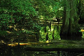
Bayou Talla is a stream in the U.S. state of Mississippi. It is a tributary to the Jourdan River.
References
- ↑ U.S. Geological Survey Geographic Names Information System: Catahoula Creek
- ↑ Browning (cited for distance only)
- ↑ Heins & Clemmer, p. 284
- ↑ Pecora, p. 696
- ↑ Heins & Clemmer, p. 284
- ↑ Heins & Clemmer, pp. 285–286
- ↑ Heins & Clemmer, p. 286
- ↑ Baca, pp. 19–20
- ↑ "Formation of Hancock County (works progress administration)", Hancock County Historical Society, retrieved and archived 28 March 2020.
- ↑ Thigpen (1965), pp. 3–68
- ↑ Heins & Clemmer, p. 286
- ↑ Heins & Rooks, p. 61
- ↑ Hood & Heins, pp. 286–287
- ↑ Perrin, pp. 86–87
- ↑ Browning