
Bass Strait is a strait separating the island state of Tasmania from the Australian mainland. The strait provides the most direct waterway between the Great Australian Bight and the Tasman Sea, and is also the only maritime route into the economically prominent Port Phillip Bay.

The Kent Group are a grouping of six granite islands located in Bass Strait, north-west of the Furneaux Group in Tasmania, Australia. Collectively, the group is comprised within the Kent Group National Park.

King Island is an island in the Bass Strait, belonging to the Australian state of Tasmania. It is the largest of four islands known as the New Year Group and the second-largest island in Bass Strait. The island's population at the 2016 census was 1,585 people, up from 1,566 in 2011. The local government area of the island is the King Island Council.
The Bass Strait Triangle is the waters that separate the states of Victoria and Tasmania, including Bass Strait, in south-eastern Australia. The term Bass Strait Triangle appears to have been first used following the disappearance of Frederick Valentich in 1978 although the region had a bad reputation long before that.

The Clarke Island, part of the Furneaux Group, is an 82-square-kilometre (32 sq mi) island in Bass Strait, south of Cape Barren Island, about 24 kilometres (15 mi) off the northeast coast of Tasmania, Australia. Banks Strait separates the island from Cape Portland on the mainland.
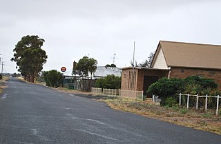
Netherby is a town in western Victoria, in Australia. The town is approximately 406 kilometres (252 mi) north west from Melbourne.

Booby Island is located 45 km (28 mi) northwest of Muttee Heads at the tip of Cape York Peninsula in Queensland, Australia. This island is in the Torres Strait, 32 km (20 mi) west of Thursday Island and 23 km (14 mi) west of Prince of Wales Island. Booby Island is also known as Ngiangu by the Kaurareg people of the western Torres Strait, its traditional owners, named for the giant Ngiangu who was forced from a neighbouring island It has been called Booby Island by a number of European explorers, including Captain Cook, for the presence of the booby birds.
Neva was a three-masted barque launched in 1813. She made two voyages transporting convicts to Australia. On her second voyage carrying convicts she wrecked in Bass Strait on 13 May 1835. Her loss was one of the worst shipwrecks in Australian history; 224 people died.

George III was a British penal transportation convict ship launched in 1810 in London. She was wrecked while transporting convicts from England to the Australian Colonies. She was wrecked in the southern end of the D'Entrecasteaux Channel, Van Diemen's Land; 134 of the 294 people on board died.

SS Lake Illawarra was a handysize bulk carrier of 7,274 tons in the service of the Australian National Line. This ship is known for causing the Tasman Bridge disaster when she collided with pylon 19 of Hobart's giant high concrete arch style Tasman Bridge on the evening of 5 January 1975 at 9.27 pm, resulting in the deaths of 12 people.

Triabunna is a rural residential locality in the local government area (LGA) of Glamorgan–Spring Bay in the South-east LGA region of Tasmania. The locality is about 86 kilometres (53 mi) north-east of the city of Hobart. The 2021 census has a population of 905 for the state suburb of Triabunna.
HMAS Matafele was a small cargo and passenger vessel which was operated by Burns Philp from 1938 to 1942 and the Royal Australian Navy (RAN) from 1943 until she was lost with all of her crew as a result of an accident in June 1944.

HMS Nairana was a passenger ferry that was requisitioned by the Royal Navy (RN) as a seaplane carrier in 1917. She was laid down in Scotland in 1914 as TSS Nairana for the Australian shipping line Huddart Parker, but construction was suspended after the outbreak of the First World War. Following resumption of work, the ship was launched in 1915, and converted to operate wheeled aircraft from her forward flying-off deck, as well as floatplanes that were lowered into the water. She saw service during the war with the Grand Fleet, and in 1918–19 supported the British intervention in the Russian Civil War.
Jack Kenneth Loney was an amateur Australian maritime historian who published over one hundred books and numerous newspaper and magazine articles. He was a schoolteacher and principal until his retirement. He became interested in maritime history after preparing several general history booklets covering the Otway region of western Victoria, Australia.

HMAS Goorangai was a 223-ton auxiliary minesweeper of the Royal Australian Navy (RAN). She was built in 1919 for the Government of New South Wales, then sold in 1926 to the fishing company Cam & Sons. The trawler was requisitioned for military service following the outbreak of World War II, converted into a minesweeper, and assigned to Melbourne. She was sunk in an accidental collision with MV Duntroon in 1940, becoming the RAN's first loss of World War II, and the first RAN surface ship to be lost in wartime.

HMS Beatrice was a 98-ton displacement, schooner launched in 1860 at Newhaven.
Netherby was a full-rigged sailing ship of the Black Ball Line that ran aground and sank off the coast of King Island—an island in Bass Strait between Tasmania and the Australian mainland—on 14 July 1866 while sailing from London to Brisbane.

The vessel MV Blythe Star was a coastal freighter which foundered off south-western Tasmania in October 1973, leading to the largest maritime search operation conducted in Australia to that time. No sign of the vessel was found until local fishing boats passing over the wreck site in the mid-to-late 1990s were able to identify the presence of a large wreck, and a bell was eventually recovered by a trawler, which was positively identified as belonging to Blythe Star in the early new millennium. The wreck was then formally identified by the CSIRO and UTAS in April 2023, having been made aware of a large, unidentified wreck prior to their survey. The crew of 10 successfully took to a small inflatable liferaft, but it was not until after 11 days, and the deaths of three seamen, that the survivors were found ashore in rugged terrain near Deep Glen Bay on Tasmania's southeast coast. As a result of this tragedy, the AUSREP maritime position reporting system was introduced to the Australian Navigation Act.
The Tasmanian Seafarers' Memorial is a public memorial structure located at Triabunna, Tasmania which jointly commemorates all Tasmanians who died at sea, along with the lives of all seafarers of any origin who lost their lives in Tasmanian waters. The memorial comprises individual commemorative plaques for each maritime tragedy involving recreational, commercial, mercantile or naval vessels and personnel lost since 1803. As of February 2017, the memorial contained plaques for 116 events involving the loss of over 1450 lives.
