Related Research Articles
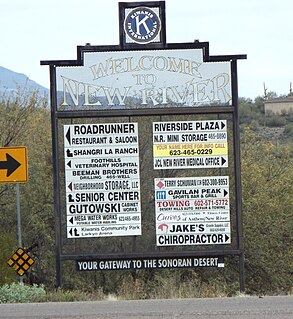
New River is an unincorporated community and a census-designated place (CDP) in Maricopa County, Arizona, United States. The population was 14,952 at the 2010 census.

Northern Arizona is an unofficial, colloquially-defined region of the U.S. state of Arizona. Generally consisting of Apache, Coconino, Mohave, and Navajo counties, the region is geographically dominated by the Colorado Plateau, the southern border of which in Arizona is called the Mogollon Rim.
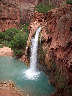
Havasu Falls is a waterfall of Havasu Creek, located in the Grand Canyon, Arizona, United States. It is within Havasupai tribal lands.

The Arizona Strip is the part of Arizona lying north of the Colorado River. The difficulty of crossing the Grand Canyon causes this region to have more physical and cultural connections with southern Utah and Nevada than with the rest of Arizona. The largest settlements in the Strip are Colorado City, Fredonia, and Beaver Dam, with its surrounding communities of Scenic, Littlefield and Desert Springs.
The Mogollon Plateau or Mogollon Mesa is a pine-covered southern plateau section of the larger Colorado Plateau in east-central Arizona and west-central New Mexico, United States. The southern boundary of the plateau is the Mogollon Rim. The Mogollon Plateau is 7,000–8,000 feet (2,100–2,400 m) high. The plateau lends its name to the Mogollon tribe, part of the Cochise-Mogollan peoples who inhabited this and nearby areas from 5,000 to 2,500 years ago. Their descendants are believed to include the Anasazi.
The Beaver Dam Wash is a seasonal stream near the southwestern Utah-Nevada border in the United States. At its southern end in northern Arizona, near the point where it empties into the Virgin River, the stream flows throughout the year. Part of the wash is in the Beaver Dam Wash National Conservation Area, managed by the Bureau of Land Management. The wash was so named on account of beaver dams which once were built on its course.

The Wickenburg Massacre was the November 5, 1871, murder of six stagecoach passengers en route westbound from Wickenburg, Arizona Territory, headed for San Bernardino, California, on the La Paz road.
The Black Mountains of northwest Arizona are an extensive, mostly linear, north-south trending 75 miles (121 km) long mountain range. It forms the north-south border of southwest Mohave County as it borders the eastern shore of the south-flowing Colorado River from Hoover Dam.

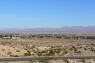
Desert Hills is an unincorporated community in Maricopa County, Arizona, United States. It is located in the New River census-designated place. Sitting on over 4.31 sq. mi. of the 85086 Zip Code, And the (623) Area Code, forming the southern boundary of Anthem and the western boundary of Cave Creek: about 30 miles (48 km) north of downtown Phoenix. Located east of the I-17, Desert Hills is roughly bounded by 35th Avenue to the west, Desert Hills Drive to the north, 28th Street to the east. The majority of Desert Hills sits north of Carefree Highway, however, a small portion resides south from Central Avenue to the west to 14th Street to the east: and south for one mile to Dove Valley Road. Note a community known as Tramonto, falls within these boundaries but is considered part of Phoenix.

Havasu Creek is a stream in the U.S. state of Arizona associated with the Havasupai people. It is a tributary to the Colorado River, which it enters in the Grand Canyon.

Temescal Creek is an approximately 29-mile-long (47 km) watercourse in Riverside County, in the U.S. state of California. Flowing primarily in a northwestern direction, it connects Lake Elsinore with the Santa Ana River. It drains the eastern slopes of the Santa Ana Mountains on its left and on its right the western slopes of the Temescal Mountains along its length. With a drainage basin of about 1,000 square miles (2,600 km2), it is the largest tributary of the Santa Ana River, hydrologically connecting the 720-square-mile (1,900 km2) San Jacinto River and Lake Elsinore watersheds to the rest of the Santa Ana watershed. However, flowing through an arid rain shadow zone of the Santa Ana Mountains, and with diversion of ground water for human use, the creek today is ephemeral for most of its length, except for runoff from housing developments and agricultural return flows.

The Gila Bend Mountains are a 35-mile (56 km) long mountain range of the north-central Sonoran Desert southwest of Phoenix, Arizona and in southwest Maricopa County.

The Belmont Mountains are a 25 mi (40 km) long, arid, low elevation mountain range about 50 mi west of Phoenix, Arizona in the northern Sonoran Desert, north of the Gila River. The range is in the south of a region of two parallel washes; the Bouse Wash flows northwest to the Colorado River, and the Centennial Wash flows southeast to meet the Gila River.

The Phoenix Mountains Preserve is a group of parks located among the Phoenix Mountains in Phoenix, Arizona, United States. The Phoenix Mountains Park and Recreation Area, the first of these parks to be preserved, has been designated as a Phoenix Point of Pride. Two of the parks rank among the world's largest city parks.

North Mountain and Shaw Butte are two adjacent mountains in the Phoenix Mountains Preserve in Phoenix, Arizona. The two mountains lie to the south of Thunderbird Road, north of Hatcher Road, east of North 19th Avenue, and west of North Cave Creek Road.

Deer Valley or Deer Valley Village is one of the 15 urban villages that make up Phoenix, Arizona, United States. As of 2010, the population was 165,656, 25% of whom were under 18 years of age. The origin of the name is unclear; it first appeared on a 1921 General Land Office map of the area describing the valley created by Skunk Creek.
Sheep Creek is a geographical place name. With variations, the name is given to hundreds of bodies of water, roads, canals, reservoirs and populated areas in the United States and other countries. It is the name of a tributary to Lockyear Creek in Queensland, Australia, and the name of at least three bodies of water in Canada. The U.S. state of Montana has 85 different locales that bear that name or a derivation. The U.S. state of Idaho has 92 natural and man-made areas that incorporate Sheep Creek into their names. Nature areas that include trails named Sheep Creek can be found in Canada's Yukon Territory, Colorado's Larimer County and in Utah's Bryce Canyon National Park.
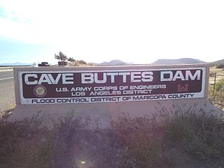
The Cave Buttes Dam is an earthen dam located near Cave Creek, Arizona. As a dry dam, it is the primary dam to prevent flooding in North Phoenix. Built in 1979 to replace the nearby Cave Creek Dam, it is designed to prevent flooding in the city from the Cave Creek Wash.

Aztec Pass is a gap and a valley between the Juniper Mountains and Santa Maria Mountains in Yavapai County, Arizona. The summit of the pass is at an elevation of 6,232 feet, at 34°56′12″N112°58′12″W the divide between Muddy Wash on the west and Walnut Creek on the east. The eastern entrance to the pass is at the mouth of the valley of Walnut Creek where it emerges from the hills on the west side of Chino Valley at 34°58′54″N112°38′04″W at an elevation of 4,583 feet / 1,397 meters. The western entrance to the pass is at the top of the valley of Muddy Wash at the foot of the Juniper Mountains, located at 34°58′30″N113°02′03″W.
References
- ↑ Thompson, Clay (4 August 2014). "Why is there a dam on an empty wash in Cave Creek?". Arizona Republic . Retrieved 15 November 2015.
Coordinates: 33°43′32.09″N112°2′50.13″W / 33.7255806°N 112.0472583°W