Central Napier

Last updated

Central Napier
Fountain Napier 2 (31680203112).jpg
Blythe Memorial Fountain
Central Napier
Country New Zealand
City Napier
Electoral wardNelson Park
Population
 (2018) [1]
  Total420
Hospital Hill Bluff Hill
Pfeil oben.svg
Pfeil links.svgCentral NapierPfeil rechts.svg
Pfeil unten.svg
(Hawke Bay)
Napier South

Central Napier is the central area and business district of Napier, in the Hawke's Bay region of New Zealand's eastern North Island. It enjoys two schools in the main area - Nelson Park School and Napier Intermediate. The main shopping street/downtown area of Napier is Emerson Street. Central Napier enjoys Art Deco style architecture on surrounding buildings in Emerson Street. Housing in Central Napier is quite calm, with housing options available in various places throughout Central Napier. Most houses were built between 1900-2010.

Contents

Economy

Retail

Mid City Plaza opened between 1920 and 1933. It covers 3,177 m², and had 9 tenants and 20 carparks in May 2019. [2]

Ocean Boulevard Mall opened in 1976. It contained just two tenants and no publicly available carparks in March 2020. [3]

Demographics

Historical population
YearPop.±% p.a.
2006405    
2013414+0.31%
2018420+0.29%
Source: [1]
Clive Square Clive Square East at Emerson, Napier P1220236.jpg
Clive Square

Napier Central had a population of 420 at the 2018 New Zealand census, an increase of 6 people (1.4%) since the 2013 census, and an increase of 15 people (3.7%) since the 2006 census. There were 126 households. There were 237 males and 186 females, giving a sex ratio of 1.27 males per female. The median age was 31.9 years (compared with 37.4 years nationally), with 45 people (10.7%) aged under 15 years, 144 (34.3%) aged 15 to 29, 192 (45.7%) aged 30 to 64, and 36 (8.6%) aged 65 or older.

Ethnicities were 69.3% European/Pākehā, 23.6% Māori, 4.3% Pacific peoples, 11.4% Asian, and 4.3% other ethnicities (totals add to more than 100% since people could identify with multiple ethnicities).

The proportion of people born overseas was 35.0%, compared with 27.1% nationally.

Although some people objected to giving their religion, 52.1% had no religion, 30.7% were Christian, 0.7% were Muslim, 3.6% were Buddhist and 6.4% had other religions.

Of those at least 15 years old, 57 (15.2%) people had a bachelor or higher degree, and 42 (11.2%) people had no formal qualifications. The median income was $22,700, compared with $31,800 nationally. The employment status of those at least 15 was that 216 (57.6%) people were employed full-time, 60 (16.0%) were part-time, and 15 (4.0%) were unemployed. [1]

Related Research Articles

Central Hawkes Bay District Territorial authority in Hawkes Bay, New Zealand

Central Hawke's Bay District is part of the Hawke's Bay Region in the North Island of New Zealand. Formed in 1989, it has an area of 3,327.92 square kilometres with a population of 15,600. It had a population of 12,717 people as of the 2013 census. This is a decrease of 237 people, or 1.8 percent, since the 2006 census. It covers the area from Pukehou in the north to Takapau in the south, and from the western Ruahine Range to the Pacific coast in the east.

Hastings District Territorial authority in Hawkes Bay Region, New Zealand

Hastings District is a territorial authority district within the Hawke's Bay Region, on the east coast of the North Island of New Zealand. It covers the southern half of the Hawke's Bay coast, excluding Napier City, which is a separate territorial authority. Hastings District Council is headquartered in the city of Hastings, the district's largest town.

Clive, New Zealand Town in New Zealand

Clive is a small town, ten kilometres from the city centres of both Napier and Hastings in the Hawke's Bay region of New Zealand's North Island. It is close to the mouth of the Ngaruroro River.

Hornby, New Zealand Suburb of Christchurch in Christchurch City Council, New Zealand

Hornby is a major residential and retail suburb at the western edge of Christchurch, New Zealand. The suburb is directly connected to other parts of Christchurch and the South Island by a number of main arterial routes, including State Highway 1 and the Christchurch Southern Motorway.

Napier Hill Suburb of Napier in New Zealand

Napier Hill is a limestone outcrop and suburb rising above the lowland districts of the city of Napier on New Zealand's North Island.

Palmerston North Central Central business district in Manawatū-Whanganui region, New Zealand

Palmerston North Central is the central suburb and central business district of Palmerston North, on New Zealand's North Island.

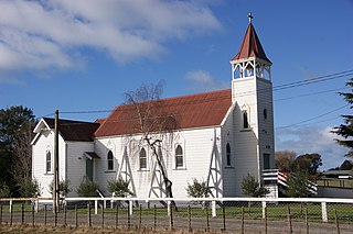
Bay View is a settlement in the Hawke's Bay region of the eastern North Island of New Zealand. It lies on State Highway 2, nine kilometres north of the city centre of Napier. The Esk River flows into the sea just to the north. Hawke's Bay Airport and the Napier suburb of Westshore lie just to the south. Bay View has been administered by the Napier City Council since the 1989 local government reforms.

Onekawa is a suburb of the city of Napier, in the Hawke's Bay Region of the eastern North Island of New Zealand.

Maraenui is a suburb of the city of Napier, in the Hawke's Bay region of New Zealand's eastern North Island.

Ahuriri Suburb of Napier in New Zealand

Ahuriri is a suburb of the city of Napier, in the Hawke's Bay region of New Zealand's eastern North Island.

Greenmeadows is a suburb of the city of Napier, in the Hawke's Bay region of New Zealand's eastern North Island. It is part of the Taradale ward of Napier and was part of the earlier Taradale Borough.

Westshore, New Zealand Suburb of Napier in New Zealand

Westshore is a northern coastal suburb of the city of Napier in Hawke's Bay, New Zealand.

Marewa is a suburb of the city of Napier, in the Hawke's Bay Region of New Zealand's eastern North Island.

Poraiti is a semi-rural suburb of the city of Napier, in the Hawke's Bay region of New Zealand's eastern North Island.

Camberley is a suburb of Hastings City, in the Hawke's Bay Region of New Zealand's North Island.

Hastings Central Suburb of Hastings in New Zealand

Hastings Central is the central suburb and business district of Hastings City, in the Hawke's Bay Region of New Zealand's North Island.

Pirimai is a suburb of the city of Napier, in the Hawke's Bay region of New Zealand's eastern North Island.

Hawkes Bay District Health Board

The Hawke's Bay District Health Board is a district health board with the focus on providing healthcare to Hawke's Bay, New Zealand.

Rotorua Central Suburb of Rotorua Lakes in New Zealand

Rotorua Central is the central business district and central suburb of Rotorua, in the Bay of Plenty region of New Zealand's North Island.

Napier South Suburb of Napier in New Zealand

Napier South is a suburb of the city of Napier, in the Hawke's Bay region of New Zealand's eastern North Island.

References

  1. 1 2 3 "Statistical area 1 dataset for 2018 Census". Statistics New Zealand. March 2020. Napier Central (214300). 2018 Census place summary: Napier Central
  2. "Napier's historic Mid City Plaza". New Zealand Media and Entertainment. New Zealand Herald. 18 May 2019.
  3. Fuller, Christian (4 March 2020). "Napier store owner considers future amid mall car park privatisation". New Zealand Media and Entertainment. Hawke's Bay Today.

Coordinates: 39°29′31″S176°54′49″E / 39.491875°S 176.913612°E / -39.491875; 176.913612