
Neamț County is a county (județ) of Romania, in the historic region of Moldavia, with the county seat at Piatra Neamț. The county takes its name from the Neamț River.
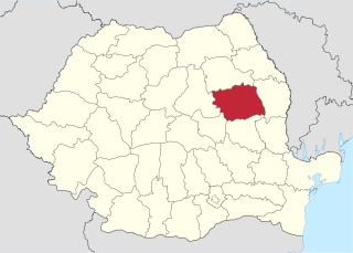
Bacău County is a county (județ) of Romania, in Western Moldavia, with its capital city at Bacău. It has one commune, Ghimeș-Făget, in Transylvania.

Onești is a city in Bacău County, Romania, with a population of 39,172 inhabitants. It is situated in the historical region of Moldavia.

The Siret or Sireth is a river that rises from the Carpathians in the Northern Bukovina region of Ukraine, and flows southward into Romania before it joins the Danube. It is 647 km (402 mi) long, of which 559 km (347 mi) in Romania, and its basin area is 44,811 km2 (17,302 sq mi), of which 42,890 km2 (16,560 sq mi) in Romania. Its average discharge is 250 m3/s (8,800 cu ft/s). In ancient times, it was named Hierasus.

The Trotuș is a river in eastern Romania, a right tributary of the river Siret. It emerges from the Ciuc Mountains in the Eastern Carpathians and joins the Siret in Domnești-Sat near Adjud after passing through Comănești and Onești in Bacău County. The total length of the Trotuș from its source to its confluence with the Siret is 162 km (101 mi). Its basin area is 4,456 km2 (1,720 sq mi).
The Cladova is a right tributary of the river Mureș in Romania. It discharges into the Mureș near Radna. Its length is 16 km (9.9 mi) and its basin size is 71 km2 (27 sq mi).
The Stejar is a right tributary of the river Mureș in Romania. It discharges into the Mureș in Stejar. Its length is 16 km (9.9 mi) and its basin size is 45 km2 (17 sq mi). Its name means Oak tree in Romanian and "Deer Branch" in Hungarian.
The Tazlău is a left tributary of the river Trotuș in Romania. Its source is in the Tarcău Mountains. It discharges into the Trotuș in Slobozia, near the city Onești. The Belci Dam, which failed in 1991, was built on the river Tazlău. The following villages are situated along the river Tazlău, from source to mouth: Tazlău, Frumoasa, Balcani, Ludași, Pârjol, Tărâța, Hemieni, Scorțeni, Tescani, Berești-Tazlău, Sănduleni, Livezi, Helegiu and Slobozia. Its length is 12 km (7.5 mi) and its basin size is 38 km2 (15 sq mi).
The Tazlăul Sărat is a right tributary of the river Tazlău in Romania. It discharges into the Tazlău in Tescani. The following towns and villages are situated along the river Tazlăul Sărat, from source to mouth: Bolătău, Zemeș, Moinești, Găzărie, Prohozești, Negreni, Șesuri, Leontinești and Ardeoani. Its length is 46 km (29 mi) and its basin size is 210 km2 (81 sq mi).
The Cucuieți is a right tributary of the river Tazlău in Romania. It discharges into the Tazlău in Pârjol. Its length is 13 km (8.1 mi) and its basin size is 27 km2 (10 sq mi).
The Boul is a left tributary of the river Tazlău in Romania. It discharges into the Tazlău near Scorțeni. Its length is 12 km (7.5 mi) and its basin size is 24 km2 (9.3 sq mi).
The Solonț is a right tributary of the river Tazlău in Romania. It discharges into the Tazlău in Tărâța. Its length is 14 km (8.7 mi) and its basin size is 38 km2 (15 sq mi).
The Schit is a right tributary of the river Tazlău in Romania. It discharges into the Tazlău in Balcani. Its length is 12 km (7.5 mi) and its basin size is 63 km2 (24 sq mi).
The Bârsănești is a right tributary of the river Tazlău in Romania. Its length is 13 km (8.1 mi) and its basin size is 23 km2 (8.9 sq mi).
The Lupul is a right tributary of the river Tazlău in Romania. It flows into the Tazlău in Poiana. Its length is 9 km (5.6 mi) and its basin size is 17 km2 (6.6 sq mi).
The Moreni is a right tributary of the river Tazlău in Romania. It discharges into the Tazlău in Scăriga. Its length is 12 km (7.5 mi) and its basin size is 53 km2 (20 sq mi).
The Răchitiș is a left tributary of the river Tazlău in Romania. It discharges into the Tazlău in Sănduleni. Its length is 18 km (11 mi) and its basin size is 55 km2 (21 sq mi).
The Orășa is a left tributary of the river Tazlău, in Romania. It flows into the Tazlău near Livezi. Its length is 12 km (7.5 mi) and its basin size is 31 km2 (12 sq mi).
The Borzontul Mare is a left tributary of the river Mureș in Romania. It discharges into the Mureș near Joseni. The upper reach of the river is also known as Putna. Its length is 15 km (9.3 mi) and its basin size is 46 km2 (18 sq mi).

The Danube is the second-longest river in Europe, after the Volga in Russia. It flows through much of Central and Southeastern Europe, from the Black Forest into the Black Sea. Its longest headstream Breg rises in Furtwangen im Schwarzwald, while the river carries its name from its source confluence in Donaueschingen onwards.
