Antigua Guatemala, commonly known as Antigua or La Antigua, is a city in the central highlands of Guatemala. The city was the capital of the Captaincy General of Guatemala from 1543 through 1773, with much of its Baroque-influenced architecture and layout dating from that period. These characteristics had it designated as a UNESCO World Heritage Site in 1979. Antigua Guatemala serves as the capital of the homonymous municipality and the Sacatepéquez Department.

Lake Atitlán is a lake in the Guatemalan Highlands of the Sierra Madre mountain range. The lake is located in the Sololá Department of southwestern Guatemala. It is known as the deepest lake in Central America.

Las Condes is a commune of Chile located in Santiago Province, Santiago Metropolitan Region. The area is inhabited primarily by upper-mid- to high income families, and known in the Chilean collective consciousness as home to the country's economic elite. Most of Las Condes' commercial activity is situated along Apoquindo Avenue, which is called colloquially "Sanhattan". It belongs to the Northeastern zone of Santiago de Chile.

The Almolonga volcano, also called "Cerro Quemado" or "La Muela" due to its distinct shape, is an andesitic stratovolcano in the south-western department of Quetzaltenango in Guatemala. Part of the mountain range of the Sierra Madre, the volcano is located near the town of Almolonga, just south of Quetzaltenango, Guatemala's second largest city.

Cerro Navia is a commune of Chile located in Santiago Province, Santiago Metropolitan Region. It is one of the most densely populated communes of Santiago, Chile.

San Cristóbal Hill is a hill in northern Santiago, Chile. It rises 850 m AMSL and about 300 m above the rest of Santiago; the peak is the third highest point in the city, after Cerro Manquehue and Cerro Renca. Cerro San Cristóbal was named by the Spanish conquistadors for St Christopher, in recognition of its use as a landmark. Its original indigenous name is Tupahue.

Jocotenango is a town and small municipality in the northeast section of Guatemalan department of Sacatepéquez, and is situated north of Antigua Guatemala. It has seven zones, two villages, and one hamlet. According to the 2018 census, the municipality has a total population of 21,657 of which 1,680 are native population and the balance are non-indigenous; and approximately 19,280 live in an urban area, while the balance are rural dwellers.
Santiago Gabriel Salcedo González, nicknamed Sasá, is a Paraguayan association football player currently playing for Sol de América in Primera División Paraguaya.

Volcán Chingo is a stratovolcano on the border between Guatemala and El Salvador. The highest point on the Guatemala/ El Salvador border is Volcán Chingo at 5,823 feet. It is also known to be the second highest of a group of volcanoes in the SE Guatemala region. The population of people living within 30 km of the Volcán Chingo is estimated to be around 867,678 people. There are no historical eruptions documented for this volcano but it is currently active. The exact volcano number when trying to locate it in the Smithsonian website is 342170.

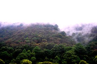
The Central American pine–oak forests is a tropical and subtropical coniferous forests ecoregion in the mountains of northern Central America and Chiapas state in southern Mexico.
The Real Audiencia of Santiago de Guatemala, simply known as the Audiencia of Guatemala or the Audiencia of Los Confines, was a Real Audiencia in the Imperial Spanish territory in Central America known as the Captaincy General of Guatemala (1609-1821). The Audiencia's presiding officer, the president, was the head of the government of the area. The Audiencia was initially created by decrees of November 20, 1542 and September 13, 1543, and had its seat in Antigua Guatemala.

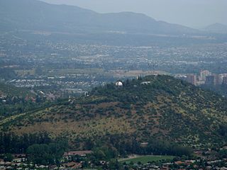
The National Astronomical Observatory of Chile is an astronomical observatory owned and operated by the Department of Astronomy of the University of Chile (UCh). It is located on Cerro Calán, a hill in the commune of Las Condes. The commune is an eastern suburb of Santiago located in Santiago Province of the Santiago Metropolitan Region. OAN was founded in 1852 and became a part of UCh in 1927. The facility on Cerro Calán was completed in 1962.

Cerro Blanco is an underground metro station on the Line 2 of the Santiago Metro, in Santiago, Chile. The station takes its name from the nearby Cerro Blanco. It was opened on 8 September 2004 as the northern terminus of the extension of the line from Puente Cal y Canto. On 25 November 2005 the line was extended further north to Einstein.

Santiago Metro Line 2 is one of the seven rapid transit lines that currently make up the Santiago Metro network in Santiago, Chile. It has 26 stations and 25.9 km (16.1 mi) of track. The line intersects with Line 1 at Los Héroes, with the Line 3 at Puente Cal y Canto, with Line 4A at La Cisterna, with Line 5 at Santa Ana, and Line 6 at Franklin. It will also intersect with the future Line 7 and Line 9 at Puente Cal y Canto. Its distinctive colour on the network line map is banana yellow.

Cerro Quiac is a small Maya archaeological site located at an altitude of 2,635 metres (8,645 ft), overlooking the Plains of Urbina in the Guatemalan Highlands. When investigated in 1970 it had five stone sculptures, by 1977 only four were left. The sculptures included figures and geometric decoration. The site is still used for contemporary Maya rituals. Cerro Quiac is located in the northeast of the municipality of Cantel, within the boundaries of the hamlet of Chirijquiac.
Santiago Arzamendia Duarte is professional footballer who plays as a left-back for Argentine club Estudiantes. Born in Argentina, he plays for the Paraguay national team.

The Cerro de la Viga is a mountain located in the municipalities of Arteaga, Coahuila and Santiago, Nuevo León in northeastern Mexico. Its peak named Cerro San Rafael culminates at 3,712 m above the sea level and has a prominence of 1,395 m. It is the highest point in Coahuila and the second highest point in the Sierra Madre Oriental and in northern Mexico. The mountain is surrounded by the Cerro Rancho Nuevo, Sierra El Álamo, Sierra San Isidro, Sierra Mauricio, Sierra El Muerto (Santiago), El Coahuilón, Sierra Las Alazanas and Cerro La Mina.


