The Leuni were an ancient Celtic tribe of Gallaecia, living in the north of modern Portugal, in the province of Minho, between the rivers Lima and Minho.
The Quaquerni were an ancient Celtic tribe of Gallaecia, living in the north of modern Portugal, province of Minho, in the mountains at the mouths of the rivers Tâmega and Cávado.
The Seurbi were an pre-Roman group of tribes living in the north of modern Portugal, in the province of Minho, between the rivers Cávado and Lima.

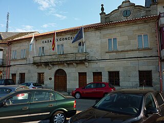
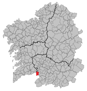
Salvaterra de Miño is a municipality (concello) in Galicia, Spain in the province of Pontevedra. The Municipality is located on the southern border of the province of Pontevedra, at the confluence of the valleys of the rivers Tea and Minho, and by the natural limits of the Serra da Cañiza. It borders the Municipalities of As Neves in the east, Mondariz and Poteareas to the north, and to the south by the Minno river. The Minno river is the southern natural border that today separates Portugal with its fortified town of Monção from current Galicia to the north.
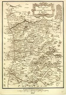
Entre Douro e Minho is one of the historical provinces of Portugal which encompassed the country's northern Atlantic seaboard between the Douro and Minho rivers. Contemporaries often referred to the province as simply "Minho". It was one of six provinces Portugal was commonly divided into from the early modern period until 1936, although these provinces were not recognized as official units of government.
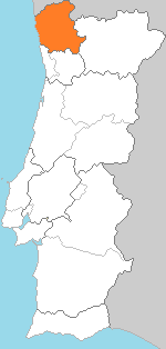
Minho was a former province of Portugal, established in 1936 and dissolved in 1976. It consisted of 23 municipalities, with its capital in the city of Braga. Today, the area would include the districts of Braga and Viana do Castelo. Minho has substantial Celtic influences and shares many cultural traits with neighbouring Galicia in Northwestern Spain. The region was part of the Roman Province and early Germanic medieval Kingdom of Gallaecia. Historical remains of Celtic Minho include Briteiros Iron Age Hillfort, the largest Gallaecian native stronghold in the Entre Douro e Minho region, in North Portugal. The University of Minho, founded in 1973, takes its name from the former province.
Minho or Miño may refer to:

Minho or Miño is the longest river in Galicia, sharing the border with Portugal, with a length of 340 kilometres (210 mi). By discharge, it is the fourth river of the Iberian peninsula, after the Douro, Ebro and Tagus.

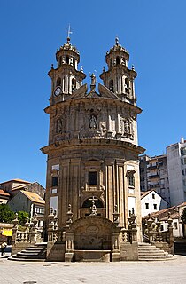
The Comunidade Intermunicipal do Cávado is an administrative division in northern Portugal. It was created in 2008. It is also a NUTS3 subregion of the Norte Region. The seat of the intermunicipal community is Braga. Cávado comprises part of the former Braga District. The population in 2011 was 410,169, in an area of 1,245.79 km², which makes it one of the most densely populated subregions of Portugal.

Póvoa de Varzim, with an area of 82.06 square kilometres, lies between the Cávado and Ave Rivers, or, from a wider perspective, halfway between the Minho and Douro Rivers on the northern coast of Portugal. Although in administrative reforms of 1936, the city was integrated in Douro Litoral, the case for such an administrative integration is arguable, because Póvoa de Varzim is found in a transition region. It has characteristic Minho traditions, historical and demographic bounds with several towns and villages in the region, religiously it is part of Braga archdiocese, and due to that it is perhaps preferable to recognize Póvoa as part of the old region, favouring more Entre-Douro-e-Minho, given its central geographic position in this region.

O Baixo Miño is a comarca in the Galician province of Pontevedra. The overall population of this local region is 48,042. To the west of O Baixo Miño lies the Atlantic Ocean and to its southeast is the Minho River, which forms a natural boundary with Portugal.
Pevidém is a village in the municipality of Guimarães, province Minho, Portugal.

Portomarín is a municipality in the Spanish province of Lugo. It has a population of 2008 and an area of 115 km². It is located on the pilgrimage route known as the French Way of the Camino de Santiago.

A Pastoriza is a municipality in the Spanish province of Lugo. It has a population of 3,911 and an area of 175 km². It belongs to the Terra Chá region. In this county the most important river in Galicia begins and one of the most plentiful in Spain, the Minho River.
Riocavado de la Sierra is a municipality and town located in the province of Burgos, Castile and León, Spain. According to the 2004 census (INE), the municipality had a population of 71.

Ave River is a river in Northern Portugal. It has its source in the Cabreira Mountain in the Minho Region. In it`s course passes through the cities of Guimaraes, Vizela, Santo Tirso, Trofa and Vila do Conde. The Vizela River and Este River (Portugal) flows into it. The Ave flows into the Atlantic Ocean in the city of Vila do Conde.

The Ponte da Barbeita is a Gothic bridge that cross the Rio Mouro in the civil parish, municipality of Monção, in the Portuguese district of Viana do Castelo.
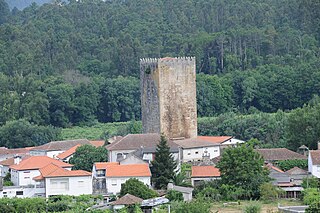
The Castle of Lapela is a ruined medieval castle located next to the Minho River in the town of Lapela, in Monção municipality, Viana do Castelo District, Portugal.