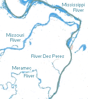
St. Louis is an independent city in the U.S. state of Missouri. It is located near the confluence of the Mississippi and the Missouri rivers. In 2020, the city proper had a population of 301,578, while its bi-state metropolitan area, which extends into Illinois, had an estimated population of over 2.8 million. It is the largest metropolitan area in Missouri and the second largest in Illinois. The city's combined statistical area (CSA) is the 20th largest in the United States.

Hannibal is a city along the Mississippi River in Marion and Ralls counties in the U.S. state of Missouri. According to the 2020 U.S. Census, the population was 17,312, making it the largest city in Marion County. The bulk of the city is in Marion County, with a tiny sliver in the south extending into Ralls County.
The Saint Louis Zoo, officially known as the Saint Louis Zoological Park, is a zoo in Forest Park, St. Louis, Missouri. It is recognized as a leading zoo in animal management, research, conservation, and education. The zoo is accredited by the Association of Zoos and Aquariums (AZA). Admission is free based on a public subsidy from a cultural tax district, the Metropolitan Zoological Park and Museum District (ZMD); fees are charged for some special attractions. A special feature is the 2 ft narrow-gauge Emerson Zooline Railroad with passenger trains pulled by Chance Rides C.P. Huntington locomotives that encircle the zoo, stopping at the more popular attractions.

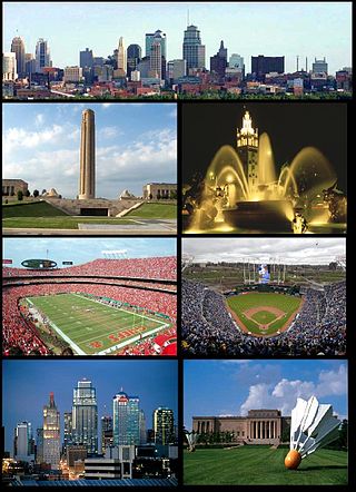
The Kansas City metropolitan area is a bi-state metropolitan area anchored by Kansas City, Missouri. Its 14 counties straddle the border between the U.S. states of Missouri and Kansas. With 8,472 square miles (21,940 km2) and a population of more than 2.2 million people, it is the second-largest metropolitan area centered in Missouri and is the largest metropolitan area in Kansas, though Wichita is the largest metropolitan area centered in Kansas. Alongside Kansas City, Missouri, these are the suburbs with populations above 100,000: Overland Park, Kansas; Kansas City, Kansas; Olathe, Kansas; Independence, Missouri; and Lee's Summit, Missouri.

Greater St. Louis is a bi-state metropolitan statistical area in the United States with its core in both Missouri and Illinois. Its largest principal city is the independent city of St. Louis, and its largest employer is St. Louis County, Missouri which lies immediately to the west. The pre-war city core is on the Mississippi Riverfront on the border with Illinois in the geographic center of the metro area. The Mississippi River bisects the metro area geographically between Illinois and Missouri; however, the Missouri portion is much more populous. St. Louis is the focus of the largest metro area in Missouri and the Illinois portion known as Metro East is the second largest metropolitan area in that state. St. Louis County is independent of the City of St. Louis and their two populations are generally tabulated separately.

Forest Park is a public park in western St. Louis, Missouri. It is a prominent civic center and covers 1,326 acres (5.37 km2). Opened in 1876, more than a decade after its proposal, the park has hosted several significant events, including the Louisiana Purchase Exposition of 1904 and the 1904 Summer Olympics. Bounded by Washington University in St. Louis, Skinker Boulevard, Lindell Boulevard, Kingshighway Boulevard, and Oakland Avenue, it is known as the "Heart of St. Louis" and features a variety of attractions, including the St. Louis Zoo, the St. Louis Art Museum, the Missouri History Museum, and the St. Louis Science Center.

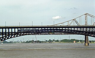
The old Chain of Rocks Bridge spans the Mississippi River on the north edge of St. Louis, Missouri, United States. The eastern end of the bridge is on Chouteau Island, while the western end is on the Missouri shoreline. Its most notable feature is a 22-degree bend occurring at the middle of the crossing, which was found to be necessary during construction due to both the presence of a water intake and the inability of parts of the bedrock of the river to carry the weight of the bridge.

St. Louis is located at 38°38′53″N90°12′44″W.
The culture of St. Louis, Missouri includes a variety of attractions located within the city of St. Louis, Missouri, and in surrounding communities in Greater St. Louis, such as local museums, attractions, music, performing arts venues, and places of worship.

Transportation in Greater St. Louis, Missouri includes road, rail, ship, and air transportation modes connecting the bi-state St. Louis metropolitan area with surrounding communities throughout the Midwest, national transportation networks, and international locations. The Greater St. Louis region also supports a multi-modal transportation network that includes bus, paratransit, and light rail service in addition to shared-use paths, bike lanes and greenways.
In 1997, with support from The McKnight Foundation, a group of non-profit organizations led by Trailnet formed a partnership to plan and implement the Confluence Greenway. The Confluence Greenway was planned as a 200-square-mile (520 km2) system of parks, conservation and recreation areas located in the St. Louis, Missouri metropolitan area. Various parks, trails, and attractions are located along forty miles of both the Missouri and Illinois banks of the Mississippi River and Missouri River.

Shaw is a neighborhood in St. Louis, Missouri. It is bordered on the North by Interstate 44, the east by S. Grand Blvd, the west by Tower Grove Ave and the Missouri Botanical Gardens, and the south by Tower Grove Park. The Shaw Neighborhood is a local historic district whose historic structure and character is protected by ordinance.

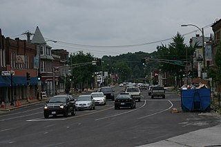
Baden is a neighborhood of St. Louis, Missouri.

The Great Rivers Greenway District is a public agency created in 2000 to develop a regional network of greenways. Great Rivers Greenway engages citizens and community partners to plan, build and care for the greenways. In its first 20 years the agency built more than 128 miles of greenways connecting parks, rivers, schools, neighborhoods, business districts and transit.

North Riverfront is a neighborhood of St. Louis, Missouri. The neighborhood is bounded by Adelaide St. on the south, the Mississippi River on the east, Maline Creek on the north, and Hall Street, Calvary Avenue, Bellefontaine Cemetery, and I-70 to the west.

Riverview is a neighborhood of St. Louis, Missouri. Riverview comprises the extreme northern section of the city, bounded by the Mississippi River to the east, the city limits to the west, and Chain of Rocks Road to the south, with the northern boundary lying a third of a mile north of I-270. The only major road running through the neighborhood is Riverview Drive.

North Riverfront Park is a municipal park in St. Louis, Missouri.
The numbered streets of St. Louis, Missouri generally run north–south through the city, starting with 1st Street at the Mississippi River, and increasing in value the further west they are. 1st through 25th Streets are primarily centered around the Downtown and Downtown West neighborhoods, with many extending further north and south into other neighborhoods. There are a few other higher value streets that appear elsewhere in the St. Louis area, and although they are not adjacent to the 1st–25th grid in the eastern part of the city, their numberings in relation to their distances from the river are relatively consistent.
The streets of St. Louis, Missouri, United States, and the surrounding area of Greater St. Louis are under the jurisdiction of the City of St. Louis Street Department. According to the department's Streets Division, there are 1,000 miles (1,600 km) of streets and 600 miles (970 km) of alleys within the city.

Walt Disney's Riverfront Square was a planned theme park in St. Louis, Missouri that would have been the second Disney park, after Disneyland. The park was in development between 1963 and 1965.


