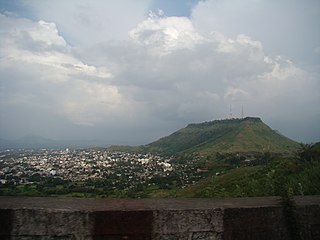
Satara is a city located in the Satara District of Maharashtra state of India, near the confluence of the river Krishna and its tributary, the Venna. The city was established in the 16th century and was the seat of the Chhatrapati of the Maratha Kingdom, Shahu I.

Shivraj Vishwanath Patil is an Indian politician who was the Minister of Home Affairs of India, from 2004 to 2008 and 10th Speaker of the Lok Sabha from 1991 to 1996. He was Governor of the state of Punjab and Administrator of the Union Territory of Chandigarh from 2010 to 2015. Previously, he served in the Indira Gandhi and Rajiv Gandhi cabinets as Minister of Defence during the 1980s.

Osmanabad District, officially known as Dharashiv District, is an administrative district in the Marathwada region in the Indian state of Maharashtra. The district headquarter is located at Osmanabad. The District of Osmanabad derives its name from the last ruler of Hyderabad, the 7th Nizam, Mir Osman Ali Khan, of which the region was a part till 1947. This region was earlier part of The Hyderabad State until Independence.This primarily rural district occupies an area of 7,569 km2 (2,922 sq mi) of which 241.4 km2 (93.2 sq mi) is urban and has a population of 1,657,576 of which 16.96% were urban.
Kolhapur district is a district in the Maharashtra state of India. The city of Kolhapur is its district headquarter. It is situated near Panchaganga river.

Osmanabad, officially known as Dharashiv, is a city and a municipal council in Osmanabad district in the Indian state of Maharashtra. The city is the administrative headquarter of Osmanabad district. It is the seventh largest city in Marathwada, and the 39th largest city in Maharashtra by population.

Latur district is a district in Maharashtra state of India. Latur city is the district headquarters and is the 16th largest city in the state of Maharashtra. The district is primarily agricultural. Urban population comprises 25.47% of the total population.
Udgir, is second largest city and municipal council in Latur district of the Indian state of Maharashtra. It is located in the Marathwada division of the state. The city is located very close to the borders of Karnataka and Telangana states. Udgir is home to the historical Udgir Fort. The town and nearby villages rely mainly on agriculture, which serves as a major source of income for the population. Udgir city is proposed to be become district.
Nilanga is a town with a municipal council in Latur District in the Indian state of Maharashtra. It is also the headquarters for Nilanga Taluka. It is the Taluka Headquarter.
Paranda is a town with a municipal council in the Osmanabad district of the Indian state of Maharashtra. It is the headquarters town for the Paranda Tehsil.
Shirur Anantpal is a town and headquarters of Shirur Anantpal Taluka in Latur district in the Indian state of Maharashtra.
Deoni is a town and administrative centre of Deoni Taluka in Latur subdivision of Latur district in the Indian state of Maharashtra. Deoni has a total area of 415.32 km2.

Amit Vilasrao Deshmukh is an Indian politician and a member of Indian National Congress. He is the son of veteran congress leader Vilasrao Deshmukh. He is a three term Member of the Maharashtra Legislative Assembly from the Latur city constituency. He is the National Secretary of the All India Congress Committee.

Latur is a city in the Indian state of Maharashtra, and is one of the largest cities of the Marathwada region. It is the administrative headquarters of Latur district and Latur Taluka. The city is a tourist hub surrounded by many historical monuments, including Udgir Fort and Kharosa Caves. The people in Latur are called Laturkar. The most spoken language in Latur is Marathi. The city's quality of education attracts students from all over Maharashtra. It is a drought prone area with acute water shortage in its city and rural areas. The economy is agriculture intensive, but in recent years is also dependent on Educational sector & its allied activities. Industrial development is minimal in the district. Latur is 43 kilometers from the epicenter of the devastating 1993 Latur earthquake.
Latur Taluka is an administrative subdivision (taluka) of Latur District in Maharashtra, India.
Sakol is a panchayat village in Shirur Anantpal Taluka in Latur subdivision of Latur district in the Indian state of Maharashtra. The village of Sakol is 12 km by road southeast of the village of Shirur Anantpal and 40 km by road northeast of the town of Nilanga.
Chakur Taluka is a taluka, administrative subdivision, of Latur District in Maharashtra, India. The administrative center for the taluka is the village of Chakur. In the 2011 census there were seventy-two panchayat villages in Chakur Taluka.
Halgara is a panchayat village in the state of Maharashtra, India. Administratively, Halgara is under Nilanga Taluka of Latur District in Maharashtra. The village of Halgara is 15 km (9.3 mi) by road east of the town of Nilanga, 5 km (3.1 mi) by south of town of Aurad Shahajani.
Umarga (Omerga) Tehsil is a tehsil/ taluka/ subdistrict in Osmanabad district, Maharashtra on the Deccan Plateau of India. The town of Umarga is the administrative headquarters of the tehsil. There are 79 panchayat villages in Umarga Tehsil.
Maharashtra Major State Highway 3, commonly referred to as MH MSH 3, is a major state highway that runs through Solapur, Osmanabad, Latur, Nanded, Yavatmal, Wardha and Nagpur districts in the state of Maharashtra and State Highway 11 (Maharashtra). This state highway touches numerous cities and villages VIZ. Solapur, Tuljapur, Ausa, Latur, Chakur, Ahmedpur, Nanded, Umarkhed, Mahagaon, Arni, Yavatmal, Wardha - Butibori - Via NH 7 Uptill Nagpur.
National Highway 361, commonly called NH 361, is a national highway in India that runs entirely within the state of Maharashtra. Its western terminal is in Tuljapur near the intersection of NH 52 and the eastern terminal is in Butibori near Nagpur at the intersection of NH 44. The total length of the highway NH-361 is 548 km. It is a spur road of National Highway 61.

