
Puerto Suárez International Airport, also known as Capitán Av. Salvador Ogaya G. Airport, is an airport serving Puerto Suárez, a city in the Santa Cruz Department of Bolivia. The airport is in the easternmost part of Bolivia, near the border with Brazil.

Capitán Av. Selin Zeitun Lopez Airport is an airport serving Riberalta, a port city on the Beni River in the Beni Department of Bolivia. The airport is in the western section of the city, near the confluence of the Beni and Madre de Dios Rivers.
Rurrenabaque Airport is an airport serving Rurrenabaque, a port city on the Beni River in the Beni Department of Bolivia. The airport is 2 kilometres (1.2 mi) northeast of the city.

Capitán Oriel Lea Plaza Airport is an airport serving Tarija, the capital of the Tarija Department of Bolivia. The airport is in the southeastern section of the city, which is within a basin of the Cordillera Central mountain range. There is distant mountainous terrain in all quadrants.
Teniente Jorge Henrich Arauz Airport is an airport serving the city of Trinidad, Bolivia. It is the main airport and gateway to the Bolivian section of the Amazon basin.
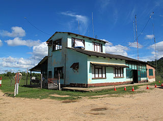
Santa Ana del Yacuma Airport is an airport serving the town of Santa Ana del Yacuma in the Beni Department of Bolivia. The runway is just south of the town.
Bermejo Airport is an airport serving Bermejo, a city in the Tarija Department of Bolivia.
Lieutenant Colonel Rafael Pabón Airport is an airport serving the city of Villamontes in the Gran Chaco Province of the Tarija Department of Bolivia.
La Quiaca Airport is a very high elevation airport serving La Quiaca, a town in the Jujuy Province of Argentina. La Quiaca is on the border with Bolivia, across from the Bolivian town of Villazon.
Monteagudo Airport is an airport serving Monteagudo, a town in the Chuquisaca Department of Bolivia.
Camiri Airport Spanish: Aeropuerto Camiri, is an airport serving Camiri, a city in the Santa Cruz Department of Bolivia.
Copacabana Airport is an extremely high elevation airport serving Copacabana, a town on Lake Titicaca in the La Paz Department of Bolivia.
Ixiamas Airport is an airport serving the town of Ixiamas in the La Paz Department of Bolivia.
San Joaquín Airport Spanish: Aeropuerto de San Joaquín, is an airport 2 kilometres (1.2 mi) south of San Joaquín, a town in the Beni Department of Bolivia. The airport replaces an older one adjacent to the town.
Reyes Airport Spanish: Aeropuerto de Reyes, is an airport serving Reyes, the capital of the José Ballivián Province in Bolivia's Beni Department. The runway is 2 kilometres (1.2 mi) west of the town.
Tupiza Airport is a very high elevation airport 16 kilometres (10 mi) northeast of Tupiza, a city in the Potosí Department of Bolivia.
Uyuni Airport, also known as Joya Andina Airport, is an airport at extremely high elevation just northwest of Uyuni, in the southwestern Potosí Department of Bolivia. It is close to the Salar de Uyuni, the world's largest salt flat. It was opened by the Bolivian president Evo Morales on July 11, 2011. Currently the airport is served by one airline: Boliviana de Aviacion which offers regular flights to and from La Paz and Cochabamba.
Villazón Airport is a high-elevation airport 5 kilometres (3.1 mi) northwest of the city of Villazón in the Potosí Department of Bolivia. The airport and city are in the southeastern reaches of the Bolivian Altiplano, on the border with Argentina.
Uncia Airport is a high-elevation airport serving the cities of Llallagua and Uncia in the Potosí Department of Bolivia.
Cañada Larga Airport is an airstrip serving the farming village of Cañada Larga in the Santa Cruz Department of Bolivia.
