This article is about the Transport in Zambia.

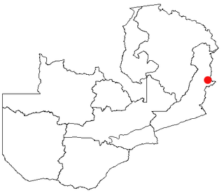
Chipata is a city and administrative centre of the Eastern Province of Zambia and Chipata District. It was declared the 5th city of the country, after Lusaka, Ndola, Kitwe and Livingstone, by President Edgar Lungu on 24 February 2017. The city has undergone rapid economic and infrastructure growth in the years, leading up to city status.

Northern Province is one of Zambia's ten provinces. It covers approximately one-sixth of Zambia in land area. The provincial capital is Kasama. The province is made up of 12 districts, namely Kasama District, Chilubi District, Kaputa District, Luwingu District, Mbala District, Mporokoso District, Mpulungu District, Mungwi District, Nsama District, Lupososhi District, Lunte District and Senga Hill District. Currently, only Kasama and Mbala have attained municipal council status, while the rest are still district councils. It is widely considered to be the heartland of the Bemba, one of the largest tribes in Zambia.
Lundazi is a town in the Eastern Province of Zambia, lying near the border with Malawi, around 116 mi (187 km) north of Chipata. Lundazi is known as a "Boma" or administrative centre. It was a former colonial headquarters. Lundazi is the seat for Lundazi District. It is perched high above the eastern side of the Luangwa Valley, and close to a quiet border crossing to Malawi.

Mpika is a town in the Muchinga Province of Zambia, lying at the junction of the M1 Road to Kasama and Mbala and the Tanzam Highway to Dar es Salaam, Tanzania in the north-east and Lusaka in the south-west. It also has a railway station on the TAZARA Railway about 5 kilometres (3 mi) away. Mpika is situated between the Muchinga Escarpment to the east and vast miombo plains to the west. The town has an estimated population of 40,000 inhabitants (2008), while the district population is estimated at 150,000 inhabitants. Since Mpika District was the biggest district in Zambia before its division in 2017, the population density was less than 4 people per square kilometre.

The Great East Road is a major road in Zambia and the main route linking its Eastern Province with the rest of the country. It is also the major link between Zambia and Malawi and between Zambia and northern Mozambique. However, the route does not carry as much traffic as many of the other regional arterial roads and between the main cities it serves, Lusaka and Chipata, it passes through rural and wilderness areas. In Lusaka the road forms the main arterial road for the eastern suburbs. The entire route from Lusaka to Chipata and the border with Malawi is designated the T4 road on Zambia's road network.

Petauke is a town and seat of Petauke District located in the Eastern Province of Zambia.

Eastern Province is one of Zambia's ten provinces. The province lies between the Luangwa River and borders with Malawi to the east and Mozambique to the south, from Isoka in the northeast to the north of Luangwa in the south. The provincial capital is Chipata. Eastern province has an area of 51,476 km2 (19,875 sq mi), locally shares border with three other provinces of the country and is divided into fifteen districts.

The ten provinces of Zambia are divided into a total of 116 districts as of 2018.
This article gives lists of the National Monuments and other historic sites of Zambia, with a one- or two-line description providing links to details given on other pages.
Mfuwe is the main settlement of South Luangwa National Park in the Eastern Province of Zambia, serving the tourism industry and wildlife conservation in the Luangwa Valley. It is located in Mambwe District, about 100 km (62 mi) west-north-west of Chipata.

Chadiza is a town in the Eastern Province of Zambia. Its headquarters are located in Chadiza District. It lies 35 km south of the Great East Road and about 80 km south-south-west of Chipata, on a plateau studded by isolated rocky hills, between the middle Luangwa valley and the Zambezi. It is also 35 kilometres north-north-east of the Chimefusa Border.

Katete is a medium-sized town in the Eastern Province of Zambia, and is headquarters of Katete District. The town is at the foot of rocky hills which lie to its east, including Mpangwe Hill and Kangarema Hill, which rise to 1600 m. The hills are surrounded by cultivated fields. Katete lies on the Great East Road about 90 km south-west of the provincial capital, Chipata, at an elevation of 1060 m on the watershed between the middle Luangwa River and the Zambezi. In the town is a major road junction, with a surfaced road branching off and running 50 km to the Mozambique border and connecting with Tete on the Zambezi 339 km to the south-east.

The Mafinga Hills are a plateau covered by hills, situated on the border between Zambia and Malawi, in Southern Africa. These hills are composed of quartzites, phyllites and feldspathic sandstones of sedimentary origin.

Chama District with the headquarters at Chama is the largest district of the Eastern Province in Zambia and includes a large wilderness in the Upper Luangwa valley just north-east of the North Luangwa National Park. It is made up of two constituencies, namely Chama North and Chama South.

Chipata District is a district of Zambia, located in Eastern Province. The capital lies at Chipata. As of the 2022 Zambian Census, the district had a population of 327,059 people.

Lundazi District is a district in Zambia, located in Eastern Province. The capital is Lundazi. The district shares borders with Chasefu District to the north, Lumezi District to the south-west, and the Republic of Malawi to the east and south.

Muchinga Province is one of the ten provinces of Zambia. It is located in the northeast of the country and borders with Tanzania in the north, Malawi in the east, Eastern Province in the south, Central Province in the southwest, Luapula Province in the west, and Northern Province in the northwest. The administrative center of the province is Chinsali.
Mwami is a town in the Eastern Province of Zambia. The town lies at the international border with Malawi, adjacent to the Malawian city of Mchinji.
The M14 is a road in the Muchinga Province of Zambia that connects Nakonde with the Malawian Border at Katumbi via Chitipa, Thendere and Muyombe.
