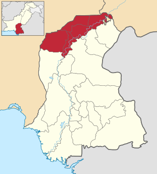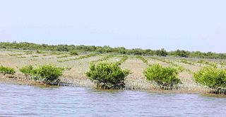
Hyderabad District, is a district of Sindh, Pakistan. Its capital is the city of Hyderabad. The district is the second most urbanized in Sindh, after Karachi, with 80% of its population residing in urban areas.

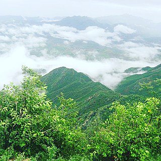
Cherat is a hill station dating from the 1860s that is located immediately above the villages of Chapri, Saleh Khana, Kotli Kalan and Dak Ismail Khel in the Nowshera District of Khyber-Pakhtunkhwa in Pakistan. Cherat lies 34 miles south east from the city of Peshawar at an elevation of 4,500 feet on the west of the Khattak range, which divides the district of Nowshera from Kohat District.

Hamirpur district is one of the 75 districts of Uttar Pradesh state of India and Hamirpur town is the district headquarters. Hamirpur district is a part of Chitrakoot Division. The district occupies an area of 4,121.9 km2. The district has a population of 1,104,285. As of 2011 it is the third least populous district of Uttar Pradesh, after Mahoba and Chitrakoot. Two major rivers Yamuna and Betwa meet here. On the banks of river Betwa lies the "Coarse sand" which is exported to many parts in U.P.

Jacobabad District is a district in the province of Sindh, Pakistan. According to 2023 Census population of Jacobabad District is 1,174,097 It is located in the north of Sindh, by the provincial boundary with Balochistan. Its headquarters is the town of Jacobabad, which was founded by General John Jacob in 1847.

Larkana Division is an administrative division of the Sindh Province of Pakistan. It was created in 1980 by bifurcation of Sukkur Division. In 2000 abolished by General Pervaiz Musharraf rule but Sindh government restored it again on 11 July 2011. CNIC code of Larkana Division is 43.

Changbhakar State, also known as Chang Bhakar, was one of the small princely states of British Empire in India in the Chhattisgarh States Agency. It included 117 villages and had an area of 2,330 square kilometres (899 sq mi) with a 1941 population of 21,266 people. Bharatpur was the capital of the princely state.
Sahang (ساهنگ) is a town in Gujar Khan Tehsil, Punjab, Pakistan. Raja Sajjad Sarwar is chairman of the union council. Sahang is also the chief town of the Union Council Sahang which is an administrative subdivision of the Tehsil Sahang is one of the most biggest and important union councils of tehsil Gujar Khan. The notable tribes of this union council are Sadaat, Pakhral Rajpoot Minhas, Gakhars, Awan Malik, Dar, Rajput, Gujar, Bhatti, and Nagrial.
Jandiala Sher Khan, or Jandy ala Sher Khan, is a town of Sheikhupura District in the Punjab, Pakistan. It is part of Sheikhupura Tehsil and is located at 31°49'15N 73°55'10E. The town is notable for being the birthplace of famous poet Waris Shah, known as the Punjabi Shakespeare, and contains his Mausoleum.

Hyderabad Tehsil (rural) is an administrative subdivision (tehsil) of Hyderabad District in the Sindh province of Pakistan. Hyderabad district is subdivided into 4 talukas, the Urban area around the capital Hyderabad is part of Hyderabad City Taluka.

Hyderabad City Tehsil is an administrative subdivision (tehsil) of Hyderabad District in the Sindh province of Pakistan. Hyderabad district is subdivided into 4 talukas, the Urban area around the capital Hyderabad is part of Hyderabad City Taluka.
Matiari Tehsil is an administrative subdivision, (Tehsil), of Matiari District in the Sindh province of Pakistan. As of the 2017 census, Matiari Taluka has a population of 340,677. The total population constitutes 297,553 rural and 43,124 urban population. Total area of this Taluka is 706 km2.
Chachiha is a village and gram panchayat in the tehsil of Joura, in the Morena district of the Indian state of Madhya Pradesh. In 2011 it had 2,053 inhabitants.

Malhara Assembly constituency is one of the 230 Vidhan Sabha constituencies of Madhya Pradesh state in central India. This constituency came into existence in 1951, as one of the 48 Vidhan Sabha constituencies of the erstwhile Vindhya Pradesh state, but it was abolished in 1956. It again came into existence in 1961, following delimitation of the legislative assembly constituencies.
Kasoda is a village in Erandol, Jalgaon district, Maharashtra. Kasoda is 48km from city Jalgaon and 322km from city Mumbai. Kasoda is second biggest village in Jalgaon district. As per census 2011, population of kasoda is about 35,000. The name Kasoda is derived from kushada which was related to name of a saint who spent most of his life in jungles.
Chikta is a village in the Bidhuna Tehsil of Auraiya district in Uttar Pradesh, India. According to the 2011 census Chikta has 114 families residing in it with a population of 600 of which 315 are males and 285 are females. Average Sex Ratio of Chikta village is 905 which is lower than Uttar Pradesh state average of 912. Child Sex Ratio for the Chikta as per census is 731, lower than Uttar Pradesh average of 902.

Sujawal District is a district of the Sindh province of Pakistan. It is located at 24°36'23" North and 68°4'19" East and is bordered in the northwest by the Indus River, which separates it from Thatta District. The district has an area of 7335 km2.
Uthanur or Uttanur is a village located in Mulbagal Tehsil of Kolar district in the southern Indian state of Karnataka. It is located about 85 km east of the state capital, Bangalore. In 2011, its population was 1604 inhabitants, with 817 males and 787 females. In this village the Shri Varadaraja Swamy, the Chowdeshary, and the Uttameshwara temples are very famous.
Tarpal is a small Village in Gogunda Tehsil in Udaipur District of Rajasthan, situated about 413 km from Jaipur and around 53 km from the District headquarter Udaipur.
Nimbahera is one of the 200 Legislative Assembly constituencies of Rajasthan state in India.

Lakhmademau is a village in Purwa block of Unnao district, Uttar Pradesh, India. It is connected to minor district roads and has one primary schools and one medical practitioner. As of 2011, its population is 1,461, in 296 households.


