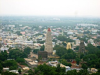
Mangalagiri is a model town in Guntur district situated between the twin cities of Vijayawada and Guntur of the Indian state of Andhra Pradesh. It is a major suburb region of the cities of Vijayawada and Guntur. It is currently the 31st most populous city of Andhra Pradesh. The town is the headquarters of Mangalagiri mandal under Guntur revenue division. It is situated on National Highway 16 between Vijayawada and Guntur. The town was known to have existed since 225 B.C..

Gudivada is a town in Krishna district of the Indian state of Andhra Pradesh. It is a municipality and the headquarters of Gudivada mandal in Gudivada revenue division. It is one of the cities in the state to be a part of Andhra Pradesh Capital Region. It is Twenty sixth most populous city in the state with a population of 118,167.
Kurnool District is one of the four districts in the Rayalaseema region of the Indian state of Andhra Pradesh. The district is located in the west-central part of the state and is bounded by Mahabubnagar district of Telangana in the north, Raichur district of Karnataka in the northwest, Bellary district of Karnataka in the west, Ananthapur district in the south, YSR Kadapa district in the South East and Prakasham district in the east. The city of Kurnool is the headquarters of the district. It has a population of 4,053,463 of which 28.35% were urban as of 2011. The district is the second largest by area and seventh largest by population in the state.

Rajampet is a Municipality in YSR Kadapa district of the Indian state of Andhra Pradesh, located in the Rayalaseema Region. The town has an average elevation of 139 meters (456 ft). Rajampet was a Nagar panchayat and upgraded as a Grade II Municipality in 2019 and has an area of 35.38 square kilometres (13.66 sq mi). It consists of 20 election wards.

Nuzvid is a city in Krishna district of the Indian state of Andhra Pradesh. It serves as the administrative headquarters for Nuzvid mandal and Nuzvid revenue division.

Kovur is a town in Nellore district of the Indian state of Andhra Pradesh. The town is the headquarters of the Kovur Mandal and Assembly Constituency. It is located in Kovur mandal of Nellore revenue division. It forms a part of Nellore Urban Development Authority. The poet "Thikkanna" was born in this place.

Gudur is a town in Nellore district of the Indian state of Andhra Pradesh. It is a municipality and the headquarters of Gudur mandal and Gudur revenue division.

Bagaha is a city and a municipality in the district of Pashchim Champaran in the state of Bihar, India. It is a subdivision of Pashchim Champaran district and is a Police District. It is located around 64 kilometres (40 mi) northwest of its district headquarters Bettiah. It is 294 km away from Bihar's state capital Patna.

Barkakana is a census town in the Patratu CD block in the Ramgarh subdivision of the Ramgarh district in the state of Jharkhand, India.

Narsipatnam is a town in Visakhapatnam district of the Indian state of Andhra Pradesh. It was upgraded from a gram panchayat into municipality in 2012. The town is spread over an area of 42 km2 (16 sq mi) The resting place of the revolutionary Indian freedom fighter Alluri Sitarama Raju is located in Krishna Devi Peta village of Narsipatnam.

Nidadavolu is a town in West Godavari district of the Indian state of Andhra Pradesh. It is a municipality and the mandal headquarters of Nidadavolu mandal in Kovvur revenue division.
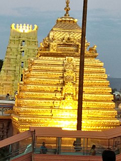
Srisailam is a census town in Kurnool district of the Indian state of Andhra Pradesh. It is the mandal headquarters of Srisailam mandal in Kurnool revenue division. The town is famous for Mallikarjuna Jyotirlinga Temple and is one of the holy pilgrimage site for Saivism and Shaktism sects of Hinduism. The town is classified as both Jyotirlinga and Shakti Peetha.

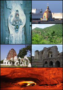
Tadipatri or Tadpatri is a town in Anantapur district of the Indian state of Andhra Pradesh. It is the mandal headquarters of Tadipatri mandal in Anantapur revenue division. It is located at the border of Kurnool district and Kadapa district. The ancient world-famous Chintala Venkataramana Temple sprawling over five acre area is located in Tadipatri. From Tadipatri town at a distance of 1 kilometre, overlooking the Penna River, the Bugga Ramalingeswara Temple is located which is remarkable for a lingam seated on a pedestal that is perpetually filled with water from a small spring.
Ibrahimpatnam is a neighbourhood of Vijayawada in Krishna district of the Indian state of Andhra Pradesh. It is also the mandal headquarters of Ibrahimpatnam mandal. Dr Narla Tata Rao Thermal Power Station, one of the major Thermal power stations of the state is located near the town. Railway Wagon Workshop at Rayanapadu is also located very near to Ibrahimpatnam at a distance of 4 km.

Angalakuduru is an area of Tenali in Guntur district of the Indian state of Andhra Pradesh. It is located in Tenali mandal of Tenali revenue division. It is a residential area in Tenali. It forms a part of Andhra Pradesh Capital Region.
Kheri Leela is a small village in Makrana tehsil, Nagaur district, Rajasthan, India.
Loma is a village in the Jandaha block of Vaishali district in the Indian state of Bihar. It is located more than 30 km from the nearest city of Hajipur.

Padgampora, also known as Padgampur, is a village in Awantipora tehsil in Pulwama district of Jammu and Kashmir in India. It is located 14 km (8.7 mi) towards East from District headquarters Pulwama. 14 km (8.7 mi) from Tral. 25 km from State capital Srinagar.

Kaliasole is a village in Kaliasole in Dhanbad Sadar subdivision of Dhanbad district of State Capital Ranchi in the Indian state of Jharkhand.
Chamua railway station is a railway station on Muzaffarpur–Gorakhpur main line under the Samastipur railway division of East Central Railway zone. This is situated at Dewaliya, Chamua in West Champaran district of the Indian state of Bihar.