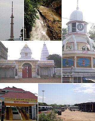
Baripada is a city and a municipality in Mayurbhanj district in the state of Odisha, India. Located along the east bank of the Budhabalanga river, Baripada is the cultural centre of north Odisha. In recent years, it has emerged as an educational hub with the opening of numerous professional colleges.

Rayagada district is a district in southern Odisha, a state in India, which became a separate district in October 1992. Its population consists mainly of tribes, primarily the Khonds and the Soras. In addition to Odia, Kui and Sora are spoken by the district's indigenous population. It was founded by Maharajah Biswanatha Deba Gajapati of the Surjyabansha dynasty of Jeypore.

Koraput district is a district of India in southern Odisha, with headquarters at Koraput. The district is located in the Eastern Ghats and is known for its hilly terrain, rich and diverse types of mineral deposits and its tribal culture and traditions. The district headquarters town of Koraput and its largest city, Jeypore are major centres of trade and commerce for South Odisha and fall on an important road connecting Visakhapatnam to Raipur.
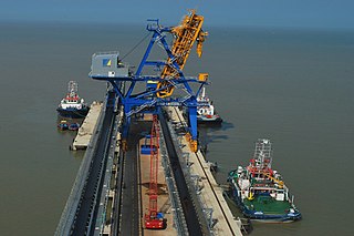
Bhadrak is a district of Odisha state in eastern India. Bhadrak city is the headquarters and the largest city of the district.
Nabarangpur district, also known as Nabarangapur district or Nawarangpur district, is a district of Odisha, India. The city of Nabarangpur is the district capital. Most of its population is tribal and the land is heavily forested. It borders Kalahandi and Koraput districts. Nabarangpur district is situated at 19.14′ latitude and 82.32′ longitude at an average elevation of 572 metres (1,877 ft).
Nabarangpur is a town, villa city and a municipality in Nabarangapur district in the Indian state of Odisha. It is the headquarters of Nabarangpur district.
Bhawanipatna is a city and headquarters of the Kalahandi district, in the Indian state of Odisha. Bhawanipatna has numerous temples dedicated to different deities of the Hindu pantheon. It is named after the presiding deity, Bhawani-Shankar and Patna which means "place" in Odia like "Padaa". Bhawanipatna municipality is the administrative head of the city, which is divided into twenty wards with different sub-areas called pada. Originally, these padaas were inhabited by people of different communities, but over the last few decades, these padaas have become homogeneous. Bhawanipatna has more than forty padaas.
Banapur is a town and a Notified Area Council in Khordha district in the state of Odisha, India. The town is named after the King Banasura of Lord Shri Krishna era.
Barpali is a small town and a block ( Tehsil) within the Bargarh district in the state of Odisha, India. Barpali is largely famous for renowned Odia Poet Swabhaba Kabi Gangadhar Meher who was born here. However, there are several other cultural notations which have made Barpali famous nationally and internationally, like: the indigenous sambalpuri saree weaving art and the earthen pottery handicrafts (Terracotta) etc, creations from the native inhabitants of Barpali. Among others, the name Barpali also draws attention towards the past studies, wide usage and then outward expansion of preliminary versions of sanitary toilets started by foreigners here, known as 'Barpali Toilets' nearly 40 years ago.

Jatni is a town and a major sub-urban area of Bhubaneswar, the state capital of Odisha. It is also a municipality in Khordha district in the Indian state of Odisha. Jatni, also known as Khurda Road Junction in Indian Railways parlance, acts as an important railway junction between the main railroads running between Kolkata and Chennai, with diversions to the Hindu pilgrimage city of Puri, and to Balangir, passing through the districts of Nayagad, Daspalla, Phulbani, Boudh and Sonepur the vast tribal hinterland of Odisha. It has emerged as a commercial hub with a number of educational and other institutions. It is home to Premier Public Institutes like NISER and IIT-Bhubaneswar and ICAR- International Centre for Foot and Mouth Disease (ICFMD). Jatni is famous for its celebration of the festival of Ganesh Chaturthi.

Khariar is a city and a Notified Area Council in Nuapada District of the Indian state of Odisha.
Pattamundai is a town and a municipality in Kendrapara district in the Indian state of Odisha, located on the centre of SH-9A from Cuttack to Chandbali along the south end of Brahmani River. It is also the headquarter of Pattamundai Block.
Junagarh is a town and a notified area council in Kalahandi district in the Indian state of Odisha. MLA of Junagarh is Captain Divya Shankar Mishra. It was the capital of the former state of Kalahandi. Junagarh is 26 km from Bhawanipatna, connecting National Highway 201.This highway recently has been termed as National Highway 26.
Umerkote, also known as Umarkot and Amarkot, is a town of Nabarangpur district, Odisha, in eastern India. Umerkote is an urban area and the name of a Municipality declared on 3 March 2014 and a Subdivision declared by State Cabinet on 3 November 2015. The town is a prominent business place of the Nabarangpur District.

Gariaband District is one of the 33 districts of Chhattisgarh. It has its headquarters at Gariaband town. The district was carved out of Raipur district in 2012.
Kashipur is a block & tahasil in Rayagada district in the Indian state of Odisha. It is known for the Utkal Aluminium International Limited (UAIL)

Durgi is a census village & Panchayat Headquarter of Bissam Cuttack Block in Rayagada district of Odisha, India. There are total 439 families residing in this village. The wards/ villages comes under Durgi Panchayat are:- Durgi, Bhaleri, Kundanpadar, Rengabai, Barangpadar, Thambalpadhu, Budhanagar, Kachapai, Kalipadar, Kurankul, Tentili Kalipadar, Mulipada, Dharamguda, Balipadar, Haduguda, Huruguda, Khariguda and IAY Colony.

Bargaon or Baragan is a village under Khariar Tahasil in Nuapada district of Odisha state in India. It is situated 10 km away from sub-district headquarter Khariar and 63 km towards south from district headquarter Nuapada. The word "Bargaon" is composed of two words, "Bara" means 'Divine' and "gaan" means 'village'. On the 150th birth anniversary of Mahatma Gandhi, the village was recognised as "Lok Kala Gram" of Nuapada district by the Dept. Of Language, Literature and Culture, Government of Odisha

Hirlipali is a village in Attabira Tehsil of Bargarh district of Odisha, India. The village is located on the banks of canal that flows reservoir water from Hirakud Dam. It is about 10 km from Attabira and about 20 km from Bargarh town. The total geographical area of Hirlipali Gram Panchayat is 25.19 square kilometers, and has a total population of 8,320 peoples. There are about 1,817 households in Hirlipali Gram Panchayat

