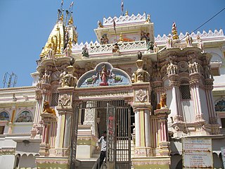
Chandlodiya

Last updated

Chandlodiya (Chandlodia)
town
India Gujarat location map.svg
Red pog.svg
Chandlodiya (Chandlodia)
Location in Gujarat, India
India location map.svg
Red pog.svg
Chandlodiya (Chandlodia)
Chandlodiya (Chandlodia) (India)
Coordinates: 23°05′46″N72°32′17″E / 23.096189°N 72.53817°E / 23.096189; 72.53817 Coordinates: 23°05′46″N72°32′17″E / 23.096189°N 72.53817°E / 23.096189; 72.53817
CountryFlag of India.svg  India
State Gujarat
District Ahmedabad
Government
  TypeMunicipal Corporation
Population
 (2001)
  Total56,135
Languages
  Official Gujarati, Hindi
Time zone UTC+5:30 (IST)
Vehicle registration GJ01
Website gujaratindia.com

Chandlodia is an area under Ahmedabad Municipal Corporation in Ahmedabad district in the state of Gujarat, India.

Ahmedabad district District in Gujarat, India

Ahmedabad District comprises the city of Ahmedabad, in the central part of the state of Gujarat in western India. It is the seventh most populous district in India.
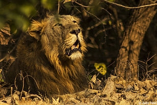
Gujarat State in India

Gujarat is a state on the western coast of India with a coastline of 1,600 km (990 mi) – most of which lies on the Kathiawar peninsula – and a population in excess of 60 million. It is the fifth largest Indian state by area and the ninth largest state by population. Gujarat is bordered by Rajasthan to the northeast, Daman and Diu to the south, Dadra and Nagar Haveli and Maharashtra to the southeast, Madhya Pradesh to the east, and the Arabian Sea and the Pakistani province of Sindh to the west. Its capital city is Gandhinagar, while its largest city is Ahmedabad. The Gujarati-speaking people of India are indigenous to the state. The economy of Gujarat is the fifth-largest state economy in India with 13.14 lakh crore (US$190 billion) in GDP and a per capita GDP of 174,000 (US$2,500). Gujarat ranks fifteenth among Indian states in human development index.

India Country in South Asia

India, officially the Republic of India, is a country in South Asia. It is the seventh-largest country by area, the second-most populous country, and the most populous democracy in the world. Bounded by the Indian Ocean on the south, the Arabian Sea on the southwest, and the Bay of Bengal on the southeast, it shares land borders with Pakistan to the west; China, Nepal, and Bhutan to the north; and Bangladesh and Myanmar to the east. In the Indian Ocean, India is in the vicinity of Sri Lanka and the Maldives; its Andaman and Nicobar Islands share a maritime border with Thailand and Indonesia.

Demographics

As of 2001 India census, [1] Chandlodiya had a population of 56,135. Males constitute 54% of the population and females 46%. Chandlodiya has an average literacy rate of 74%, higher than the national average of 59.5%; with male literacy of 79% and female literacy of 68%. 12% of the population is under 6 years of age.

Census Acquiring and recording information about the members of a given population

A census is the procedure of systematically acquiring and recording information about the members of a given population. This term is used mostly in connection with national population and housing censuses; other common censuses include traditional culture, business, supplies, and traffic censuses. The United Nations defines the essential features of population and housing censuses as "individual enumeration, universality within a defined territory, simultaneity and defined periodicity", and recommends that population censuses be taken at least every ten years. United Nations recommendations also cover census topics to be collected, official definitions, classifications and other useful information to co-ordinate international practices.

Related Research Articles

Ahmedabad Cantonment city in Gujarat, India

Ahmedabad Cantonment is situated between Ahmedabad city and Gandhinagar in the state of Gujarat in India.

Chandkheda Neighborhood in Ahmedabad, Gujarat, India

Chandkheda is a neighborhood in northwestern Ahmedabad, India. It is situated on west of Sabarmati River.

Dahegam city in Gujarat, India

Dahegam is a city and a municipality in Gandhinagar district in the state of Gujarat, India.

Gadhada Town in Gujarat, India

ad

Ghatlodiya neighbourhood in Ahmedabad, Gujarat, India

Ghatlodiya is an area in Ahmedabad in the state of Gujarat, in western India.

Lambha city in Gujarat, India

Lambha is a census town in Ahmadabad district in the Indian state of Gujarat.

Makarba city in Gujarat, India

Makarba is a census town in Ahmedabad district in the Indian state of Gujarat.

Marwar Junction city in Rajasthan, India

Marwar Junction is a census town in Pali district in the Indian state of Rajasthan. This is the only railway junction in Pali district.

Memnagar neighborhood in Ahmedabad, Gujarat, India

Memnagar is a neighborhood in Ahmedabad in the Indian state of Gujarat.

Nandej city in Gujarat, India

Nandej is a census town in Ahmedabad district in the Indian state of Gujarat.

Phulera Province in Rajasthan, India

Phulera is a town and a part of the Jaipur district in the Indian state of Rajasthan. The DMIC project runs through Phulera. It is a major railway junction.

Rajur city in Maharashtra, India

Rajur is a census town in Yavatmal district in the Indian state of Maharashtra. Rajur is also known as Rajur Colliery.

Ramol city in Gujarat, India

Ramol is a city and a municipality in Ahmedabad district in the Indian state of Gujarat.

Ranip Area in Gujarat, India

Ranip is a neighbourhood in Ahmedabad in the Indian state of Gujarat.

Sarkhej-Okaf city in Gujarat, India

Sarkhej is an area and a municipality in Ahmedabad district in the Indian state of Gujarat.

Singarva city in Gujarat, India

Singarva is a census town in Ahmedabad district in the Indian state of Gujarat.

Thaltej city in Gujarat, India

Thaltej is a census town and a suburb in Ahmedabad district in the Indian state of Gujarat. The town comes under Ward No:8, North West Zone of Ahmedabad Municipal Corporation, the civic body that governs the City of Ahmedabad.

Vastral city in Gujarat, India

Vastral is a city and a municipality in Ahmedabad district in the Indian state of Gujarat.

Gota, Gujarat city in Gujarat, India

Gota is a census town in Ahmedabad district in the Indian state of Gujarat.

Jodhpur, Gujarat city in Gujarat, India

Jodhpur is a city and a municipality in Ahmedabad district in the Indian state of Gujarat.

References

  1. "Census of India 2001: Data from the 2001 Census, including cities, villages and towns (Provisional)". Census Commission of India. Archived from the original on 16 June 2004. Retrieved 1 November 2008.