Related Research Articles

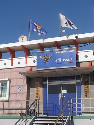
A police station is a building which serves to accommodate police officers and other members of staff. These buildings often contain offices and accommodation for personnel and vehicles, along with locker rooms, temporary holding cells and interview/interrogation rooms.

Tiruvallur is a Grade I municipality in the Indian state of Tamil Nadu. It is located on the banks of Coovum river about 46 km (29 mi) from downtown Chennai (Madras) and just 5 km from megacity border, in the western part of the Chennai Metropolitan Area (CMA). It is a satellite town of Chennai and is the administrative headquarters of Tiruvallur district. The city is known for the Veera Raghavar temple, one of the 108 sacred shrines of Vaishnavites. The tank festival is held at a pond near this temple. A Shiva temple near this shrine which is popular among the locals. There is also a 40-foot (12 m) tall Viswaroopa Panchamukha Hanuman temple, where the murti is made of a single green granite stone.

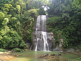
Moulvibazar also spelled Maulvibazar, Moulavibazar, and Maulavibazar, is the southeastern district of Sylhet Division in northeastern Bangladesh, named after the town of Moulvibazar. It is bordered by the Indian states of Tripura and Assam to the south and east, respectively; and by the Bangladeshi districts of Habiganj to the west and Sylhet to the north.

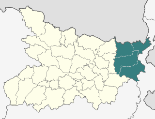
Purnia division is an administrative geographical unit of Bihar state of India. Purnia is the administrative headquarters of the division. The division consists of Purnia district, Katihar district, Araria district, and Kishanganj district. It was established in 1990. It is also known as Seemanchal. It is a part of the Kosi—Seemanchal subregion of the cultural Mithila region.

Raiganj is a city and a municipality in the Indian state of West Bengal. It is the headquarters of the Uttar Dinajpur district. The police station was set up 125 years ago and railway connectivity reached the place 115 years ago. The city houses the 111-year-old Raiganj Coronation High School and more than 50-years-old government primary Raiganj Sarala Sundari GSFP School. Raiganj got its railway connection in 1896. The train used to go to Parbatipur junction in Bangladesh from Raiganj. It is a 200-year-old town.

Fiji–India relations are the foreign relations between Fiji and India. Fiji has a high commission in New Delhi, whilst India has a high commission in Suva.

Thrissur, is one of the 14 districts in the Indian state of Kerala. It is situated in the central part the state. Spanning an area of about 3,032 km2 (1,171 sq mi), Thrissur district is home to over 9% of Kerala's population.

Mahad is a city in Raigad district situated in the North Konkan region of Maharashtra state, India. It is located 108.5 km (67.4 mi) from District's headquarter Alibag, and 167 km (104 mi) from Mumbai. Mahad is known for Raigad Fort, the capital of the Maratha Empire in Shivaji's era and the revolutionary Mahad Satyagraha launched by at Chavdar Tale in the wake of modern India.

Doiwala is a town and a Nagar Palika in Dehradun district in the state of Uttarakhand, India.
Farrukhnagar is a small town and municipality in Farrukhnagar tehsil of Gurugram district in the Indian state of Haryana. It is situated 21 kilometres (13 mi) from Gurgaon and shares its border with Jhajjar district. It is part of the Ahirwal region.
Jaysingpur is a city and municipal council in the Kolhapur district of the Indian state of Maharashtra. The city derives its name from Raja Jaysing, the father of Shrimant Chhatrapati Shahu Maharaj of Kolhapur, who planned and developed the architecture of the city. Shahu Maharaj laid out Jaysingpur as one of the few "chess board cities" in Maharashtra where roads meet at 90-degree angles. Jaysingpur has emerged as a satellite of Sangli city and is growing at rapid pace.

Jiaganj Azimganj is a city and a municipality in Murshidabad district in the Indian state of West Bengal.

Pahalgam, known as Pahalgom is a town and a notified area committee, near Anantnag city in the Anantnag district of the Indian-administered union territory of Jammu and Kashmir. It is a popular tourist destination and hill station. Its lush green meadows and pristine waters attract thousands of tourists from all over the world each year. It is located 45 kilometres (28 mi) from Anantnag on the banks of Lidder River at an altitude of 7,200 feet (2,200 m). Pahalgam is the headquarters of one of the eleven tehsils of Anantnag district.

The Rambagh Palace in Jaipur, Rajasthan is the former residence of the Maharaja of Jaipur located 5 miles (8.0 km) outside the walls of the city of Jaipur on Bhawani Singh road.
Darbhanga Colony is a posh central neighborhood in Prayagraj, India. It was formerly owned by the Royal family of Darbhanga. It still houses the Lowther Castle in the colony. Darbhanga Colony played important a role in Independence movement of India as the Fourth and Eighth annual convention of Indian National Congress was held in here.

The Central Business District of Belapur is a node of Navi Mumbai. The Navi Mumbai Municipal Corporation is headquartered in Belapur. The Reserve Bank of India maintains a branch office at CBD Belapur. This area is one of the fastest developing regions in Navi Mumbai in terms of new residential and commercial construction projects. CBD Belapur is connected to other parts of Mumbai through railways, BEST & NMMT buses. It had a ferry service for traveling to Elephanta caves from Sector-11.

The Song River is a river in Dehradun district that drains the central and eastern part of the Doon Valley, in the state of Uttarakhand, India. A tributary of Sooswa river, which in turn is a tributary of the Ganges, it originates as spring-fed stream in the southern slopes of the Radi Top of Mussoorie ridge of the Himalayan range and runs from Dhanaulti towards Narendranagar. As is common in hilly areas, there are several streams running south from the mountains that merge into one river that emerges from the hills a little after Sahastradhara.
Moinuddin Ahmed Chowdhury was a politician in East Pakistan, social benefactor, and member of the Ghugudanga Zamindar family.
Ahmed satellite station is the second-oldest satellite station in India. Built with the intention of providing New Delhi with satellite coverage and promoting cross-country exchange of information, the satellite station was inaugurated on 25 February 1977 and named after the former president Fakhruddin Ali Ahmed. The station was reputably built at a cost of ₹100 million, with 60% of the station built indigenously and the other fraction purchased with help from a loan from Canada. It was built to conform to the strictest standards of the time and was predicted to be 99.99% accurate, with its tracking system accurate to 1/100 of a degree. It is situated in the Doiwala region of Dehradun, just off the nearby village of Chandmari, nestled in the sal trees of the region – a location chosen for its isolated natural surroundings and their capacity to function as a barrier to microwave or radio noise.
The Char Dham Railway, the Indian Railways's under construction twin railway lines under Char Dham Pariyojana project by connecting the holiest places of Hinduism called Chota Char Dham, from the existing Doiwala railway station near Dehradun to Gangotri and Yamunotri via a fork at Uttarkashi and another set of twin rail links from the upcoming railway station at Karnaprayag to Kedarnath and Badrinath via a fork at Saikot. The line is also of strategic military importance and has been designated a national project.
References
- ↑ "Ahmed Satellite station".
- ↑ India Telecom Series: Vol. 2: Cellular & Wireless Markets. Information Gatekeepers Inc. ISBN 9781568512211.
- ↑ "India's space odyssey".