Chard Reservoir

Last updated

Chard Reservoir
Chard Reservoir - geograph.org.uk - 245020.jpg
Somerset UK relief location map.jpg
Red pog.svg
Chard Reservoir
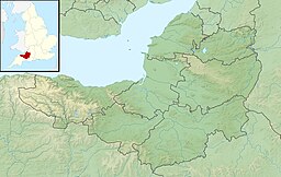
Location Chard, Somerset, England
Coordinates 50°53′04″N2°56′34″W / 50.88444°N 2.94278°W / 50.88444; -2.94278 Coordinates: 50°53′04″N2°56′34″W / 50.88444°N 2.94278°W / 50.88444; -2.94278
Primary inflows River Isle
Primary outflows river Isle
Catchment area 7.65 km2 (2.95 sq mi) [1]
Built1842
Surface area36.97 hectares (91.4 acres)
Water volume795,000 m3 (645 acre⋅ft) [1]

Chard Reservoir is a 36.97-hectare (91.4-acre) reservoir north east of Chard Somerset, England. It is owned and managed by South Somerset District Council [2] and is a recipient of the Green Flag Award. [3]

It was built on the river Isle in 1842 to provide water for the Chard Canal. [2]

It is a Local Nature Reserve. [4] It is used for dog walking, fishing and birdwatching, with a bird hide having been installed. [5] Birds which are spotted regularly include herons, egrets, kingfishers, cormorants, grebes, gulls, ducks and also a wide range of woodland birds such as nuthatch, treecreeper and woodpeckers. Rarities have included ring-necked duck, great white egret, cattle egret and yellow-browed warbler. [6]

The water is stocked with carp. [3]

Related Research Articles

Cheddar, Somerset Human settlement in England

Cheddar is a large village and civil parish in the Sedgemoor district of the English county of Somerset. It is situated on the southern edge of the Mendip Hills, 9 miles (14 km) north-west of Wells, 11 miles (18 km) south-east of Weston-super-Mare and 18 miles (29 km) south-west of Bristol. The civil parish includes the hamlets of Nyland and Bradley Cross. The parish had a population of 5,755 in 2011 and an acreage of 8,592 acres (3,477 ha) as of 1961.

River Axe (Lyme Bay) River in southwest England

The River Axe is a 22-mile (35 km) long river in the counties of Dorset, Somerset and Devon, in the south-west of England. It rises in Dorset and flows south to Lyme Bay which it enters through the Axe Estuary in Devon. It is a shallow, non-navigable river, although its mouth at Seaton has some boating activity. The name Axe derives from a Common Brittonic word meaning "abounding in fish", and is cognate with pysg, the Welsh word for fish.

Somerset Levels Coastal plain and wetland area of Somerset, England

The Somerset Levels are a coastal plain and wetland area of Somerset, England, running south from the Mendips to the Blackdown Hills.

River Huntspill River in Somerset, England

The River Huntspill is an artificial river, in the Somerset Levels, in the Sedgemoor district of Somerset, England. It was built in 1940 to supply process water to ROF Bridgwater, and has resulted in reduced flooding of the lower Brue Valley. Huntspill Sluice at the river's western end, also known as West Huntspill Sluice, separates it from the River Parrett.

Bridgwater Bay Bay in Bristol Channel

Bridgwater Bay is on the Bristol Channel, 5 kilometres (3.1 mi) north of Bridgwater in Somerset, England at the mouth of the River Parrett and the end of the River Parrett Trail. It stretches from Minehead at the southwestern end of the bay to Brean Down in the north. The area consists of large areas of mudflats, saltmarsh, sandflats and shingle ridges, some of which are vegetated. It has been designated as a Site of Special Scientific Interest (SSSI) covering an area of 3,574.1 hectares since 1989, and is designated as a wetland of international importance under the Ramsar Convention. The risks to wildlife are highlighted in the local Oil Spill Contingency Plan.

Chard, Somerset Human settlement in England

Chard is a town and a civil parish in the English county of Somerset. It lies on the A30 road near the Devon and Dorset borders, 15 miles (24 km) south west of Yeovil. The parish has a population of approximately 13,000 and, at an elevation of 121 metres (397 ft), Chard is the southernmost and one of the highest towns in Somerset. Administratively Chard forms part of the district of South Somerset.

Crewkerne Human settlement in England

Crewkerne is a town and electoral ward in Somerset, England, 9 miles (14 km) southwest of Yeovil and 7 miles (11 km) east of Chard all in the South Somerset district. The civil parish of West Crewkerne includes the hamlets of Coombe, Woolminstone and Henley – and borders the county of Dorset to the south. The town is on the main headwater of the River Parrett, A30 road and West of England Main Line railway, in modern times the slower route between the capital and the southwest peninsula, having been eclipsed by the Taunton route.

Chard Canal

The Chard Canal was a 13.5 miles (21.7 km) tub boat canal in Somerset, England, that ran from the Bridgwater and Taunton Canal at Creech St. Michael, over four aqueducts, through three tunnels and four inclined planes to Chard. It was completed in 1842, was never commercially viable, and closed in 1868. The major engineering features are still clearly visible in the landscape.

Abberton Reservoir Reservoir in the United Kingdom

Abberton Reservoir is a pumped storage freshwater reservoir in eastern England near the Essex coast, with an area of 700 hectares. Most of its water is pumped from the River Stour. It is the largest body of freshwater in Essex.

Churchstanton Human settlement in England

Churchstanton is a village and civil parish in Somerset, England, situated within the Blackdown Hills Area of Outstanding Natural Beauty, on the River Otter 5 miles (8.0 km) south of Taunton in the Somerset West and Taunton district.

Brent Reservoir

The Brent Reservoir is a reservoir in North West London. It straddles the boundary between the boroughs of Brent and Barnet and is owned by the Canal & River Trust. The reservoir takes its informal name from a public house called The Welsh Harp, which stood nearby until the early 1970s. It is a 68.6-hectare (170-acre) biological Site of Special Scientific Interest (SSSI), the only SSSI in either borough and among more than 30 SSSIs in Greater London.

River Isle Tributary of the River Parrett in Somerset, England

The River Isle flows from its source near Combe St Nicholas, through Somerset, England and discharges into the River Parrett south of Langport near Midelney.

Kempton Park Reservoirs

Kempton Park Reservoirs are a Site of Special Scientific Interest in the London Borough of Hounslow and Kempton Park in Surrey. It is owned by Thames Water. It is part of South West London Waterbodies Ramsar site and Special Protection Area Kempton Park East reservoir is also a local nature reserve.

Ham Wall Wetland nature reserve in Somerset, England

Ham Wall is an English wetland National Nature Reserve (NNR) 4 kilometres (2.5 mi) west of Glastonbury on the Somerset Levels. It is managed by the Royal Society for the Protection of Birds (RSPB). Since the last Ice Age, decomposing plants in the marshes of the Brue valley in Somerset have accumulated as deep layers of peat that were commercially exploited on a large scale in the twentieth century. Consumer demand eventually declined, and in 1994 the landowners, Fisons, gave their old workings to what is now Natural England, who passed the management of the 260 hectares Ham Wall section to the RSPB.

Portbury Ashlands

Portbury Ashlands which is now known as Portbury Wharf Nature Reserve is a nature reserve between Portishead and the Royal Portbury Dock in Somerset, England. It was formed from the redevelopment of the area of Portishead formerly occupied by two power stations. To the east of the harbour, an area known as "the Ashlands" was used for over 50 years to get rid of power station waste which was dumped into lagoons on the site.

Otterhead Lakes Body of water

Otterhead Lakes are a pair of reservoirs in the Blackdown Hills Area of Outstanding Natural Beauty south of Otterford in Somerset, England. They are fed by the River Otter and managed by the Otterhead Estate Trust Company Limited, working with the Somerset Wildlife Trust on behalf of Wessex Water. They are a Local Nature Reserve.

Sutcliffe Park


Sutcliffe Park is a 16.7 hectare public park in Eltham in the Royal Borough of Greenwich in London. It is located west of Eltham town centre, east of Lee Green, north of Horn Park and south of Kidbrooke.

References

  1. 1 2 "Chard reservoir management plan" (PDF). South Somerset Council. p. 11. Archived from the original (PDF) on 13 June 2011. Retrieved 18 November 2010.
  2. 1 2 "Chard Reservoir leaflet" (PDF). south Somerset Council. Archived from the original (PDF) on 13 June 2011. Retrieved 18 November 2010.
  3. 1 2 "Chard Reservoir Local Nature Reserve". Green Flag Award. Kepp Britain Tidy. Archived from the original on 14 March 2012. Retrieved 18 November 2010.
  4. "Chard Reservoir". Local Nature Reserves. Natural England.
  5. "Chard Reservoir Nature Reserve". Chard Reservoir Nature Reserve. Retrieved 18 November 2010.
  6. "Home". chardres.totalserve.co.uk.