Salamis is an ancient Greek city-state on the east coast of Cyprus, at the mouth of the river Pedieos, 6 km north of modern Famagusta. According to tradition, the founder of Salamis was Teucer, son of Telamon, who could not return home after the Trojan war because he had failed to avenge his brother Ajax.

Lapithos or Lapethos is a town in Cyprus. De facto, it is under the control of Northern Cyprus.
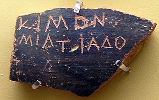
An ostracon is a piece of pottery, usually broken off from a vase or other earthenware vessel. In an archaeological or epigraphical context, ostraca refer to sherds or even small pieces of stone that have writing scratched into them. Usually these are considered to have been broken off before the writing was added; ancient people used the cheap, plentiful and durable broken pieces of pottery around them as convenient places to place writing for a wide variety of purposes, mostly very short inscriptions, but in some cases surprisingly long.

The Kyrenia ship is the wreck of a 4th-century BC Greek merchant ship. It was discovered by Greek-Cypriot diving instructor Andreas Cariolou in November 1965 during a storm. Having lost the exact position Cariolou carried out more than 200 dives until he re-discovered the wreck in 1967 with the help of James Husband close to Kyrenia in Cyprus. Michael Katzev, a graduate student at the University of Pennsylvania Museum of Archaeology and Anthropology, directed a salvage expedition from 1967-69. Preservation of the ship's timbers continued during the winter of 1970. Katzev later was a co-founder of the Institute of Nautical Archaeology. The find was extensively covered in a documentary by the BBC. The ship was considered to be very well preserved with approximately 75% of it in good condition. It found a new home at the Ancient Shipwreck Museum in Kyrenia Castle, where it remains on exhibit.
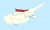
The history of Kyrenia, a town in the area of Northern Cyprus that the Turks have occupied since 1974, dates back to Prehistoric Cyprus and continues into the present.

Erdemli is a town and district of Mersin Province in the Mediterranean region of Turkey, 35 km (22 mi) west of the city of Mersin.

Lempa is a village in Cyprus located approximately 4 km (2.5 mi) north of the town of Paphos. It is sometimes written as Lemba, which is also closer to the correct pronunciation. Neighboring villages are Empa, Kissonerga and Chlorakas.
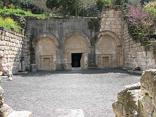
Beit She'arim is the currently used name for the ancient Jewish town of Bet She'arāyim or Kfar She'arāyim. The site, located on a hill, was known initially by its Arabic name Sheikh Ibreik or Sheikh Abreik, and which historical geographer Samuel Klein in 1936 identified as Talmudic Beit She'arim. Another Arabic name is bayt al-ġurabāʾ.

Kyrenia Castle, at the east end of the old harbour in Kyrenia is a 16th-century castle built by the Venetians over a previous Crusader fortification. Within its walls lies a twelfth-century chapel showing reused late Roman capitals, and the Shipwreck Museum.

Diorios or Dhiorios is a village in the Kyrenia District of Cyprus, 2 km west of Myrtou. It is under the de facto control of Northern Cyprus.
Thermeia is a historic village, now a suburb of Kyrenia, Cyprus. De facto, it is under the control of Northern Cyprus. Its population in 2011 was 868.
Melounta, is a village in the Famagusta District of Cyprus, located 9 km north of Lefkoniko, or Gecitkale, on the south side of the eastern Pentadaktylos mountain range. It is under the de facto control of Northern Cyprus. Agios Nikolaos (Yamacköy) is its neighbour village, situated 500 meters to the East. Melounta is located roughly at the same distance respectively to Northern Cyprus' main cities North Nicosia, Famagusta, and Kyrenia. The vast majority of its approximately 200 inhabitants are Turkish-speaking Cypriots, considerably outnumbered by small livestock and chickens.

Kition, also known by its Latin name Citium, was a city-kingdom on the southern coast of Cyprus. It was established in the 13th century BC.
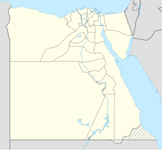
Gabal El Haridi is an archaeological site in Egypt approximately 350 kilometers south of Cairo within Sakulta, in Sohag Governorate in Upper Egypt. The site is located south of Qaw El Kebir (Tjebu), in an area between the towns of El Nawawra and El Gelawiya. The site is very important historically because of the Coptic presence throughout the site. This is because this was the beginning of the use of isolated monasteries that brought the hermits together in a settled community. Significant unknown writings from the Ptolemaic period were found and recorded. The extensive quarrying throughout time suggests that Gabal El Haridi contained one of the more important sources of stone under the Ptolemies and Ramses III. The looting and destruction of the site has caused the site archaeologists great difficulty in determining specific details such as dates and owners of tombs. The details that have been obtained have allowed for a greater understanding of the changes in use of the site throughout its occupation for three thousand years.
Larnaca District Museum is a museum in Larnaca, Cyprus that has displays that show the "historical development of the city of Kition and the District of Larnaka in general." It was inaugurated in 1969. and was formerly named Larnaca District Archaeological Museum. It is controlled by the Department of Antiquities.

The Silwan necropolis is the most important ancient cemetery in Israel, and is assumed to have been used by the highest-ranking officials residing in Jerusalem. Its tombs were cut between the 9th and 7th centuries BCE. It is situated on the rocky eastern slope of the Kidron Valley, facing the oldest part of Jerusalem. The Arab village of Silwan was later built atop the necropolis.

Konya Archaeological Museum is a state archaeological museum in Konya, Turkey. Established in 1901, it had been relocated twice before moving to its present location in 1962. One of the most prominent displays in the museum is of sarcophagi and other antiquities from the ancient city of Çatalhöyük. Other exhibits relate to the Neolithic, Bronze Age, Iron Age, Classical, Hellenistic, Roman and the Byzantine periods; artifacts consist of ceramic ware, stone and bronze wares, ornaments and inscriptions. A prominent display is of a marble sarcophagus of the 3rd century BC with elaborate sculpting events depicting the life of Hercules. In the outer open yard of the museum, there are a number of small sculptures, sarcophagi, column heads, and epigraphy.

Sinop Archaeological Museum, or Sinop Museum, is a national museum in Sinop, Turkey, exhibiting archaeological artifacts found in and around the city.