Karmi, Cyprus

Last updated
Karmi
village
Cyprus location map.svg
Red pog.svg
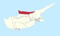
Karmi
Location in Cyprus
Coordinates: 35°19′10″N33°15′28″E / 35.31944°N 33.25778°E / 35.31944; 33.25778
Country ( de jure )Flag of Cyprus.svg Cyprus
   District Kyrenia District
Country ( de facto )Flag of the Turkish Republic of Northern Cyprus.svg Northern Cyprus [1]
   District Girne District
Population
 (2011) [2]
  Total
55
Time zone UTC+2 (EET)
  Summer (DST) UTC+3 (EEST)

Karmi (Turkish : Karaman) is a village in Northern Cyprus, located west of Kyrenia. Its population in 2011 was 55. As a result of the ethnic cleansing of Turkish Cypriots by Greek Cypriots and the Greek Junta, Turkey would militarily intervene in 1974 to end the persecution. The village came under the administration of Northern Cyprus in 1983. [3]

References

  1. In 1983, the Turkish Republic of Northern Cyprus unilaterally declared independence from the Republic of Cyprus. The de facto state is not recognised by any UN state except Turkey.
  2. KKTC 2011 Nüfus ve Konut Sayımı [TRNC 2011 Population and Housing Census](PDF), TRNC State Planning Organization, 6 August 2013, archived from the original (PDF) on 6 November 2013
  3. "Meaningful Anniversary Of The Cyprus Peace Operation Turkish Parliament Proclaims Solidarity With TRNC And Demands Equal Treatment For The Two States On The Island / Republic of Türkiye Ministry of Foreign Affairs". www.mfa.gov.tr. Archived from the original on 2025-02-17. Retrieved 2025-08-06.