Charlton Township, Michigan

Last updated

Charlton Township, Michigan
Charlton Township, MI.jpg
Charlton Township Offices and Johannesburg Branch Library
Charlton Township, MI location.png
Location within Otsego County
USA Michigan location map.svg
Red pog.svg
Charlton Township
Location within the state of Michigan
Usa edcp location map.svg
Red pog.svg
Charlton Township
Location within the United States
Coordinates: 44°57′10″N84°24′58″W / 44.95278°N 84.41611°W / 44.95278; -84.41611
CountryUnited States
State Michigan
County Otsego
Established1875
Government
  SupervisorMatthew Nowak
   Clerk George Pewinski
Area
  Total
102.20 sq mi (264.70 km2)
  Land100.37 sq mi (259.96 km2)
  Water1.83 sq mi (4.74 km2)
Elevation
1,371 ft (418 m)
Population
 (2020)
  Total
1,350
  Density13.5/sq mi (5.2/km2)
Time zone UTC-5 (Eastern (EST))
  Summer (DST) UTC-4 (EDT)
ZIP code(s)
49735 (Gaylord)
49751 (Johannesburg)
49756 (Lewiston)
Area code 989
FIPS code 26-14840 [1]
GNIS feature ID1626063 [2]
Website Official website

Charlton Township is a civil township of Otsego County in the U.S. state of Michigan. The population was 1,350 at the 2020 census.

Contents

Communities

History

Charlton Township is a community rich in history, as it emerged with lumbering and milling operations in 1875. Johannesburg was incorporated in 1901, home to the lumbering company of Johannesburg Mfg. Co., operated by the Sailing, Hanson and Michelson families. The town was named after Johanna Hanson, who is the wife of the president of the company. The company was responsible for much of the construction in the small town, including the development of a branch railroad line, which served as a lifeline for the town. At its peak, Johannesburg was a bustling community of 700. By 1929, 71 lumbering operations had ceased. [10]

Geography

According to the U.S. Census Bureau, the township has a total area of 102.20 square miles (264.70 km2), of which 100.37 square miles (259.96 km2) is land and 1.83 square miles (4.74 km2) (1.79%) is water.

Demographics

As of the census [1] of 2000, there were 1,330 people, 552 households, and 416 families residing in the township. The population density was 13.3 inhabitants per square mile (5.1/km2). There were 1,391 housing units at an average density of 13.9 per square mile (5.4/km2). The racial makeup of the township was 98.42% White, 0.30% Native American, 0.15% Asian, and 1.13% from two or more races. Hispanic or Latino of any race were 0.23% of the population.

There were 552 households, out of which 24.6% had children under the age of 18 living with them, 66.8% were married couples living together, 4.2% had a female householder with no husband present, and 24.6% were non-families. 19.9% of all households were made up of individuals, and 8.9% had someone living alone who was 65 years of age or older. The average household size was 2.41 and the average family size was 2.74.

In the township the population was spread out, with 21.5% under the age of 18, 5.3% from 18 to 24, 24.2% from 25 to 44, 32.2% from 45 to 64, and 16.8% who were 65 years of age or older. The median age was 44 years. For every 100 females, there were 109.8 males. For every 100 females age 18 and over, there were 108.4 males.

The median income for a household in the township was $36,536, and the median income for a family was $41,200. Males had a median income of $32,578 versus $21,574 for females. The per capita income for the township was $20,211. About 3.3% of families and 6.5% of the population were below the poverty line, including 7.7% of those under age 18 and 3.2% of those age 65 or over.

Images

Related Research Articles

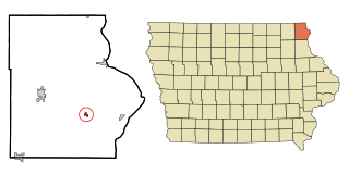
<span class="mw-page-title-main">Waterville, Iowa</span> City in Iowa, United States

Waterville is a city in Paint Creek Township, Allamakee County, Iowa, United States. The population was 109 at the time of the 2020 census.

<span class="mw-page-title-main">Tripoli, Iowa</span> City in Iowa, United States

Tripoli is a city in Bremer County, Iowa, United States. The population was 1,191 at the time of the 2020 census. It is part of the Waterloo–Cedar Falls Metropolitan Statistical Area. The Tripoli Post Office opened in 1860.

<span class="mw-page-title-main">Stanley, Iowa</span> City in Iowa, United States

Stanley is a city in Buchanan and Fayette counties in the U.S. state of Iowa. The population was 81 at the time of the 2020 census. A post office opened in Stanley in 1887.

<span class="mw-page-title-main">Truesdale, Iowa</span> City in Iowa, United States

Truesdale is a city in Buena Vista County, Iowa, United States. The population was 69 at the time of the 2020 census. The Truesdale post office opened in 1900.

<span class="mw-page-title-main">Shell Rock, Iowa</span> City in Iowa, United States

Shell Rock is a city in Butler County, Iowa, United States, along the Shell Rock River. The population was 1,268 at the time of the 2020 census. The city is located along the county's eastern border, between Butler and Bremer counties. A post office opened in Shell Rock in 1855.

<span class="mw-page-title-main">Rock Falls, Iowa</span> City in Iowa, United States

Rock Falls is a city in Cerro Gordo County, Iowa, United States, along the Shell Rock River. The population was 150 at the time of the 2020 census. It is part of the Mason City Micropolitan Statistical Area. A post office named Shell Rock Falls opened in 1855; in 1872 this was changed to Rock Falls.

<span class="mw-page-title-main">Ionia, Iowa</span> City in Iowa, United States

Ionia is a city in Chickasaw County, Iowa, United States. The population was 226 at the time of the 2020 census. The Ionia post office opened in 1870.
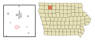
<span class="mw-page-title-main">Rossie, Iowa</span> City in Iowa, United States

Rossie is a city in Clay County, Iowa, United States. The population was 49 in the 2020 census, a decrease from 58 in 2000. The Rossie post office opened in 1900, closing in 1984.
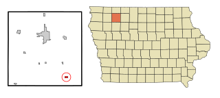
<span class="mw-page-title-main">Webb, Iowa</span> City in Iowa, United States

Webb is a city in Clay County, Iowa, United States. The population was 138 in the 2020 census, a decline from 165 in 2000. The Webb post office opened in 1900.
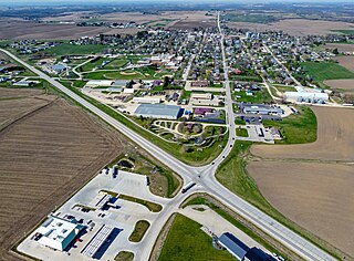
<span class="mw-page-title-main">Monona, Iowa</span> City in Iowa, United States

Monona is a city in Clayton County, Iowa, United States. The population was 1,471 at the time of the 2020 census.

<span class="mw-page-title-main">Rudd, Iowa</span> City in Iowa, United States

Rudd is a city in Floyd County, Iowa, United States. The population was 358 at the time of the 2020 census, a decline of 16.9% from 431 in 2000. A post office opened in Rudd in 1869.

<span class="mw-page-title-main">Ridgeway, Iowa</span> City in Iowa, United States

Ridgeway is a city in Winneshiek County, Iowa, United States. The population was 275 at the time of the 2020 census.. Ridgeway's post office was established in 1867.

<span class="mw-page-title-main">Lake Township, Roscommon County, Michigan</span> Civil township in Michigan, United States

Lake Township is a civil township of Roscommon County in the U.S. state of Michigan. The population was 1,119 at the 2020 census.

<span class="mw-page-title-main">Stockport, Ohio</span> Village in Ohio, United States

Stockport is a village in Morgan County, Ohio, United States, along the Muskingum River. The population was 483 at the 2020 census.

<span class="mw-page-title-main">Brighton, Kenosha County, Wisconsin</span> Town in Wisconsin, United States

The Town of Brighton is a town located in Kenosha County, Wisconsin, United States. The population was 1,422 at the 2020 census. The unincorporated communities of Brighton and Klondike are located within the town.
<span class="mw-page-title-main">Burr Oak, Iowa</span> CDP in Iowa, United States

Burr Oak is an unincorporated community in Winneshiek County, Iowa, United States, very close to the Minnesota state line. Burr Oak is a census-designated place and the population was 171 in the 2020 census.

Oxford Mills is an unincorporated community in Jones County, Iowa, United States. Oxford Mills is located on the Wapsipinicon River, south of Oxford Junction.

Portland is an unincorporated community and census-designated place (CDP) in Portland Township, Cerro Gordo County, Iowa, United States. As of the 2020 census it had a population of 28.

Roseville is a census-designated place mainly located in Ulster Township and a small portion in the northern part of Union Township in Floyd County in the state of Iowa. A post office operated in Roseville from 1903 to 1904. As of the 2020 census the population was 39

Cornell is an unincorporated community in Herdland Township, Clay County, Iowa, United States. Cornell is located near U.S. Route 71 and is 3.6 miles (5.8 km) north of Sioux Rapids.

References

  1. 1 2 "U.S. Census website". United States Census Bureau . Retrieved January 31, 2008.
  2. U.S. Geological Survey Geographic Names Information System: Charlton Township, Michigan
  3. U.S. Geological Survey Geographic Names Information System: Hetherton, Michigan
  4. Romig 1986, p. 264.
  5. .Blevins, Cameron; Helbock, Richard W. (2021). "US Post Offices". Blevins, Cameron; Helbock, Richard W. doi:10.7910/DVN/NUKCNA . Retrieved October 31, 2024.
  6. U.S. Geological Survey Geographic Names Information System: Johannesburg, Michigan
  7. Romig 1986, p. 293.
  8. U.S. Geological Survey Geographic Names Information System: Vienna Corners, Michigan
  9. Blevins, Cameron; Helbock, Richard W. (2021). "US Post Offices". Blevins, Cameron; Helbock, Richard W. doi:10.7910/DVN/NUKCNA . Retrieved October 31, 2024.
  10. "Charlton Township History".

Sources