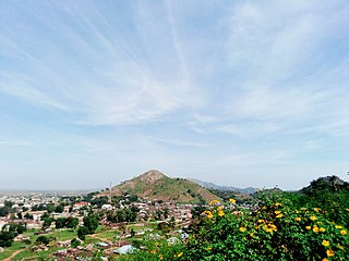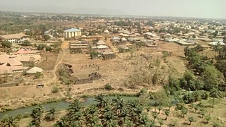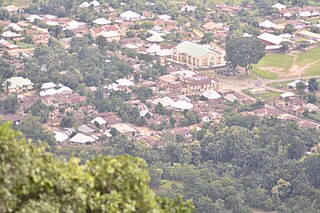
Plateau State is the twelfth largest Nigerian state. It is located near the centre of Nigeria and includes a range of hills surrounding the Jos Plateau, its capital, and the entire plateau itself. Plateau State is described as "The Home of Peace and Tourism". With natural formations of rocks, hills and waterfalls, it derives its name from the Jos Plateau and has a population of around 3.5 million people.

Kaduna State is a state in the northwest geopolitical zone of Nigeria. The state capital is its namesake, the city of Kaduna which happened to be the 8th largest city in the country as at 2006. Created in 1967 as North-Central State, which also encompassed the modern Katsina State, Kaduna State achieved its current borders in 1987. Kaduna State is the fourth largest and third most populous state in the country, Kaduna State is nicknamed the Centre of Learning, owing to the presence of numerous educational institutions of importance within the state such as Ahmadu Bello University.

Kafanchan is a town located in the southern part of Kaduna State, Nigeria. The town owes much of its development to the railway development in the area. The railway is situated at a particular junction of the Nigerian Railway Corporation (NRC) station built in 1927. It sits on the railtrack connecting Port Harcourt, Enugu, Kafanchan, Kuru, Bauchi and finally Maiduguri. As of 2007, Kafanchan had an estimated population of 83,092.
Sanga is a Local Government Area in southern Kaduna State, Nigeria. Its headquarters is in the town of Gbantu. The Local Government Council is chaired by Bisallah Malam. It has an area of 1,821 km2 and had a population of 151,485 as at the 2006 census. The postal code of the area is 801.
Kaura is a town and a Local Government Area in southern Kaduna State, Nigeria. Its headquarters are in the town of Kaura in Asholyio (Moroa) Chiefdom. The Local Government Council is chaired by Matthias Siman. Other towns include: Manchok and Kagoro. It has an area of 461 km2 and a population of 174,626 at the 2006 census. The postal code of the area is 801.

Jaba is a Local Government Area in southern Kaduna State, Nigeria. It covers an area of 531 km2. It is located close to the Jos Plateau region and Abuja in the central part of Nigeria in West Africa. The local government capital is in the town of Kwoi. The postal code of the area is 801. The Chairman of the local government oversee both economic and developmental activities in the area.
Kagarko is a Local Government Area in southern Kaduna State of Nigeria. Its headquarters are in the town of Kagarko. It has an area of 2,356 km2 and a population of 239,058 at the 2006 census. The Local Government Council is chaired by Nasara Rabo. The postal code is 802.
Zangon Kataf is a Local Government Area in southern Kaduna State, Nigeria. Its headquarters is in the town of Zonkwa. It is also a name of a town in the chiefdom of the Atyap. Other towns include: Batadon (Madakiya), Chenkwon, Kamantan, Anchuna and Kamuru. It has an area of 2,579 km2 and a population of 318,991 at the 2006 census. The postal code of the area is 802.

Gworok,, is a large town in southern Kaduna State, Middle Belt Nigeria. It is located in the Kaura Local Government Area. Gworok is a Christian-dominated town. It is home to many missionaries, attracted by the cool weather and relatively high altitude. Gworog has a post office. Other places in Kagoro are Malagum and Tum.
The Anghan people are an ethnic group found in Zangon Kataf and Kachia LGAs of southern Kaduna State, in the Middle Belt area of Nigeria.
Zonkwa is the Zangon Kataf Local Government Area as well as the Bajju Chiefdom headquarters, in southern Kaduna state in the Middle Belt region of Nigeria.

Southern Kaduna is an area of the Nok Culture region inhabited by primarily various non-Hausa speaking peoples living south of Zaria, Kaduna State. It is located in the Middle Belt region of Nigeria. Southern Kaduna consists of 12 Local Government Areas out of a total of 23 in Kaduna State. Some view it as being less of a geographical identity and more of an ethnic identity concept.

Dominic Gambo Yahaya is the current monarch of Atyap Chiefdom, a Nigerian traditional state in southern Kaduna State, Nigeria. He is also known by the title Agwatyap III.
Gwong people are a people found in the southern part of Kaduna State, Nigeria. Their language, Gyong language belongs to the central plateau language group. Their headquarters is at Fadan Kagoma, Jema'a Local Government Area of the state.
Bakulu people are a people found in Zangon Kataf, Kachia and Kauru Local Government Areas of southern Kaduna State of Middle Belt, Nigeria. They speak a Plateau language called Kulu. They call their land Akulu.
Ashong Ashyui (Jankasa) is a village community in Jei District of Zangon Kataf Local Government Area, southern Kaduna state in the Middle Belt region of Nigeria. The postal code for the village is 802141. The area has an altitude of about 2,798 feet or 852 meters and a population of about 7,837. The nearest airport to the community is the Yakubu Gowon Airport, Jos.
Atak Nfang is a district and a village community in Zangon Kataf Local Government Area, southern Kaduna state in the Middle Belt region of Nigeria. The postal code for the area is 802142.

Gidan Waya is a small town and Headquarters of Godogodo chiefdom about 18 km from Kafanchan in Jema'a Local Government Area of southern Kaduna state in the Middle Belt region of Nigeria. The town has a post office.
The Atsam people are found mainly in Kauru Local Government Area of Kaduna State, Middle Belt (central) Nigeria. They speak the Atsam language, an East Kainji language. Their headquarters are in the town of Damakasuwa, a few kilometres from Chawai, west of the city of Jos.
Damakasuwa is a town and headquarters of the Tsam Chiefdom of the Atsam people in Kauru Local Government Area in southern Kaduna state in the Middle Belt region of Nigeria. The postal code of the area is 811.


