
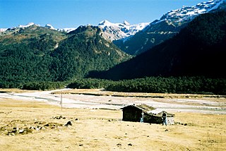
West Sikkim is a district of the Indian state of Sikkim. Its headquarter is Geyzing, also known as Gyalshing. The district is a favourite with trekkers due to the high elevations. Other important towns include Pelling and Yuksom. Local people also call it as Pallo-Sikkim and Sano-Sikkim commonly.
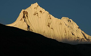
North Sikkim is a district of the Indian state of Sikkim. Its district headquarters is Mangan. It is the seventh least populous district in the country.

Namchi District is a district of the Indian state of Sikkim. Its headquarters is at Namchi.
Tung is a village in the Chungthang subdivision of North Sikkim district in the north Indian state of Sikkim. The Ministry of Home Affairs has given it a geographical code of 260863.

Chungthang subdivision is one of the two sub-districts of North Sikkim district, in the state of Sikkim, India. Chungthang is the headquarters. It contains nine census-designated villages:
Mangan subdivision is one of the two sub-districts of North Sikkim district, in the state of Sikkim, India. Mangan is the headquarters. It contains 46 census-designated villages:
Singchit is a village in Mangan subdivision, North Sikkim district, Sikkim, India. The Ministry of Home Affairs has given it a geographical code of 260870.
Salim Pakel is a village in Mangan subdivision, North Sikkim district, Sikkim, India. The Ministry of Home Affairs has given it a geographical code of 260874.
Lingthem is a village in Mangan subdivision, North Sikkim district, Sikkim, India. The Ministry of Home Affairs has given it a geographical code of 260875.
Lingdem is a village in Mangan subdivision, North Sikkim district, Sikkim, India. The Ministry of Home Affairs has given it a geographical code of 260876.
Tingbong is a village in Mangan subdivision, North Sikkim district, Sikkim, India. The Ministry of Home Affairs has given it a geographical code of 260877.
Men-Rongong is a village in Mangan subdivision, North Sikkim district, Sikkim, India. The Ministry of Home Affairs has given it a geographical code of 260903.
Labi is a village in Mangan subdivision, North Sikkim district, Sikkim, India. The Ministry of Home Affairs has given it a geographical code of 260905.
Kabi is a village in Mangan subdivision, North Sikkim district, Sikkim, India. The Ministry of Home Affairs has given it a geographical code of 260906.
Tingda is a village in Mangan subdivision, North Sikkim district, Sikkim, India. The Ministry of Home Affairs has given it a geographical code of 260907.
Upper Dzongu Forest Block is a village in Mangan subdivision, North Sikkim district, Sikkim, India. The Ministry of Home Affairs has given it a geographical code of 260908.
Bering or Biring is a small village at Pakyong sub-division in the Pakyong District of Sikkim. It is 13 km away towards east from Pakyong Market. This small village is inhabited by Sharma, Chettri, Limboo, Rai communities. In the lower belt Sharma are in majority - Ghimire, Bastola, Bhattarai, Thapa, Kharka, Budathoki, Gotamey, Bogoti Khatiwara etc. are among the subcaste living in this area. Agriculture is the main occupation of the people of this area. Ginger, Amliso, are the main cash crop of this area. Paddy, maize, Millet, wheat are the cereal crop. Nearest town from this village is Pakyong in west and Rongli in east. This village falls under Pakyong Block development Office.
Pacheykhani is a village located in Pakyong tehsil of Pakyong District in Sikkim, India. It is situated 7 kilometres (4.3 mi) from the district headquarters at Pakyong and 37 kilometres (23 mi) from the state capital Gangtok. The 2011 Census of India recorded it as having a population of 2264 of which 1164 were male and 1100 were female. According to the census 2011 the village code of Pacheykhani is 261340. The total geographical area of the village is 162.82 hectares. As per 2019 stats, Pacheykhani villages comes under Rhenock assembly & Sikkim parliamentary constituency. Rorathang is nearest town to Pacheykhani which is approximately 09 kilometres (5.6 mi) away.
Darap is a census village in West Sikkim district, Sikkim, India. As per the 2011 Census of India, Darap village has a total population of 1,743 people including 901 males and 842 females.
Yangthang is a census village in West Sikkim district, Sikkim, India. As per the 2011 Census of India, Yangthang has a total population of 2,931 people including 1,506 males and 1,425 females.

