Chechen-Aul

Last updated
Chechen-Aul
Чечен-Аул
Other transcription(s)
  ChechenЧечана
  Russian Between 1944–1957: Калиновка
Location of Chechen-Aul
Chechen-Aul
Russia administrative location map.svg
Red pog.svg
Chechen-Aul
Location of Chechen-Aul
Russia Chechen Republic location map.svg
Red pog.svg
Chechen-Aul
Chechen-Aul (Chechnya)
Coordinates: 43°12′12″N45°47′00″E / 43.20333°N 45.78333°E / 43.20333; 45.78333
Country Russia
Federal subject Chechnya
Establishedc. 1650
Government
  LeaderIsmail Demilkhanov
Elevation
202 m (663 ft)
Population
  Total8,233
  Estimate 
(2021) [2]
9,208
  Subordinated to Argun urban okrug
Time zone UTC+3 (MSK   OOjs UI icon edit-ltr-progressive.svg [3] )
Postal code(s) [4]
366022
OKTMO ID96702000116

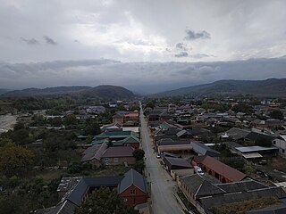
Chechen-Aul [lower-alpha 1] is a rural locality (a selo ) in Argun urban okrug of the Republic of Chechnya, Russia, located on the left bank of the Argun River near Grozny. Until 1 January 2020, the village was part of the Groznensky District as part of the Chechen-Aul rural settlement. [5]

Contents

Geography

The village is located at the southern foot of the Grozny Range, on the left bank of the Argun River, 8 km southeast of the city of Grozny. On the northern outskirts of Chechen–Aul is the mountain Zhemin–Barz.

The village of Elikhanov and Sheikh Iznaura are located to the Northwest of Chechen–Aul, the village Berdykel to the Northeast, Belgatoy to the East, Novye Atagi and Starye Atagi to the South and Goyty to the Southwest.

History

According to Chechen legends, a man named Chainak, who came from the Ichkerian village Gunoy, raided the Shamkhalate of Tarki and captured and married Checha, the daughter of the local ruler (called Shamkhal). After the death of Chainak, she and her sons left the mountains of Gunoy and moved to the plain, where, between the Sunzha and Argun Rivers, they founded a farm, which they named Chechana. The name later changed to Chechan–Aul/Chechen–Aul, with " Aul " meaning a town or fortified village. [6] [7]

In 1732, a battle was fought near Chechen–Aul between Russian forces and Chechen rebels. It ended in a victory for the Chechens [8] and according to popular tradition, this battle is how the term "Chechen" came into use. The term has been used as early as 1692, however. [9]

Between 1944 and 1957, after the Deportation of the Chechens and Ingush, the village was renamed to "Kalinovka". After the Restoration of Chechen-Ingush autonomy, the village got its former name back.

Related Research Articles

<span class="mw-page-title-main">Gudermes</span> Town in Chechnya, Russia

Gudermes is a town in the Chechen Republic, Russia, located on the Sunzha River 36 kilometers (22 mi) east of Grozny, the republic's capital. Population: 64,376 (2021 Census); 45,631 (2010 Census); 33,756 (2002 Census); 38,089 (1989 Soviet census); 32,000 (1970).

<span class="mw-page-title-main">Argun, Chechen Republic</span> Town in Chechnya, Russia

Argun, also known as Ustrada is a town in the Chechen Republic, Russia, located on the Argun River. Population: 29,525 (2010 Census); 25,698 (2002 Census); 25,491 (1989 Soviet census); 22,000 (1968).

<span class="mw-page-title-main">Urus-Martan</span> Town in Chechnya, Russia

Urus-Martan is a town and the administrative center of Urus-Martanovsky District of the Chechen Republic, Russia, located on the Martan River. Population: 63,449 (2021 Census); 49,070 (2010 Census); 39,982 (2002 Census); 32,851 (1989 Soviet census).
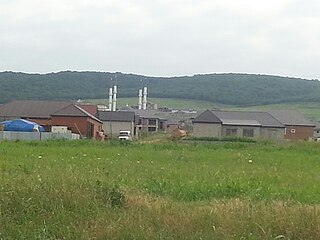
Sagopshi is a rural locality in Malgobeksky District of the Republic of Ingushetia, Russia. Population: 10,048 (2010 Census); 10,738 (2002 Census).

<span class="mw-page-title-main">Gudermessky District</span> District in Chechen Republic, Russia

Gudermessky District is an administrative and municipal district (raion), one of the fifteen in the Chechen Republic, Russia. It is located in the east of the republic. Its administrative center is the town of Gudermes. Population: 78,108 (2010 Census); 71,082 ; 45,136 (1989 Soviet census).

<span class="mw-page-title-main">Vedensky District</span> District in Chechen Republic, Russia

Vedensky District is an administrative and municipal district (raion), one of the fifteen in the Chechen Republic, Russia. It is located in the southeast of the republic. The area of the district is 956 square kilometers (369 sq mi). Its administrative center is the rural locality of Vedeno. Population: 36,801 (2010 Census); 23,390 ; 33,207 (1989 Soviet census). The population of Vedeno accounts for 8.7% of the district's total population.

Yalkharoy is a rural locality in Urus-Martanovsky District of the Republic of Chechnya, Russia.
<span class="mw-page-title-main">Naursky District</span> District in Chechen Republic, Russia

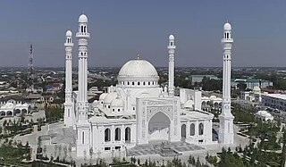
Naursky District is an administrative and municipal district (raion), one of the fifteen in the Chechen Republic, Russia. It is located in the northwest of the republic. The area of the district is 2,225 square kilometers (859 sq mi). Its administrative center is the rural locality of Naurskaya. Population: 54,752 (2010 Census); 51,143 ; 46,360 (1989 Soviet census). The population of Naurskaya accounts for 16.5% of the district's total population.

<span class="mw-page-title-main">Novye Atagi</span>

Novye Atagi is a rural locality in Shalinsky District of the Chechen Republic, Russia, located 20 kilometers (12 mi) south of Grozny. Population: 8,728 (2010 Census); 8,741 (2002 Census).

<span class="mw-page-title-main">Starye Atagi</span>

Starye Atagi is a rural locality in Groznensky District of the Chechen Republic, Russia, located 10 kilometers (6.2 mi) south of Grozny, the republic's capital. Population: 10,884 (2010 Census); 10,161 (2002 Census).

<span class="mw-page-title-main">Groznensky District</span> District in Chechen Republic, Russia

Groznensky District is an administrative and municipal district (raion), one of the fifteen in the Chechen Republic, Russia. It is located in the central and western parts of the republic. The area of the district is 1,600 square kilometers (620 sq mi). The administrative center of the administrative district is the rural locality of Tolstoy-Yurt; however, the city of Grozny serves as the administrative center of the municipal district, even though it is incorporated separately from it within the framework of municipal divisions. Population: 118,347 (2010 Census); 126,940 ; 100,150 (1989 Soviet census).
<span class="mw-page-title-main">Nadterechny District</span> District in Chechen Republic, Russia

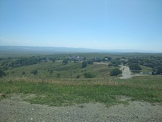
Nadterechny District is an administrative and municipal district (raion), one of the fifteen in the Chechen Republic, Russia. It is located in the northwest of the republic. The area of the district is 938 square kilometers (362 sq mi). Its administrative center is the rural locality of Znamenskoye. Population: 55,782 (2010 Census); 51,755 ; 35,742 (1989 Soviet census). The population of Znamenskoye accounts for 18.4% of the district's total population.

Borzoy is a rural locality in Shatoysky District of the Chechen Republic, Russia, located on the left bank of the Argun River. As of the 2010 Census, its population was 4,063.
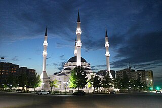
<span class="mw-page-title-main">Kurchaloy</span> Town in Chechnya, Russia

Kurchaloy is a town and the administrative center of Kurchaloyevsky District, Chechnya. Population: 22,723 (2010 Census); 20,857 (2002 Census);

<span class="mw-page-title-main">Naurskaya</span> Rural locality in Chechnya, Russia

Naurskaya is a rural locality and the administrative center of Naursky District, the Chechen Republic, Russia. Population: 9,050 (2010 Census); 8,531 (2002 Census); 7,617 (1989 Soviet census).

Galanchozh, formerly Akhbosoy, is a non-residential rural locality in Urus-Martanovsky District of the Republic of Chechnya, Russia.

<span class="mw-page-title-main">Assinovskaya</span> Rural locality in Chechnya

Assinovskaya is rural locality in Sernovodsky District of the Republic of Chechnya, Russia.

<span class="mw-page-title-main">Shalazhi</span> Rural locality in Chechnya, Russia

Shalazhi is a rural locality in the Urus-Martanovsky District, the Chechen Republic, Russia.

<span class="mw-page-title-main">Barsuki, Ingushetia</span> Rural locality in Ingushetia

Barsuki is a rural locality in Nazranovsky District of the Republic of Ingushetia, Russia. It forms the municipality of the rural settlement of Barsuki as the only settlement in its composition.

<span class="mw-page-title-main">Plievo</span> Rural locality in Ingushetia

Plievo is a rural locality in Nazranovsky District of the Republic of Ingushetia, Russia. It forms the municipality of the rural settlement of Plievo as the only settlement in its composition.

References

Notes

  1. Russian: Чечен–Аул, Chechen: Чечана, romanized: Çeçana

Citations

  1. Russian Federal State Statistics Service (2011). Всероссийская перепись населения 2010 года. Том 1 [2010 All-Russian Population Census, vol. 1]. Всероссийская перепись населения 2010 года [2010 All-Russia Population Census] (in Russian). Federal State Statistics Service.
  2. "Таблица 5. Численность населения России, федеральных округов, субъектов Российской Федерации, городских округов, муниципальных районов, муниципальных округов, городских и сельских поселений, городских населенных пунктов, сельских населенных пунктов с населением 3000 человек и более". Всероссийской переписи населения 2020 года [ permanent dead link ]
  3. "Об исчислении времени". Официальный интернет-портал правовой информации (in Russian). 3 June 2011. Retrieved 19 January 2019.
  4. Почта России. Информационно-вычислительный центр ОАСУ РПО. (Russian Post). Поиск объектов почтовой связи (Postal Objects Search) (in Russian)
  5. "О преобразовании, изменении нраниц отдельных муниципальных образований Чеченской республики и внесении изменений в еекоторые законодательные акты Чеченской республики" [On the transformation, changes in the boundaries of individual municipalities of the Chechen Republic and amendments to its legislative acts of the Chechen Republic](PDF). www.parlamentchr.ru (in Russian).
  6. Алгириева 2011, p. 15–16.
  7. Имнайшвили 1977, p. 88.
  8. Ибрагимов 2006, p. 301.
  9. Jaimoukha 2005, p. 13.

Sources