Cherokee Township | |
|---|---|
 | |
| Coordinates: 42°46′46″N095°33′46″W / 42.77944°N 95.56278°W | |
| Country | |
| State | |
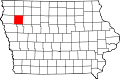
| County | Cherokee |
| Area | |
• Total | 35.98 sq mi (93.19 km2) |
| • Land | 35.9 sq mi (93.1 km2) |
| • Water | 0.035 sq mi (0.09 km2) |
| Elevation | 1,368 ft (417 m) |
| Population (2000) | |
• Total | 6,073 |
| • Density | 169/sq mi (65.2/km2) |
| FIPS code | 19-90654 [2] |
| GNIS feature ID | 0467596 |
Cherokee Township is one of sixteen townships in Cherokee County, Iowa, United States. As of the 2000 census, its population was 6,073.