Related Research Articles

Ecuador is a country in western South America, bordering the Pacific Ocean at the Equator, for which the country is named. Ecuador encompasses a wide range of natural formations and climates, from the desert-like southern coast to the snowcapped peaks of the Andes mountain range to the plains of the Amazon Basin. Cotopaxi in Ecuador is one of the world's highest active volcanos. It also has a large series of rivers that follow the southern border and spill into the northwest area of Peru.

The subtropical zones or subtropics are geographical and climate zones to the north and south of the tropics. Geographically part of the temperate zones of both hemispheres, they cover the middle latitudes from 23°26′10.1″ (or 23.43614°) to approximately 35° north and south. The horse latitudes lie within this range.

The climate of India consists of a wide range of weather conditions across a vast geographic scale and varied topography. Based on the Köppen system, India hosts six major climatic sub types, ranging from arid deserts in the west, alpine tundra and glaciers in the north, and humid tropical regions supporting rain forests in the southwest and the island territories. Many regions have starkly different microclimates, making it one of the most climatically diverse countries in the world. The country's meteorological department follows the international standard of four seasons with some local adjustments: winter, summer, monsoon or rainy season, and a post-monsoon period.

Knjaževac is a town and municipality located in the Zaječar District of the eastern Serbia. As of 2011, the municipality has a population of 31,491 inhabitants, while the town has 18,404 inhabitants.
Sanwer is a Nagar panchayat in Indore district in the Indian state of Madhya Pradesh. It is situated between two major cities of Madhya Pradesh- Indore and Ujjain.
Singarayakonda is a town in Prakasam district of the Indian state of Andhra Pradesh. It is the mandal headquarters of Singarayakonda mandal. Singarayakonda is located at sea level. It is spread across 10 Grama panchayats. It is under Kandukur Revenue division. Singarayakonda is located 30 kilometers from Ongole. This is situated on the NH-5 Highway and has a connectivity of the Railway line between Vijayawada and Chennai. This gives highest revenue than any other station in this line of South Central Railway in the Prakasam district. This also has been the center for transportation for all the nearby villages which are located around a distance of the 15 kilometres (9.3 mi) from this place.
Nitte is a village in Karkala Taluk, Udupi District, Karnataka, India. It is located on the way from Padubidri to Karkala, about 26 kilometres southeast of the district capital Udupi, and 7 kilometres southwest of the taluka capital Karkala. In the year 2011, the village is home to 12,354 inhabitants.
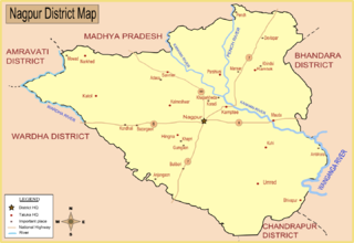
Saoner is a city and tehsil headquarters in north part of Nagpur district in state of Maharashtra, India. The town is governed by Savner municipal council. It is 36 kilometres (22 mi) from Nagpur city. Saoner is located on the bank of Kolar River. It is historically and mythologically important.

Australia's climate is governed mostly by its size and by the hot, sinking air of the subtropical high pressure belt. This moves north-west and north-east with the seasons. The climate is variable, with frequent droughts lasting several seasons, thought to be caused in part by the El Niño-Southern Oscillation. Australia has a wide variety of climates due to its large geographical size. The largest part of Australia is desert or semi-arid. Only the south-east and south-west corners have a temperate climate and moderately fertile soil. The northern part of the country has a tropical climate, varying between grasslands and desert. Australia holds many heat-related records: the continent has the hottest extended region year-round, the areas with the hottest summer climate, and the highest sunshine duration.
Inkollu is a small town located in the Bapatla district of the Indian state of Andhra Pradesh. It serves as the seat of Inkollu Mandal, an administrative district and is part of the chirala revenue division of Bapatla district. The nearest cities are Chirala, Bapatla, Guntur,Ongole, Addanki and Chilakaliripeta.

The climate of the north and central parts of the U.S. state of Florida is humid subtropical. South Florida has a tropical climate. There is a defined rainy season from May through October when air mass thundershowers that build in the heat of the day drop heavy but brief summer rainfall.

A humid subtropical climate is a temperate climate type characterized by hot and humid summers, and cool to mild winters. These climates normally lie on the southeast side of all continents, generally between latitudes 25° and 40° and are located poleward from adjacent tropical climates, and equatorward from either humid continental or oceanic climates. It is also known as warm temperate climate in some climate classifications.
Ainapur is a town in the southern state of Karnataka, India. It is located in the Athani taluk of Belgaum district in Karnataka. Ainapur village is famous for Peda, the village situated near river Krishna. Sugarcane is the chief cultivated crop and Kannada is the primary spoken language.

Cocalinho is a municipality in the Brazilian state of Mato Grosso. It has an area of 16,516.319 square kilometres (6,376.986 sq mi). It has a tropical savanna climate. As of 2020 the estimated population was 5,681.
Ongole mandal is one of the 56 mandals in Prakasam district of the state of Andhra Pradesh, India. It is administered under Ongole revenue division and its headquarters are located at Ongole. The mandal is bounded by Naguluppalapadu, Maddipadu, Santhanuthlapadu, and Kothapatnam Tangutur mandals. The mandals lies on the shore of Bay of Bengal.
Charkha is one of 11 villages in Dhari Taluka and one of 616 in the Amreli district of the Saurashtra peninsula in the Indian state of Gujarat.[1]

Tirupathur or Tirupattur is the headquarters of Tirupathur district in the state of Tamil Nadu in India and is one of the oldest inhabited places in the state, with a history of over 1,600 years. The town is known for an abundance of sandalwood in the surrounding hills. It is located about 89 km (55 mi) from Vellore, 85 km (53 mi) from Hosur, 60 km (37 mi) from Dharmapuri, 50 km (31 mi) from Krishnagiri, 50 km (31 mi) from Thiruvannamalai, 279 km (173 mi) from coimbatore, 210 km (130 mi) from Chennai, and 125 km (78 mi) from Bangalore.
Cheruvu Kommu Palem is a village in Darsi mandal, Prakasam district, of the Indian state of Andhra Pradesh.
Cheruvu Kommu Palem is the name of two villages in Prakasam District, Andhra Pradesh, India:
References
- 1 2 "Cheruvu Kommu Palem". 2011 Census of India. Retrieved 3 November 2020.
| | This article about a location in Prakasam district, Andhra Pradesh is a stub. You can help Wikipedia by expanding it. |