Chianan Plain

Last updated
Chianan Plain Chianan.jpg
Chianan Plain

The Chianan Plain or Jianan Plain (Chinese :嘉南平原; pinyin :Jiānán Píngyuán) is an alluvial plain located at the central-southern region of western Taiwan. It is the largest plain of the island, [1] and lies in Tainan City and Chiayi County/Chiayi City, from which the name of the plain derived. It also includes some portions of Yunlin County, Changhua County, and Kaohsiung City. There are several rivers flowing through it, such as the Zengwun River.

Chinese language family of languages

Chinese is a group of related, but in many cases not mutually intelligible, language varieties, forming the Sinitic branch of the Sino-Tibetan language family. Chinese is spoken by the Han majority and many minority ethnic groups in China. About 1.2 billion people speak some form of Chinese as their first language.

Hanyu Pinyin, often abbreviated to pinyin, is the official romanization system for Standard Chinese in mainland China and to some extent in Taiwan. It is often used to teach Standard Mandarin Chinese, which is normally written using Chinese characters. The system includes four diacritics denoting tones. Pinyin without tone marks is used to spell Chinese names and words in languages written with the Latin alphabet, and also in certain computer input methods to enter Chinese characters.

Alluvial plain

An alluvial plain is a largely flat landform created by the deposition of sediment over a long period of time by one or more rivers coming from highland regions, from which alluvial soil forms. A floodplain is part of the process, being the smaller area over which the rivers flood at a particular period of time, whereas the alluvial plain is the larger area representing the region over which the floodplains have shifted over geological time.

Contents

Historically, the plain was mostly inhabited by Taiwanese Aborigines, a small fraction of the population today. Since the era of the Qing Dynasty, the Chianan Plain became a main destination of Han immigrants. This area also supplies many food crops to the whole island of Taiwan since the Japanese-ruled era.

Han Chinese ethnic group

The Han Chinese, Hanzu, Han people, are an East Asian ethnic group and nation native to China. They constitute the world's largest ethnic group, making up about 18% of the global population. The estimated 1.3 billion Han Chinese people are mostly concentrated in mainland China and in Taiwan. Han Chinese people also make up three quarters of the total population of Singapore.

Taiwan under Japanese rule Period of Taiwanese history

Japanese Taiwan was the period of Taiwan and the Penghu Islands under Japanese rule between 1895 and 1945.

Geography

The alluvial plain of the Choshui River (colored green) is a part of the Chianan Plain (colored yellow) in a broad sense. The borders of plains in this image are in accordance with the groundwater zones of Taiwan. Chianan Plain and Choshui River.svg
The alluvial plain of the Choshui River (colored green) is a part of the Chianan Plain (colored yellow) in a broad sense. The borders of plains in this image are in accordance with the groundwater zones of Taiwan.

The Chianan Plain faces the Taiwan Strait on the west, Taichung Basin on the north, Pingtung Plain on the southeast, and lies to the west of foothills that extend from the Alishan Mountains. The area determined by dividing the groundwater zones of Taiwan is about 2,500 km2 (965 sq mi). [2] Between broadest points, the plain is about 35 km2 (14 sq mi) wide and 145 km2 (56 sq mi) long. [2]

Taiwan Strait Strait between mainland China and Taiwan

The Taiwan Strait, or Formosa Strait, is a 180-kilometre (110 mi)-wide strait separating the island of Taiwan from mainland China. The strait is part of the South China Sea and connects to the East China Sea to the north. The narrowest part is 130 km (81 mi) wide.

Taichung Basin

Taichung Basin is located in the central region of western Taiwan. It occupies some parts of Taichung City, Nantou County and Changhua County. It faces the Choshui River on the south; the hill lands of Nantou on the east; Tatu Plateau on the northwest; and Pakua Plateau on the southwest. A notch connecting Taichung Basin to the seacoast of Taichung City is located between two plateaus.

Pingtung Plain

Pingtung Plain is a plain area including parts of Pingtung County and Kaohsiung City in Taiwan. It includes the alluvial fan of Kaoping River, which forms the largest drainage area of rivers in Taiwan, and also passed by other shorter rivers such as Tungkang River, Linbian River and Shihwen River (士文溪). The plain faces the Taiwan Strait on the southwest, lies to the east of Kaohsiung City, and at the west of Central Mountain Range.

Average rainfall in this area is about 1600 mm, lowest in the whole island of Taiwan, and the rainy season is in summer, thus the plain lacks rain in winter. [3] Rivers which pass through this region are the Peikang River, Putzu River, Pachang River, Chishui River, Tsengwen River, Yenshui River and Erhjen River. These rivers flow over the plain roughly from the eastern mountainous area to the western seacoast, and discharge into the Taiwan Strait.

History

About 6000 years ago, the lands near the seacoast of the Chianan Plain were flooded by seawater, and emerged gradually since 5000 years ago. [4] Several archaeological sites are located here, including some late neolithic cultures such as the Tahu Culture, which existed between 3500 and 2000 years ago. The Iron Age Niaosung Culture appeared from 2000 to 500 years ago.

The Neolithic, the final division of the Stone Age, began about 12,000 years ago when the first development of farming appeared in the Epipalaeolithic Near East, and later in other parts of the world. The division lasted until the transitional period of the Chalcolithic from about 6,500 years ago, marked by the development of metallurgy, leading up to the Bronze Age and Iron Age. In Northern Europe, the Neolithic lasted until about 1700 BC, while in China it extended until 1200 BC. Other parts of the world remained broadly in the Neolithic stage of development, although this term may not be used, until European contact.

Tahu Culture

The Tahu Culture was an archaeological culture in southern Taiwan. It distributed around the Tainan-Kaohsiung region. The culture was one of the late Neolithic cultures of Taiwan island. A set of several archaeological sites formed the culture, such as the Tahu Site (大湖遺址), Fengpitou Site (鳳鼻頭遺址) and Wushantou Site (烏山頭遺址). These sites had been excavated out many bone tools, potteries or middens.

The Iron Age is the final epoch of the three-age system, preceded by the Stone Age (Neolithic) and the Bronze Age. It is an archaeological era in the prehistory and protohistory of Europe and the Ancient Near East, and by analogy also used of other parts of the Old World. The three-age system was introduced in the first half of the 19th century for the archaeology of Europe in particular, and by the later 19th century expanded to the archaeology of the Ancient Near East. Its name harks back to the mythological "Ages of Man" of Hesiod. As an archaeological era it was first introduced for Scandinavia by Christian Jürgensen Thomsen in the 1830s. By the 1860s, it was embraced as a useful division of the "earliest history of mankind" in general and began to be applied in Assyriology. The development of the now-conventional periodization in the archaeology of the Ancient Near East was developed in the 1920s to 1930s. As its name suggests, Iron Age technology is characterized by the production of tools and weaponry by ferrous metallurgy (ironworking), more specifically from carbon steel.

The Hoanya people are known in written history to have lived in the northern part of Chianan Plain, and the Siraya people lived in the south. [5] Han Chinese began to immigrate to the Chianan Plain since the European-ruled era of Taiwan. After the Koxinga defeated the Dutch to claim Taiwan in 1662, Han people ruled this region, and became the majority later. Most of them came from Zhangzhou and Quanzhou of Fujian, and Chaozhou of Guangdong, in the era of the Qing Dynasty.

Hoanya people

The Hoanya are a Taiwanese aboriginal people who live primarily in Changhua county, Chiayi city, Nantou county, and near Tainan City.

Siraya people

The Siraya people are an indigenous people in Taiwan. The Siraya settled flat coastal plains in the southwest part of the island of Taiwan and corresponding sections of the east coast; the area is identified today with Tainan City and Taitung County. At least four communities make up the group: Mattauw, Soelangh, Baccloangh, and Sinckan. The first four communities correspond to the modern-day districts of Madou, Jiali, Shanhua, and Xinshi, respectively.

Koxinga Chinese military leader

Zheng Chenggong, Prince of Yanping, better known internationally by his Hokkien honorific Koxinga or Coxinga, was a Chinese Ming loyalist who resisted the Qing conquest of China in the 17th century, fighting them on China's southeastern coast.

Japanese started to rule Taiwan in 1895. In this era, the colonial government launched infrastructure and businesses on the Chianan Plain, such as the Western Line railway, the irrigation system of the Chianan Canal, and sugar production companies which were later combined into the Taiwan Sugar Corporation. After the Japanese Empire collapsed, the Republic of China held Taiwan. National Highway No. 1 and National Highway No. 3, which pass through this region, were built in the late 20th century.

A disused sugar railway in the Chianan Plain. It belonged to the Guanmiao Line of the Taiwan Sugar Corporation. Guanmiao Line.JPG
A disused sugar railway in the Chianan Plain. It belonged to the Guanmiao Line of the Taiwan Sugar Corporation.

Economy

The Chianan Plain is a place of cultivation of wet rices and other minor food grains. It is the main planting area of sugarcane in Taiwan, but sugar production is being gradually reduced. [6] The area can reap three rice harvests annually since the Chianan Canal was established, [7] and also produces peanuts, corn, sweet potatoes and some floricultural plants and vegetables. The plain was once a place of salt production, but most of the salt evaporation ponds have been abandoned in recent years. Additionally, many fish farms are located along the seacoast.

There are several industrial parks located in Chianan Plain, such as Changhua Coastal Industrial Park and Linhai Industrial Park. Heavy industries situated in this area include oil refining, steel making and shipbuilding. It also has two relatively newer high-tech industrial parks named Tainan Science Park and Kaohsiung Science Park.

See also

Related Research Articles

Chiayi County County in Southwestern Taiwan, Republic of China

Chiayi County is a county in southwestern Taiwan surrounding but not including Chiayi City. It is the sixth largest county in Taiwan.

Yunlin County County in Western Taiwan, Republic of China

Yunlin County is a county in western Taiwan. It is located east of the Taiwan Strait, west of Nantou County, and is separated from Changhua County by the Zhuoshui River and from Chiayi County by the Beigang River. Yunlin is part of the Chianan Plain, a flat land known for its agriculture. Agricultural products of Yunlin County include pomelo, tea leaves, suan cai, papaya and muskmelon. Yunlin's rivers give it potential for hydroelectricity. Douliu is the largest and capital city of Yunlin. Yunlin is one of the least developed counties on the West coast, and suffers from emigration.

Chiayi City in Southern Taiwan, Republic of China

Chiayi, officially known as Chiayi City, is a provincial city located in the plains of southwestern Taiwan. Formerly called Kagee during the late Qing dynasty and Kagi during the Japanese era, its historical name is Tirosen.

Guantian District District in Tainan, Taiwan

Guantian District is a rural district in central Tainan, Taiwan. It is the hometown of the former President of the Republic of China, Chen Shui-bian. It hosts a population of 21,659 residents.

The Chiayi-Tainan Luka or abbreviated Chianan Luka was a professional baseball team in the Taiwan Major League (TML) that existed from 1997 to 2002. Its homes were Chiayi County Baseball Stadium(not the Chiayi Baseball Field used by its CPBL then counterpart Chinatrust Whales) and Tainan Baseball Field. Except for winning championship in TML's first season in 1997, this team did not perform too well throughout its history and it only ever attracted corporate sponsors in 2000 and 2001. As a result, this team used its home cities' names as its name for most of its lifespan, rather than a company's name. After TML merged with the Chinese Professional Baseball League (CPBL) in 2003, this team merged with Taichung Agan and exchanged its name with Taipei Gida, which was further changed to Macoto Cobras since 2004.

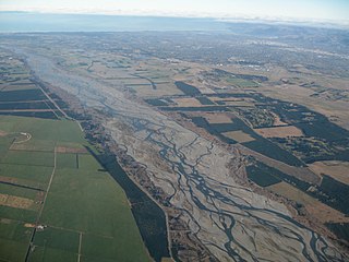
Changhua Plain, which is sometimes listed as "Changhua Coastal Plain", is an alluvial plain in central Taiwan on the west coast between the Old Zhuoshui River (舊濁水溪) and Dadu River regions, and bordered to the east by the Bagua Plateau.

Shanhua District District in Tainan, Taiwan

Shanhua District is a suburban district of Tainan, Taiwan. Until December 25, 2010, it was an urban township in the dissolved Tainan County, which is now merged with the original Tainan City to form a single special municipality.

1964 Baihe earthquake January 1964 earthquake in Taiwan

The 1964 Baihe earthquake, also known as the Great Baihe earthquake, measured 6.3 local magnitude, and occurred at 20:04 CST (UTC+8) on 18 January in Baihe Township of Tainan County, Taiwan. The hypocenter of the earthquake was 20 kilometers deep. The earthquake killed 106 people, destroyed 10,924 buildings, and caused a great fire in Jiayi City. It was the sixth deadliest earthquake in 20th century Taiwan, and the third deadliest post-World War II, after the 921 earthquake and the 2016 Taiwan earthquake.

Chianan Irrigation system of irrigation from Chinian Plain, Taiwan

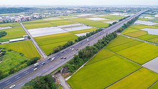
Chianan Irrigation, also known as the Kanan Irrigation System, was built for promoting the agricultural productions of Chianan Plain of Taiwan. The name "chia-nan" was derived from two place names among its surrounding area called Chiayi and Tainan. Although it includes some assistant facilities, such as the Wusanto Reservoir, the term "Chianan Canal", in a narrow sense, would only mean the canals of this system.

Districts are administrative subdivisions of Special municipalities and provincial cities of Taiwan. There are two types of district in the administrative scheme.

Zhuluo County Place in Fujian, Qing Empire

Zhuluo County was a political division in Taiwan from 1684 to 1787, during Qing Dynasty rule of the island. Initially encompassing the underdeveloped northern two-thirds of Taiwan, the county shrank in size as the population and economy of the north and central western plains grew and new counties were created. In 1787 the county underwent further restructuring and was renamed Chiayi County.

Wushantou Reservoir

Wushantou Reservoir, sometimes spelled Wushanto or Wusanto, is a reservoir and scenic area located in Lioujia District and Guantian District of Tainan, Taiwan. It is also referred to as Coral Lake due to its zigzagging shoreline. The reservoir was designed by engineer Yoichi Hatta and was the largest in Asia at the time of its completion in 1930.

Chiayi City Government the highest level executive agency of Chiayi City

Chiayi City Government is the government that governs Chiayi City of the Republic of China.

Deng Feng-Zhou Chinese poet, Local history writer, Taoist Neidan academics and Environmentalist.

Deng Feng-Zhou is a Chinese poet, local history writer, Taoist Neidan academics and environmentalist.

Tainan Cultural and Creative Park

The Chiayi Cultural and Creative Industries Park is a multi-purpose park in North District, Tainan, Taiwan.

North–South divide in Taiwan Key to the social instability in todays Taiwan.

In Taiwan, the North–South divide is also known as North-South imbalance or North-South developmental gap, refers to the uneven distribution of resources in regard to political, wealth, medical, economic development, education and other aspects across the north-south part of the country over past decades that has drawn the social and cultural differences between northern and southern Taiwan today. The core spiritual of which is derived from Southern Taiwanese's long-standing mindset as they believed they had been treated and regarded as socially inferior by the Taiwanese central government. The anger from the south quickly echoed throughout central Taiwan and eastern Taiwan as they also thought they're not fairly treated by the central government, compared to the northern part of Taiwan. It was known from the history that Taiwanese central government's policy support about the local's industrial development as well as public infrastructure is the critical determinant of a local city's future prospect on population.

By-elections for the Ninth Legislative Yuan were held in 2019, two on 27 January and four on 16 March, at Taiwan to elect 6 of the 113 members of the Legislative Yuan for the remaining term until 2020.

References

  1. Joyce Jong-Wen Wann; Tso-Kwei Peng; Mei-Huey Wu (2000). "Taiwan" (PDF). In M. Ali. Dynamics of vegetable production, distribution and consumption in Asia. Shanhua, Tainan: Asian Vegetable Research and Development Center. pp. 379–415.
  2. 1 2 Lu, Wan-Chung; Tzu-Hua Lai; Jui-Er Chen; Chih-Chao Huang; Li-Yuan Fei (2007). "臺灣地區水文地質分區特性: 嘉南平原水文地質調查研究" (PDF). 地質環境與資源研討會論文集. Central Geological Survey, MOEA. pp. 125–132.[ permanent dead link ]
  3. 謝瑞麟. "Archived copy" 雲嘉南區域水利建設概況 (in Chinese). National Policy Foundation. Archived from the original on 2008-06-19. Retrieved 2008-07-17.
  4. Chen, Yu-gao (1993). "Sea-level change and neotectonics in the southern part of Taiwan region since the late Pleistocene" (in Chinese). National Taiwan University: 158.
  5. Liu, Yi-chang (2006). "考古學研究所見人群互動關係與分布界線:以嘉南平原東側丘陵山地地區為例". In Yeh, chun-jung. 建構西拉雅2005台南地區平埔族群學術研討會論文集. Sinying: Tainan County Government. pp. 39–60.[ permanent dead link ]
  6. Wiliams, Jack F.; Wu, Yu-Chen (November 1997). "Sugar: The Sweetener in Taiwan's Development". Environment and Worlds (in Chinese). Archived from the original on 2009-07-26.
  7. Liu, Alexandra (June 2001). "Country Travel, New Style". Taiwan Panorama.