
The Great Lakes, also called the Great Lakes of North America, are a series of large interconnected freshwater lakes in the east-central interior of North America that connect to the Atlantic Ocean via the Saint Lawrence River. The five lakes are Superior, Michigan, Huron, Erie, and Ontario, and they are in general on or near the Canada–United States border. Hydrologically, Michigan and Huron are a single body of water joined at the Straits of Mackinac. The Great Lakes Waterway enables modern travel and shipping by water among the lakes.

The Chicago River is a system of rivers and canals with a combined length of 156 miles (251 km) that runs through the city of Chicago, including its center. Though not especially long, the river is notable because it is one of the reasons for Chicago's geographic importance: the related Chicago Portage is a link between the Great Lakes and the Mississippi River Basin, and ultimately the Gulf of Mexico.

The Illinois and Michigan Canal connected the Great Lakes to the Mississippi River and the Gulf of Mexico. In Illinois, it ran 96 miles (154 km) from the Chicago River in Bridgeport, Chicago to the Illinois River at LaSalle-Peru. The canal crossed the Chicago Portage, and helped establish Chicago as the transportation hub of the United States, before the railroad era. It was opened in 1848. Its function was partially replaced by the wider and deeper Chicago Sanitary and Ship Canal in 1900, and it ceased transportation operations with the completion of the Illinois Waterway in 1933.

The Illinois River is a principal tributary of the Mississippi River at approximately 273 miles (439 km) in length. Located in the U.S. state of Illinois, the river has a drainage basin of 28,756.6 square miles (74,479 km2). The Illinois River begins with the confluence of the Des Plaines and Kankakee rivers in the Chicago metropolitan area, and it generally flows to the southwest across Illinois, until it empties into the Mississippi near Grafton, Illinois. Its drainage basin extends into southeastern Wisconsin, northwestern Indiana, and a very small area of southwestern Michigan in addition to central Illinois. Along its shores are several river ports, including Peoria, Illinois. Historic and recreation areas on the river include Starved Rock, and the internationally important wetlands of the Emiquon Complex and Dixon Waterfowl Refuge.
Cook County is the most populous county in the U.S. state of Illinois and the second-most-populous county in the United States, after Los Angeles County, California. More than 40 percent of all residents of Illinois live within Cook County. As of 2020, the population was 5,275,541. The county seat is Chicago, the most populous city in Illinois and the third most populous city in the United States. The county is at the center of the Chicago metropolitan area.

Lemont is a village located in Cook, DuPage, and Will counties in the U.S. state of Illinois, and is a south-west suburb of Chicago. The population was 17,629 as of the 2020 census. The village is situated on a hillside along the south banks of the Des Plaines River. It overlooks Waterfall Glen's Midwestern Bluff Savanna on the opposite side. Lemont is home to Argonne National Laboratory and other heavy industrial sites, and has a substantial European immigrant population.

The city of Chicago is located in northern Illinois, United States, at the south western tip of Lake Michigan. It sits on the Saint Lawrence Seaway continental divide at the site of the Chicago Portage, an ancient trade route connecting the Mississippi River and the Great Lakes watersheds.
The Chicago Sanitary and Ship Canal, historically known as the Chicago Drainage Canal, is a 28-mile-long (45 km) canal system that connects the Chicago River to the Des Plaines River. It reverses the direction of the Main Stem and the South Branch of the Chicago River, which now flows out of Lake Michigan rather than into it. The related Calumet-Saganashkee Channel does the same for the Calumet River a short distance to the south, joining the Chicago canal about halfway along its route to the Des Plaines. The two provide the only navigation for ships between the Great Lakes Waterway and the Mississippi River system.
The Calumet Region is the geographic area drained by the Grand Calumet River and the Little Calumet River of northeastern Illinois and northwestern Indiana in the United States. It is part of the Great Lakes Basin, which eventually reaches the Atlantic Ocean. It is a sub-region of the greater Northwest Indiana region and the even larger Great Lakes region.

Ports of Indiana-Burns Harbor is an active maritime port owned by the State of Indiana. The state legislature created the Indiana Port Commission in 1961 to research and act upon opening maritime ports on Indiana's Lake Michigan shoreline as well as the Ohio River.

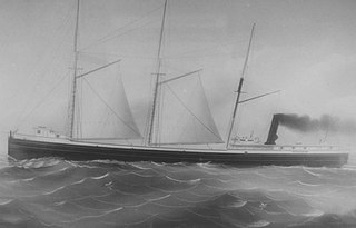
SS Keewatin is a passenger liner which once travelled between Port Arthur/Fort William on Lake Superior and Port McNicoll on Georgian Bay in Ontario, Canada. She carried passengers between these ports for the Canadian Pacific Railway's Great Lakes steamship service. Keewatin also carried packaged freight goods for the railway at these ports.
The Great Lakes megalopolis consists of a bi-national group of metropolitan areas in North America largely in the Great Lakes region. It extends from the Midwestern United States in the south and west to western Pennsylvania and Western New York in the east and northward through Southern Ontario into southwestern Quebec in Canada. It is the most populated and largest megalopolis in North America.
The John M. Osborn was a wooden steam barge that sank in Lake Superior in 1884 with the loss of five lives. The Osborn was just 2 years old when the larger, steel-hulled Alberta, which was called a "steel monster" and "terror of the lakes", rammed her. The wreck of the Osborn was discovered 100 years after her sinking. The wreck was illegally salvaged in the 1980s. Many of Osborn's artifacts became the property of the State of Michigan after they were seized from Great Lakes Shipwreck Museum. The State allows the museum to display the artifacts as a loan. The wreck of the Osborn is now protected by the Whitefish Point Underwater Preserve as part of an underwater museum.
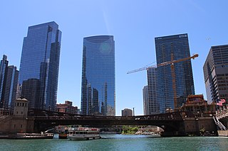
Wolf Point is the location at the confluence of the North, South and Main Branches of the Chicago River in the present day Near North Side, Loop, and Near West Side community areas of Chicago. This fork in the river is historically important in the development of early Chicago. Located about 1.6 miles (2.6 km) from Lake Michigan, this was the location of Chicago's first three taverns, its first hotel, Sauganash Hotel, its first ferry, its first drug store, its first church, its first theater company, and the first bridges across the Chicago River. The name is said to possibly derive from a Native American Chief whose name translated to wolf, but alternate theories exist.

The Chicago Area Waterway System (CAWS) is a complex of natural and artificial waterways extending through much of the Chicago metropolitan area, covering approximately 87 miles altogether. It straddles the Chicago Portage and is the sole navigable inland link between the Great Lakes and the Mississippi River and makes up the northern end of the Illinois Waterway.
The Calumet Feeder Canal was a short canal in Illinois, operated during the mid-19th century. It connected the Little Calumet River to the Illinois and Michigan (I&M) Canal, and ran from Blue Island, where the Little Calumet made a hairpin turn toward Lake Michigan, to meet the I&M canal at Sag Bridge. The canal was completed in 1849, and covered 16.75 miles (26.96 km). It was one of four feeder canals built for the I&M, the others being the Du Page Feeder, Fox River Feeder and Kankakee Feeder.
Valerie Olson van Heest is an American author, explorer, and museum exhibit designer. She is co-founder of the Michigan Shipwreck Research Association.
The Underwater Archaeological Society of Chicago (UASC) is a private non-profit organization in the United States.

SS Vernon was a wooden-hulled American passenger and package freighter that sank in a Lake Michigan storm on October 29, 1887, near Two Rivers, Wisconsin, with the loss of between 36 and 50 lives, making her one of the deadliest shipwrecks ever to have occurred in Wisconsin. Only one of the people on board survived.

SS John Mitchell was a steel-hulled, American lake freighter in service between 1907 and 1911. She was built in 1906 by the Great Lakes Engineering Works in St. Clair, Michigan, for the Cornell Steamship Company of Chicago, Illinois, which was managed by C.W. Elphicke. She entered service in 1907, and had a sister ship named William B. Davock. Throughout her career, John Mitchell carried iron ore and coal. On October 4, 1908, she ran aground at Indiana Harbor, Indiana, while loaded with iron ore.
