
Shivaji University, established in 1962, is a state university located at Kolhapur, Maharashtra, India. The university, with a campus spread over 853 acres (345 ha), is named after Chhatrapati Shivaji Maharaj, founder of the Maratha Empire. It was inaugurated on 18 November 1962 by Sarvepalli Radhakrishnan, the then president of India. Yashwantrao Chavan and Balasaheb Desai took the lead in establishing this university. Educational institutions from Kolhapur, Sangli, and Satara districts come under its jurisdiction with 279 affiliated colleges and recognised institutes. One of the major objectives behind its foundation was to cater to the educational needs of South Maharashtra region. The University's efforts towards excellence are being recognised by the substantial grants received from funding agencies such as University Grants Commission (India), Department of Science and Technology (India), and DBT. The university is self reliant in water, which is stored on campus during the rainy season. It has a biodiversity-rich campus.
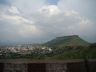
Satara is a city located in the Satara District of Maharashtra state of India, near the confluence of the river Krishna and its tributary, the Venna. The city was established in the 16th century and was the seat of the Chhatrapati of Maratha Empire, Shahu I. It is the headquarters of Satara Tehsil, as well as the Satara District. The city gets its name from the seven forts (Sat-Tara) which are around the city. The city is known as a Soldier's city as well as Pensioner's city.

Narsinghpur district is a district of Madhya Pradesh state in central India. The city of Narsinghpur is administrative headquarters of the district. As of 2001 Narsinghpur is the most literate district of MP. Village Singhpur bada in Narsinghpur is also considered as bahubali's and goon's village
Kolhapur district is a district in the Maharashtra state of India. The city of Kolhapur is its district headquarter. It is situated near Panchaganga river.
Jalgaon is a district in the northern part of Maharashtra, India. The headquarters is the city of Jalgaon.

Sangli district is a district of Maharashtra state in India. Sangli city is the district headquarters. It is bordered by Satara district, Solapur district to the North, Karnataka state to South-East, by Kolhapur district to South-West and by narrow portion in East side to Ratnagiri district. It is present on the southern tip of Maharashtra.
Bhilwara District is a district of the state of Rajasthan in western India. The town of Bhilwara is the district headquarters.
Ahmednagar district is the largest district of Maharashtra state in western India. The historical Ahmednagar city is the headquarters of the district. Ahmednagar and Sangamner are largest cities in the district. Ahmednagar was the seat of the Ahmednagar Sultanate of late medieval period. This district is known for the towns of Shirdi associated with Sai Baba, Meherabad associated with Meher Baba, Shani Shinganapur with Shanidev, and Devgad with Lord Dattatreya. Ahmednagar district is part of Nashik Division. The district is bordered by Aurangabad district to the northeast, Nashik district to the northwest, Thane and Pune districts to the southwest, Solapur district to the south and Beed district to the southeast.

Karad is a city in Satara district of Indian state of Maharashtra and it is 320 km (180.19 miles) from Mumbai and 159 km from Pune. It lies at the confluence of Koyna River and the Krishna River known as the "Priti sangam". The two rivers originate at Mahabaleshwar, which is around 100 km from Karad. They diverge at their origin, and travel for about the same distance to meet again in Karad. The rivers meet exactly head on, thus forming letter "T" which is the only head on confluence in the world. Hence Krishna and Koyna river's confluence is called Preeti Sangam, meaning Confluence of Love. Karad is well known for sugar production and is known as the sugar bowl of Maharashtra owing to the presence of many sugar factories in and around Karad. It is considered as an important educational hub in Western Maharashtra due to the presence of many prestigious educational institutes. This place is also known for resting place or (Samadhi) of the first chief minister of Maharashtra Shri. Yashwantrao Chavan situated at the confluence of Krishna and Koyana river.

Shopian or Shupiyan, known as Shupyan in Kashmiri, is an administrative division of the Shopian district, located in southern part of Kashmir Valley, of Jammu and Kashmir, India. Shopian is called the ''Apple town of Kashmir'' as majority of the population engages in apple growing practices which also provides employment to more than 60% of the population. Apple town of kashmir
Tasgaonpronunciation (help·info) is a city and a municipal council in Sangli district in the Indian state of Maharashtra. Tasgaon has rapidly merged with Sangli city as a satellite suburb and will soon become part of Sangali Urban Agglomeration. Tasgaon was given as Jahagir to Parshuram Bhau Tasgaonkar by Narayanrao Ballal Peshwa in 1774. Tasgaon Sansthan was lapsed by British during ruling of Shrimant Ganapatrao Tasgaonkar.
Achanalli is a village in the southern state of Karnataka, India. It is located in the Sirsi taluk of Uttara Kannada district in Karnataka.
Chandgad Assembly constituency is one of the 288 Vidhan Sabha constituencies in Maharashtra state in western India.
Gudas, Belgaum is a village According to Census 2011 information the location code or village code of Gudas village is 597594. Gudas village is located in Hukeri taluka of Belgaum district in Karnataka, India. It is situated 11km away from sub-district headquarter Hukkeri and 63km away from district headquarter Belgaum. As per 2009 stats, Gudas village is also a gram panchayat.
Koldur is a village in Belgaum district in Karnataka, India.
Mohare is a village in Belgaum district of Karnataka, India.

Golia is a village located in the Ganjam District of the Indian state of Odisha. It is governed by a panchayat, which also governs several nearby villages, and is famous for the large number of turtles in Nelia Pond beside the temple of Shiva. Golia is 76 kilometres (47 mi) away from the city of Brahampur and 159 kilometres (99 mi) away from the state capital, Bhubaneswar.
Karimpuzha is a gram panchayat in the Palakkad district, state of Kerala, India. It is a local government organisation that serves the villages of Karimpuzha-I and Karimpuzha-II.
Chandrapura is a community development block that forms an administrative division in the Bermo subdivision of the Bokaro district, Jharkhand state, India.
Korhalli is a large village located in Sindagi Taluk in Bijapur District of Karnataka State, India.

