Related Research Articles

Clarke County is a county located in the U.S. state of Mississippi. As of the 2010 census, the population was 16,732. Its county seat is Quitman. Clarke County is named for Joshua G. Clarke, the first Mississippi state chancellor and judge.

Enterprise is a town in Clarke County, Mississippi, United States. The population was 526 at the 2010 census.

Quitman is a city in Clarke County, Mississippi, United States, along the Chickasawhay River. The population was 2,323 at the 2010 census. Quitman is the county seat of Clarke County.

Marion is a town in Lauderdale County, Mississippi, United States. It is a northeastern suburb of Meridian, the county seat. The population of Marion was 1,479 at the 2010 census.

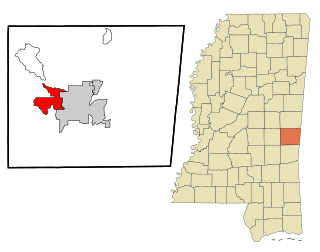
Collinsville is an unincorporated community and census-designated place (CDP) in Lauderdale County, Mississippi, United States. The population was 1,948 at the 2010 census.
Nellieburg is an unincorporated community and census-designated place (CDP) in Lauderdale County, Mississippi, United States. The population was 1,414 at the 2010 census. It is a suburb of Meridian.

The Chunky River is a short tributary of the Chickasawhay River in east-central Mississippi. Via the Chickasawhay, it is part of the watershed of the Pascagoula River, which flows into the Gulf of Mexico.

The Pascagoula River is a river, about 80 miles (130 km) long, in southeastern Mississippi in the United States. The river drains an area of about 8,800 square miles (23,000 km²) and flows into Mississippi Sound of the Gulf of Mexico. The Pascagoula River Basin is managed by the Pat Harrison Waterway District.

The Leaf River is a river, about 180 mi (290 km) long, in southern Mississippi in the United States. It is a principal tributary of the Pascagoula River, which flows to the Gulf of Mexico.

Lauderdale is an unincorporated community and census-designated place (CDP) in Lauderdale County, Mississippi, United States. It is situated along U.S. Highway 45, 16 miles (26 km) northeast of Meridian, the county seat. The population of Lauderdale was 442 at the 2010 census.
Alamuchee Creek is a stream in the U.S. states of Alabama and Mississippi. It is a tributary to the Sucarnoochee River.
Archusa Creek is a stream in the U.S. state of Mississippi. It is a tributary to the Chickasawhay River.
Bogue Homo is a stream in the U.S. state of Mississippi. It is a tributary to the Chickasawhay River.
Buckatunna Creek is a stream in the U.S. state of Mississippi. It is a tributary to the Chickasawhay River.
Eucutta Creek is a stream in the U.S. state of Mississippi. It is a tributary to the Chickasawhay River.Eucutta is a name derived from the Choctaw language, most likely meaning "large pond".
Kinterbish Creek is a stream in the U.S. states of Alabama and Mississippi. It is a tributary to the Tombigbee River.
Okatibbee Creek is a stream in the U.S. state of Mississippi.
Sowashee Creek is a stream in the U.S. state of Mississippi.
Tallabogue Creek is a stream in the U.S. state of Mississippi. It is a tributary to the Chickasawhay River.
References
- 1 2 U.S. Geological Survey Geographic Names Information System: Chickasawhay Creek
- ↑ Baca, Keith A. (2007). Native American Place Names in Mississippi. University Press of Mississippi. p. 23. ISBN 978-1-60473-483-6.
Coordinates: 32°33′16″N88°48′04″W / 32.5543058°N 88.8011601°W
| This article related to a river in Mississippi is a stub. You can help Wikipedia by expanding it. |