Chihani | |
|---|---|
Commune and town | |
| Country | |
| Province | El Taref Province |
| Population (1998) | |
| • Total | 9,234 |
| Time zone | UTC+1 (CET) |
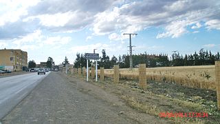
Chihani is a town and commune in El Taref Province, Algeria. According to the 1998 census it has a population of 9,234. [1]
Chihani | |
|---|---|
Commune and town | |
| Country | |
| Province | El Taref Province |
| Population (1998) | |
| • Total | 9,234 |
| Time zone | UTC+1 (CET) |
Chihani is a town and commune in El Taref Province, Algeria. According to the 1998 census it has a population of 9,234. [1]

The Mangapps Railway Museum is a heritage railway centre located near Burnham-on-Crouch in Essex, England. The 0.75 miles (1.21 km) of standard gauge running line and museum are owned and operated by the Jolly family assisted by volunteers.

Utena District Municipality is one of 60 municipalities in Lithuania.

Kreillerstraße is a Munich U-Bahn station on line U2.

Glen is a small village in County Donegal, Ireland. The focus of the townlands of Glenmenagh and Glenineeny, it is within the parish of Mevagh, and the Barony of Kilmacrenan. The village is on the crossroads between the towns of Milford, Letterkenny, Creeslough, and Carrigart. The village once supported a schoolhouse, post office and shop, as well as historically a fair. Today however, one of the few businesses left is the historic local public house, originally a shebeen and dating from the 17th century.
Cedar Bayou is an area in east central Harris County, Texas, United States.
Lazılar is a village in the Tovuz Rayon of Azerbaijan. The village forms part of the municipality of Ağbaşlar.
İsgəndərbəyli is a village in the Zangilan Rayon of Azerbaijan.
Bugaj is a village in the administrative district of Gmina Wilczyce, within Sandomierz County, Świętokrzyskie Voivodeship, in south-central Poland. It lies approximately 4 kilometres (2 mi) north of Wilczyce, 12 km (7 mi) north-west of Sandomierz, and 75 km (47 mi) east of the regional capital Kielce.
Możdżanowo is a village in the administrative district of Gmina Ustka, within Słupsk County, Pomeranian Voivodeship, in northern Poland. It lies approximately 11 kilometres (7 mi) south-west of Ustka, 17 km (11 mi) west of Słupsk, and 122 km (76 mi) west of the regional capital Gdańsk.

Raouraoua is a town and commune in Bouïra Province, Algeria. According to the 1998 census it has a population of 7,209.

Slatina is a village in the municipality of Šabac, Serbia. According to the 2002 census, the village has a population of 251 people.
Donja Kravarica is a village in the municipality of Lučani, Serbia. According to the 2011 census, the village has a population of 358 people.
Kaasiku is a village in Mustvee Parish, Jõgeva County in eastern Estonia.
Kozarica is a village in Croatia, and is a part of Mljet, Dubrovnik-Neretva County.

Forte de Santo António is a fort in the Azores. It is located in Angra do Heroísmo, on the island of Terceira. <
Kopitarce is a village in the municipality of Vladičin Han, Serbia. According to the 2002 census, the village has a population of 75 people.

Airport East station is an interchange station for Line 1 and Line 12 of Shenzhen Metro in Shenzhen, Guangdong Province, China. Line 1 platforms opened on 15 June 2011 and Line 12 platforms opened on 28 November 2022.

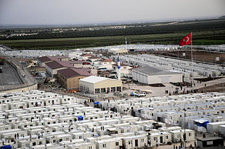
Öncüpınar Accommodation Facility is a refugee camp for refugees fleeing the Syrian Civil War located in Öncüpınar village in Kilis, Turkey, near the Syrian border. Opened in 2012, it hosted 14,000 people in February 2014.
Ash Hill is an unincorporated community in eastern Butler County, in the U.S. state of Missouri. The community is located on Missouri Route 51 ten miles east of Poplar Bluff and just over one mile west of Fisk and the St. Francis River which forms the Butler-Stoddard county line. The Missouri Pacific Railway passes through the community.
Sərkərli is a village in the Khachmaz Rayon of Azerbaijan. It was founded in the nineteenth century as an Eastern Orthodox village of Borispol by migrants from what is now central Ukraine. The original population gradually left; the village was resettled by ethnic Azeris from neighbouring villages and renamed Sərkərli in 1992. The village forms part of the municipality of Yergüc. An archaeological site containing early-Bronze Age artifacts and an eighth-century burial site was discovered nearby.
Coordinates: 36°38′49″N7°46′32″E / 36.64694°N 7.77556°E