
Vizianagaram district is one of the six districts in the Uttarandhra region of the Indian state of Andhra Pradesh with its headquarters located at Vizianagaram. The district was once the part of ancient Kalinga.Saripilli Dibbilingeswara temple, Jayathi Mallikarjuna Temple are the finest examples of ancient Eastern Ganga Dynasty built monuments in the district. The district is bounded on the east by the district of Srikakulam, north by Parvathipuram Manyam south by Visakhapatnam, Anakapalli, southeast by the Bay of Bengal, and west by Alluri Sitharama Raju district. It was formed on 1 June 1979, with some parts carved from the neighbouring districts of Srikakulam and Visakhapatnam. The district is named after the princely state of Vizianagaram. In 2011, it was the least populous district in Andhra Pradesh.

Srikakulam district is one of the twenty-six districts of the Indian state of Andhra Pradesh, located in the Uttarandhra region of the state, with its headquarters located at Srikakulam. It is one of the six districts, located in the extreme northeastern direction of the state. It was formerly known as Chicacole, and was under Ganjam district till 1936 April 1, then merged under Vizagapatam district. Srikakulam district forms the core area of Kalinga where most of its historical capitals like Kalinganagari, pithunda, Dantapuram are located.
Atmakur is a small town in Nellore district of the Indian state of Andhra Pradesh. It is a municipality in Atmakur mandal. The town is the headquarters of Atmakur mandal and Assembly Constituency.

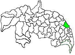
Gajapathinagaram is a census town in Vizianagaram district of the Indian state of Andhra Pradesh. It is located in Gajapathinagaram mandal of Vizianagaram revenue division. It is located on National Highway 26 between Vizianagaram and Ramabhadrapuram.
Pedana is a municipality and the headquarters of Pedana mandal under Machilipatnam revenue division of Krishna district of the Indian state of Andhra Pradesh. It is located at a distance of 8 km (5.0 mi) from the district headquarters, Machilipatnam.

Repalle is a town in Bapatla district of the Indian state of Andhra Pradesh. The town is one of the 12 municipalities in Bapatla district and the headquarters of Repalle mandal under the administration of Repalle revenue division. It is situated near Krishna River in the Coastal Andhra region of the state.

Thulluru is a Village in Guntur district of Indian state of Andhra Pradesh. It is located at a distance of 4 km from Krishna River and was a village in Thulluru mandal of Guntur district, prior to its denotification as gram panchayat.
Chandarlapadu is a village in NTR district of the Indian state of Andhra Pradesh. It is located in Chandarlapadu mandal of Nandigama revenue division. It is one of the villages in the mandal to be a part of Andhra Pradesh Capital Region.

Sangam Jagarlamudi is a village in Guntur district of the Indian state of Andhra Pradesh. It is located in Tenali mandal of Tenali revenue division. It forms a part of Andhra Pradesh Capital Region.

Narasannapeta is a census town in Srikakulam district of the Indian state of Andhra Pradesh. It is the mandal headquarters of Narasannapeta mandal in Srikakulam revenue division. 43 villages are there under the administrative division of Narasannapeta.
Polaki is a village in Srikakulam district of Andhra Pradesh in India.
Madapam is a village in Narasannapeta mandal, located in Srikakulam district of the Indian state of Andhra Pradesh.

Elamanchili is a town in Anakapalli district of the Indian state of Andhra Pradesh. It is a municipality and also the mandal headquarters of Elamanchili mandal. The town is spread over an area of 39 km2 (15 sq mi), which is under the jurisdiction of Visakhapatnam Metropolitan Region Development Authority. This town has historical importance dating back to 7th Century AD.

Duggirala is a village in Guntur district of the Indian state of Andhra Pradesh. It is the mandal headquarters of Duggirala mandal in Tenali revenue division. It is one of the major turmeric trading centres in the country.

Kollipara is a village in Guntur district of the Indian state of Andhra Pradesh. It is the headquarters of Kollipara mandal in Tenali revenue division. And it was one of the capital for Pericchedi.

Burripalem is an area of Tenali in Guntur district of the Indian state of Andhra Pradesh. It is located in Tenali, Tenali mandal of Tenali revenue division. It forms a part of Andhra Pradesh Capital Region.

Kolakaluru is a neighborhood of Tenali city in Guntur district of the Indian state of Andhra Pradesh. It is located in Tenali mandal of Tenali revenue division. It forms a part of Andhra Pradesh Capital Region.
Kollipara mandal is one of the 18 mandals in Guntur district of the state of Andhra Pradesh, India. It is under the administration of Tenali revenue division and the headquarters are located at Kollipara. The mandal is situated on the banks of the Krishna River, bordered by Duggirala, Tenali, Vemuru and Kollur mandal.

Thullur mandal is one of the 18 mandals in Guntur district of the Indian state of Andhra Pradesh. It is under the administration of Guntur Revenue Division and the headquarters are located at Thullur. The mandal is situated on the banks of Krishna River, bounded by Amaravathi, Tadikonda, Tadepalle and Mangalagiri mandals. The mandal is also a part of the new capital city of Andhra Pradesh to be developed. 18 villages from the mandal fall under the jurisdiction of Andhra Pradesh Capital City.
Bhattiprolu mandal is one of the 25 mandals in Bapatla district of the Indian state of Andhra Pradesh. It is under the administration of Tenali revenue division and the headquarters are located at Bhattiprolu. The mandal is situated on the banks of Krishna River, bounded by Kollur, Vemuru, Cherukupalle, Nagaram and Repalle mandals. The mandal headquarters ten villages are included in Andhra Pradesh Capital Region.


