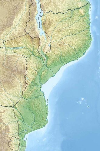
Chimanimani National Park | |
---|---|
Parque Nacional de Chimanimani | |
The reserve includes Monte Binga, the highest point in Mozambique | |
Coordinates | 19°47′42″S33°05′21″E / 19.79500°S 33.08917°E |
Area | 656 km2 (253 sq mi) |
Designation | National park |
Designated | 2003 (national reserve), 2020 (national park) |
Administrator | National Administration of Conservation Areas (ANAC) |
Chimanimani National Park (Portuguese: Parque Nacional de Chimanimani) is a protected area next to Chimoio, capital of Manica Province in Mozambique. It is located in the Chimanimani Mountains on the border with Zimbabwe. Together with Zimbabwe's Chimanimani National Park, it forms the Chimanimani Transfrontier Park. [2] It was designated a national reserve in 2003. In 2020 it was designated a national park. [3]
With an area of 656 km2, [1] the park protects the Mozambican portion of the Chimanimani Mountains, including Monte Binga (2,436 m), Mozambique's highest peak. The park has a larger buffer zone (1,723 km2), [4] which extends into lower-elevation areas to the south, east, and north, and includes the Moribane, Mpunga, Maronga, and Zomba forest reserves. The Moribane, Mpunga, and Maronga forest reserves were established in 1953. [5]
The park contains rare species such as the Red-capped robin-chat and the Welwitsch's bat. [3]
The locals preserve the cave paintings, ancient traditions and beliefs, all of which give the park a cultural identity.
The park can be reached from the city of Chimoio. The park has several road connections with the north, south and central parts of Mozambique, as well as with Zimbabwe. [6]
A transboundary protected area (TBPA) is an ecological protected area that spans boundaries of more than one country or sub-national entity. Such areas are also known as transfrontier conservation areas (TFCAs) or peace parks.
The Eastern Highlands, also known as the Manica Highlands, is a mountain range on the border of Zimbabwe and Mozambique. The Eastern Highlands extend north and south for about 300 kilometres (190 mi) through Zimbabwe's Manicaland Province and Mozambique's Manica Province.
Gonarezhou National Park is a national park located in southeastern Zimbabwe. It is situated in a relatively remote corner of Masvingo Province, south of Chimanimani along the Mozambique border. Owing to its vast size, rugged terrain and its location away from main tourist routes, large tracts of Gonarezhou remain pristine wilderness.
Chimanimani, originally known as Melsetter, is a mountainous district in Manicaland Province of eastern Zimbabwe. The district headquarters is the town of Chimanimani.
Chipinge District is a district in Manicaland Province of eastern Zimbabwe. The administrative headquarters is Chipinge.
Chimoio is the capital of Manica Province in Mozambique. It is the fifth-largest city in Mozambique.
The Bvumba Mountains or Vumba Mountains straddle the Zimbabwe–Mozambique border, and lie some 10 km southeast of the city of Mutare. The Bvumba rise to Castle Beacon at 1,911 metres, and are, together with the Chimanimani Mountains to the south and Nyanga Mountains to the north, part of the Eastern Highlands of the Manicaland and adjacent Manica provinces. They are referred to as the "Mountains of the Mist", as so often the early morning starts with a mist which clears by mid-morning. Although lying mostly within Zimbabwe, the mountains extend north-eastward to Mount Vumba in Mozambique. They are capped by cool, green hills which shelter country hotels, a casino and golf course at the Leopard Rock Hotel and a Botanical Garden with one of the best views in Africa. The mountains are also known for their coffee plantations.
Articles related to Mozambique include:
The wildlife of Zimbabwe occurs foremost in remote or rugged terrain, in national parks and private wildlife ranches, in miombo woodlands and thorny acacia or kopje. The prominent wild fauna includes African buffalo, African bush elephant, black rhinoceros, southern giraffe, African leopard, lion, plains zebra, and several antelope species.
The wildlife of Mozambique consists of the flora and fauna of this country in southeastern Africa. Mozambique has a range of different habitat types and an ecologically rich and diverse wildlife. This includes 236 species of mammal, 740 species of bird and 5,692 species of vascular plant. The Maputaland-Pondoland-Albany hotspot, with significantly high levels of biodiversity, stretches from the southern tip of Mozambique into northeastern South Africa.
Sussundenga District is a district of Manica Province in western Mozambique. The principal town is Sussundenga. The district is located in the center of the province, and borders with Manica District in the north, Gondola District in the northeast, Buzi District of Sofala Province in the east, Chibabava District of Sofala Province in the southeast, Mossurize District in the south, and with Zimbabwe in the west. The area of the district is 7,057 square kilometres (2,725 sq mi). It has a population of 129,851 as of 2007.
Chimanimani, originally known as Melsetter, is a town in Zimbabwe.
The Southern Zanzibar–Inhambane coastal forest mosaic, also known as the Southern Swahili coastal forests and woodlands, is a tropical moist broadleaf forest ecoregion of eastern Africa. It is a southern variation of Northern Zanzibar-Inhambane coastal forest mosaic. The ecoregion supports habitats of forest, savanna and swamps. The southern portion of the ecoregion is not as well studied due to the 1977-1992 civil war in Mozambique.
The Chimanimani Mountains are a mountain range on the border of Zimbabwe and Mozambique. The mountains are in the southern portion of the Eastern Highlands, or Manica Highlands, a belt of highlands that extend north and south along the international border, between the Zambezi and Save rivers.
The Peace Park Foundation, founded in 1997 by Dr Anton Rupert, President Nelson Mandela and Prince Bernhard of the Netherlands, is an organisation that aims to re-establish, renew and conserve large ecosystems in Africa, transcending man-made boundaries by creating regionally integrated and sustainably managed networks of Transfrontier Conservation Areas (TFCAs). Peace Parks Foundation has been involved in the establishment and development of ten of the 18 TFCAs found throughout southern Africa, all of which are in various stages of development. The establishment of each TFCA, or peace park, is complex and far-reaching, and involves several phases of activity, which can take many years to achieve.
The Moribane Forest Reserve which was proclaimed in 1957, is a natural forest in the buffer zone of the 640 km2 Chimanimani National Reserve, and is situated 24 km north of Dombé, in Sussundenga District of central Mozambique. The mid- to low-elevation tropical rain forest covers hilly country, from 400 to 550 metres in elevation, on the eastern verges of the largest southern African forest of this type, altogether 820 km2 in extent. It can be reached using public transport from Sussundenga.
Dombé is a town on the north bank of the Buzi River in Sussundenga District of Manica Province in central Mozambique. During the Frelimo-Renamo struggle of the 70s to early 90s it was a strategic town where the FPLM maintained a heavy mechanized presence, since the Chimoio-Dombé-Espungabera road link which offered access to Zimbabwe was repeatedly attacked and disrupted by insurgents. In 2010 the Dombé-Espungabera road was being rehabilitated, which was expected to improve the area's economic and tourism potential. The road is easier to travel during the dry months, from May to November, and then at about 50 km/h. Dombé has a fuel station but supplies can run out.
Mutare District is a district in Manicaland Province of eastern Zimbabwe. The district headquarters is the city of Mutare.
Maronga Forest Reserve is a protected area in Mozambique. It is located in foothills of the Chimanimani Mountains in Manica Province, adjacent to Chimanimani National Park and the border with Zimbabwe. The reserve is within the national park's designated buffer zone. It has an area of 83 km2., and was established in 1953. Macurupini Falls is located in the reserve.
Media related to Chimanimani National Reserve at Wikimedia Commons