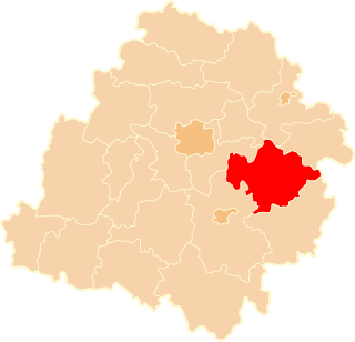
Czerniewice is a village in Tomaszów Mazowiecki County, Łódź Voivodeship, in central Poland. It is the seat of the gmina called Gmina Czerniewice. It lies on the Krzemionka River, approximately 19 kilometres (12 mi) north-east of Tomaszów Mazowiecki and 50 km (31 mi) east of the regional capital Łódź. It was probably founded in the 14th century.
Annopol Duży is a village in the administrative district of Gmina Czerniewice, within Tomaszów Mazowiecki County, Łódź Voivodeship, in central Poland. It lies approximately 4 kilometres (2 mi) west of Czerniewice, 18 km (11 mi) north of Tomaszów Mazowiecki, and 46 km (29 mi) east of the regional capital Łódź.
Annopol Mały is a village in the administrative district of Gmina Czerniewice, within Tomaszów Mazowiecki County, Łódź Voivodeship, in central Poland. It lies approximately 4 kilometres (2 mi) north-west of Czerniewice, 19 km (12 mi) north of Tomaszów Mazowiecki, and 47 km (29 mi) east of the regional capital Łódź.
Dąbrówka is a village in the administrative district of Gmina Czerniewice, within Tomaszów Mazowiecki County, Łódź Voivodeship, in central Poland. It lies approximately 3 kilometres (2 mi) south of Czerniewice, 16 km (10 mi) north-east of Tomaszów Mazowiecki, and 50 km (31 mi) east of the regional capital Łódź.
Gaj is a village in the administrative district of Gmina Czerniewice, within Tomaszów Mazowiecki County, Łódź Voivodeship, in central Poland. It lies approximately 6 kilometres (4 mi) south-east of Czerniewice, 18 km (11 mi) north-east of Tomaszów Mazowiecki, and 55 km (34 mi) east of the regional capital Łódź.
Helenów is a village in the administrative district of Gmina Czerniewice, within Tomaszów Mazowiecki County, Łódź Voivodeship, in central Poland. It lies approximately 6 kilometres (4 mi) west of Czerniewice, 17 km (11 mi) north of Tomaszów Mazowiecki, and 45 km (28 mi) east of the regional capital Łódź.
Józefów is a village in the administrative district of Gmina Czerniewice, within Tomaszów Mazowiecki County, Łódź Voivodeship, in central Poland. It lies approximately 2 kilometres (1 mi) east of Czerniewice, 19 km (12 mi) north-east of Tomaszów Mazowiecki, and 51 km (32 mi) east of the regional capital Łódź.
Krzemienica is a village in the administrative district of Gmina Czerniewice, within Tomaszów Mazowiecki County, Łódź Voivodeship, in central Poland. It lies approximately 5 kilometres (3 mi) north-east of Czerniewice, 23 km (14 mi) north-east of Tomaszów Mazowiecki, and 53 km (33 mi) east of the regional capital Łódź.
Lipie is a village in the administrative district of Gmina Czerniewice, within Tomaszów Mazowiecki County, Łódź Voivodeship, in central Poland. It lies approximately 18 kilometres (11 mi) south of Czerniewice, 13 km (8 mi) east of Tomaszów Mazowiecki, and 60 km (37 mi) south-east of the regional capital Łódź.
Mała Wola is a village in the administrative district of Gmina Czerniewice, within Tomaszów Mazowiecki County, Łódź Voivodeship, in central Poland. It lies approximately 5 kilometres (3 mi) south-east of Czerniewice, 19 km (12 mi) north-east of Tomaszów Mazowiecki, and 55 km (34 mi) east of the regional capital Łódź.
Paulinów is a village in the administrative district of Gmina Czerniewice, within Tomaszów Mazowiecki County, Łódź Voivodeship, in central Poland. It lies approximately 3 kilometres (2 mi) north of Czerniewice, 20 km (12 mi) north-east of Tomaszów Mazowiecki, and 49 km (30 mi) east of the regional capital Łódź.
Podkonice Duże is a village in the administrative district of Gmina Czerniewice, within Tomaszów Mazowiecki County, Łódź Voivodeship, in central Poland. It lies approximately 8 kilometres (5 mi) north-east of Czerniewice, 27 km (17 mi) north-east of Tomaszów Mazowiecki, and 53 km (33 mi) east of the regional capital Łódź.
Podkonice Małe is a village in the administrative district of Gmina Czerniewice, within Tomaszów Mazowiecki County, Łódź Voivodeship, in central Poland. It lies approximately 6 kilometres (4 mi) north-east of Czerniewice, 24 km (15 mi) north-east of Tomaszów Mazowiecki, and 52 km (32 mi) east of the regional capital Łódź.
Strzemeszna is a village in the administrative district of Gmina Czerniewice, within Tomaszów Mazowiecki County, Łódź Voivodeship, in central Poland. It lies approximately 4 kilometres (2 mi) east of Czerniewice, 22 km (14 mi) north-east of Tomaszów Mazowiecki, and 53 km (33 mi) east of the regional capital Łódź.
Strzemeszna Pierwsza is a village in the administrative district of Gmina Czerniewice, within Tomaszów Mazowiecki County, Łódź Voivodeship, in central Poland. It lies approximately 5 kilometres (3 mi) east of Czerniewice, 22 km (14 mi) north-east of Tomaszów Mazowiecki, and 54 km (34 mi) east of the regional capital Łódź.
Teodozjów is a village in the administrative district of Gmina Czerniewice, within Tomaszów Mazowiecki County, Łódź Voivodeship, in central Poland.
Wale is a village in the administrative district of Gmina Czerniewice, within Tomaszów Mazowiecki County, Łódź Voivodeship, in central Poland. It lies approximately 9 kilometres (6 mi) north-east of Czerniewice, 27 km (17 mi) north-east of Tomaszów Mazowiecki, and 56 km (35 mi) east of the regional capital Łódź.
Wólka Jagielczyńska is a village in the administrative district of Gmina Czerniewice, within Tomaszów Mazowiecki County, Łódź Voivodeship, in central Poland. It lies approximately 4 kilometres (2 mi) north-east of Czerniewice, 22 km (14 mi) north-east of Tomaszów Mazowiecki, and 51 km (32 mi) east of the regional capital Łódź.
Zubki Duże is a village in the administrative district of Gmina Czerniewice, within Tomaszów Mazowiecki County, Łódź Voivodeship, in central Poland. It lies approximately 6 kilometres (4 mi) north-east of Czerniewice, 24 km (15 mi) north-east of Tomaszów Mazowiecki, and 52 km (32 mi) east of the regional capital Łódź.
Zubki Małe is a village in the administrative district of Gmina Czerniewice, within Tomaszów Mazowiecki County, Łódź Voivodeship, in central Poland. It lies approximately 7 kilometres (4 mi) north-east of Czerniewice, 25 km (16 mi) north-east of Tomaszów Mazowiecki, and 53 km (33 mi) east of the regional capital Łódź.