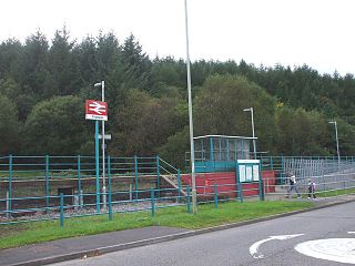
Ynyswen railway station is a railway station serving the village of Ynyswen in Rhondda Cynon Taf, south Wales. It is located on the Rhondda Line.
Kamieniec is a village in the administrative district of Gmina Żarnów, within Opoczno County, Łódź Voivodeship, in central Poland.
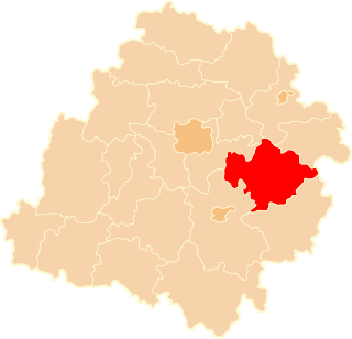
Stanisławów is a village in the administrative district of Gmina Biała Rawska, within Rawa County, Łódź Voivodeship, in central Poland.
Zygmuntów is a village in the administrative district of Gmina Fałków, within Końskie County, Świętokrzyskie Voivodeship, in south-central Poland.

The Nokia 6650 fold is a Nokia smartphone announced in March 2008, running Symbian OS. It is a Hex-band unit using GSM 850, 900, 1,800, and 1,900 MHz networks and UMTS 850 and 2,100 Mhznetworks. Also noted as a quad-band clamshell 3G smartphone, it was released in June 2008. It was sold through AT&T Mobility in the U.S. It is AT&T's replacement for the S60-powered N75. It is manufactured in three colors, metallic silver, black, and red.It was never being a global model, and therefore it was being sold exclusively for T-mobile networks. Models were RM-324 for North America and RM-400 for Europe.
Stara Kopana is a village in the administrative district of Gmina Tarczyn, within Piaseczno County, Masovian Voivodeship, in east-central Poland.
Ulatowo-Pogorzel is a village in the administrative district of Gmina Jednorożec, within Przasnysz County, Masovian Voivodeship, in east-central Poland.
Czekaj is a village in the administrative district of Gmina Mszczonów, within Żyrardów County, Masovian Voivodeship, in east-central Poland.
Edwardowo is a village in the administrative district of Gmina Mszczonów, within Żyrardów County, Masovian Voivodeship, in east-central Poland.
Janówek is a village in the administrative district of Gmina Mszczonów, within Żyrardów County, Masovian Voivodeship, in east-central Poland.
Kamionka is a village in the administrative district of Gmina Mszczonów, within Żyrardów County, Masovian Voivodeship, in east-central Poland.
Lutkówka Druga is a village in the administrative district of Gmina Mszczonów, within Żyrardów County, Masovian Voivodeship, in east-central Poland.
Małachowszczyzna is a village in the administrative district of Gmina Mszczonów, within Żyrardów County, Masovian Voivodeship, in east-central Poland.
Nowe Poręby is a village in the administrative district of Gmina Mszczonów, within Żyrardów County, Masovian Voivodeship, in east-central Poland.
Olszewek is a village in the administrative district of Gmina Mszczonów, within Żyrardów County, Masovian Voivodeship, in east-central Poland.

Osuchów-Kolonia is a village in the administrative district of Gmina Mszczonów, within Żyrardów County, Masovian Voivodeship, in east central Poland. It lies approximately 10 kilometres (6 mi) south-east of Mszczonów, 20 km (12 mi) south-east of Żyrardów, and 45 km (28 mi) south west of Warsaw.
Wymysłów is a village in the administrative district of Gmina Mszczonów, within Żyrardów County, Masovian Voivodeship, in east-central Poland.
Rogóż is a village in the administrative district of Gmina Lidzbark Warmiński, within Lidzbark County, Warmian-Masurian Voivodeship, in northern Poland. It lies approximately 8 kilometres (5 mi) north-east of Lidzbark Warmiński and 44 km (27 mi) north of the regional capital Olsztyn.
Qaplanli is a village in Golidagh Rural District, Golidagh District, Maraveh Tappeh County, Golestan Province, Iran. At the 2006 census, its population was 145, in 28 families.

Nicaro-Levisa, also Levisa-Nicaro, is a Cuban town and consejo popular of the municipality of Mayarí, in Holguín Province, formed by the settlements of Nicaro and Levisa. With a population of about 20,000, it is the most populated village in the municipality after Mayarí.