Choiseul Province is one of the nine provinces of Solomon Islands. It lies southeast of Bougainville, west of Santa Isabel Island, and north of Vella la Vella, Kolombangra & New Georgia. It has population of 36,719

Bonriki International Airport is an international airport in Kiribati, serving as the main gateway to the country. It is located in its capital, South Tarawa, which is a group of islets in the atoll of Tarawa in the Gilbert Islands, precisely on Bonriki.

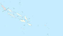
Taro Island is a small island in Solomon Islands with 507 inhabitants. It is the capital of Choiseul Province and is located in Choiseul Bay off the northwest coast.

Choiseul Island, native name Lauru, is the largest island of the Choiseul Province, Solomon Islands, at 7.08°S 157°E. The administrative headquarters of Choiseul Province is situated in the town of Taro.

Kitoi Bay Seaplane Base is a public use seaplane base owned by the Alaska Department of Fish and Game and located in Kitoi Bay, in the Kodiak Island Borough of the U.S. state of Alaska. It is included in the National Plan of Integrated Airport Systems for 2011–2015, which categorized it as a general aviation facility.
Moser Bay Seaplane Base is a public use seaplane base located in Moser Bay, in the Kodiak Island Borough of the U.S. state of Alaska. It is privately owned by Columbia Ward Fisheries.
Olga Bay Seaplane Base is a public use seaplane base located in Olga Bay, in the Kodiak Island Borough of the U.S. state of Alaska. It is privately owned by the Alaska Packers Association.
Port Bailey Seaplane Base is a public use seaplane base located in Port Bailey, in the Kodiak Island Borough of the U.S. state of Alaska. It is privately owned by Kadiak Fisheries.
Port Williams Seaplane Base is a public use seaplane base located in Port Williams, in the Kodiak Island Borough of the U.S. state of Alaska. Port William is located on the southern tip of Shuyak Island, facing Afognak Island, about 45 miles north of Kodiak.
Alitak Seaplane Base is a public use seaplane base located in Alitak, Lazy Bay, in the Kodiak Island Borough of the U.S. state of Alaska. It is privately owned by Columbia Ward Fisheries.
San Juan (Uganik) Seaplane Base is a public use seaplane base located in San Juan (Uganik), in the Kodiak Island Borough of the U.S. state of Alaska. It is privately owned by the San Juan Fishing & Packing Co.
Amook Bay Seaplane Base is a privately owned seaplane base located in Amook Bay, a community in the Kodiak Island Borough of the U.S. state of Alaska.
Karluk Airport is a state owned, public use airport located one nautical mile (2 km) east of the central business district of Karluk, a community in the Kodiak Island Borough of the U.S. state of Alaska.
Seal Bay Seaplane Base is a seaplane base located in Seal Bay, in the Kodiak Island Borough of the U.S. state of Alaska.

Kirakira Airport is an airport located at Kirakira on the island of Makira, part of the Makira-Ulawa Province in the Solomon Islands. It is also known as Ngorangora Airstrip and was constructed in the late 1950s. The airport has scheduled flights provided by Solomon Airlines, using DHC-6 Twin Otter aircraft.
Santa Ana Airport is an airport on Santa Ana, an island in the Makira-Ulawa Province in the Solomon Islands. The airport has scheduled flights provided by Solomon Airlines, using DHC-6 Twin Otter aircraft.
Babatana, also spelled Mbambatana, is the principal indigenous language of Choiseul Province, Solomon Islands. Although native to the South Choiseul coastline area between Sepa and the Manggo Bay area, the use of this language has spread across much of Choiseul Island and it is generally understood, much like Solomon Islands Pijin, across the province as a second or third language.