Gmina Kamionka Wielka is a rural gmina in Nowy Sącz County, Lesser Poland Voivodeship, in southern Poland. Its seat is the village of Kamionka Wielka, which lies approximately 9 kilometres (6 mi) south-east of Nowy Sącz and 82 km (51 mi) south-east of the regional capital Kraków.
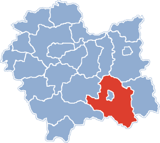
Gmina Krynica-Zdrój is an urban-rural gmina in Nowy Sącz County, Lesser Poland Voivodeship, in southern Poland, on the Slovak border. Its seat is the town of Krynica-Zdrój, which lies approximately 31 kilometres (19 mi) south-east of Nowy Sącz and 103 km (64 mi) south-east of the regional capital Kraków.

Biczyce Dolne is a village in the administrative district of Gmina Chełmiec, within Nowy Sącz County, Lesser Poland Voivodeship, in southern Poland. It lies approximately 2 kilometres (1 mi) west of Chełmiec, 4 km (2 mi) west of Nowy Sącz, and 70 km (43 mi) south-east of the regional capital Kraków.
Dąbrowa is a village in the administrative district of Gmina Chełmiec, within Nowy Sącz County, Lesser Poland Voivodeship, in southern Poland. It lies approximately 6 kilometres (4 mi) north of Chełmiec, 7 km (4 mi) north of Nowy Sącz, and 68 km (42 mi) south-east of the regional capital Kraków.
Biała Niżna is a village in the administrative district of Gmina Grybów, within Nowy Sącz County, Lesser Poland Voivodeship, in southern Poland. It lies approximately 3 kilometres (2 mi) east of Grybów, 21 km (13 mi) east of Nowy Sącz, and 89 km (55 mi) south-east of the regional capital Kraków.
Chodorowa is a village in the administrative district of Gmina Grybów, within Nowy Sącz County, Lesser Poland Voivodeship, in southern Poland. It lies approximately 4 kilometres (2 mi) north of Grybów, 18 km (11 mi) east of Nowy Sącz, and 85 km (53 mi) south-east of the regional capital Kraków.
Kąclowa is a village in the administrative district of Gmina Grybów, within Nowy Sącz County, Lesser Poland Voivodeship, in southern Poland. It lies approximately 4 kilometres (2 mi) south of Grybów, 20 km (12 mi) east of Nowy Sącz, and 91 km (57 mi) south-east of the regional capital Kraków.
Krużlowa Niżna is a village in the administrative district of Gmina Grybów, within Nowy Sącz County, Lesser Poland Voivodeship, in southern Poland. It lies approximately 7 kilometres (4 mi) north-west of Grybów, 13 km (8 mi) east of Nowy Sącz, and 82 km (51 mi) south-east of the regional capital Kraków.
Krużlowa Wyżna is a village in the administrative district of Gmina Grybów, within Nowy Sącz County, Lesser Poland Voivodeship, in southern Poland. It lies approximately 5 kilometres (3 mi) west of Grybów, 14 km (9 mi) east of Nowy Sącz, and 83 km (52 mi) south-east of the regional capital Kraków.
Ptaszkowa is a village in the administrative district of Gmina Grybów, within Nowy Sącz County, Lesser Poland Voivodeship, in southern Poland. It lies approximately 6 kilometres (4 mi) south-west of Grybów, 14 km (9 mi) east of Nowy Sącz, and 86 km (53 mi) south-east of the regional capital Kraków.
Siołkowa is a village in the administrative district of Gmina Grybów, within Nowy Sącz County, Lesser Poland Voivodeship, in southern Poland. It lies approximately 2 kilometres (1 mi) north-west of Grybów, 18 km (11 mi) east of Nowy Sącz, and 86 km (53 mi) south-east of the regional capital Kraków.
Stara Wieś is a village in the administrative district of Gmina Grybów, within Nowy Sącz County, Lesser Poland Voivodeship, in southern Poland. It lies approximately 5 kilometres (3 mi) west of Grybów, 14 km (9 mi) east of Nowy Sącz, and 83 km (52 mi) south-east of the regional capital Kraków.
Wawrzka is a village in the administrative district of Gmina Grybów, within Nowy Sącz County, Lesser Poland Voivodeship, in southern Poland. It lies approximately 6 kilometres (4 mi) south-east of Grybów, 22 km (14 mi) east of Nowy Sącz, and 92 km (57 mi) south-east of the regional capital Kraków.
Wyskitna is a village in the administrative district of Gmina Grybów, within Nowy Sącz County, Lesser Poland Voivodeship, in southern Poland. It lies approximately 7 kilometres (4 mi) north-east of Grybów, 24 km (15 mi) east of Nowy Sącz, and 89 km (55 mi) south-east of the regional capital Kraków.
Królowa Polska is a village in the administrative district of Gmina Kamionka Wielka, within Nowy Sącz County, Lesser Poland Voivodeship, in southern Poland. It lies approximately 4 kilometres (2 mi) north-east of Kamionka Wielka, 10 km (6 mi) east of Nowy Sącz, and 82 km (51 mi) south-east of the regional capital Kraków.
Bukowiec is a village in the administrative district of Gmina Korzenna, within Nowy Sącz County, Lesser Poland Voivodeship, in southern Poland. It lies approximately 7 kilometres (4 mi) north of Korzenna, 18 km (11 mi) north-east of Nowy Sącz, and 75 km (47 mi) south-east of the regional capital Kraków.
Lipnica Wielka is a village in the administrative district of Gmina Korzenna, within Nowy Sącz County, Lesser Poland Voivodeship, in southern Poland. It lies approximately 3 kilometres (2 mi) north-east of Korzenna, 16 km (10 mi) north-east of Nowy Sącz, and 78 km (48 mi) south-east of the regional capital Kraków.
Łęki is a village in the administrative district of Gmina Łososina Dolna, within Nowy Sącz County, Lesser Poland Voivodeship, in southern Poland. It lies approximately 3 kilometres (2 mi) north-west of Łososina Dolna, 17 km (11 mi) north of Nowy Sącz, and 59 km (37 mi) south-east of the regional capital Kraków.
Milik is a village in the administrative district of Gmina Muszyna, within Nowy Sącz County, Lesser Poland Voivodeship, in southern Poland, close to the border with Slovakia. It lies approximately 5 kilometres (3 mi) north-west of Muszyna, 29 km (18 mi) south-east of Nowy Sącz, and 100 km (62 mi) south-east of the regional capital Kraków. It is located in the valley of the Milik river — a tributary of the Poprad.