Cikobia-i-Ra

Last updated

Cikobia-i-Ra
Fiji map.png
Map of Vanua Levu
LocationFiji.png
Cikobia-i-Ra
Geography
Location Pacific Ocean
Coordinates 15°43′59″S179°55′0″W / 15.73306°S 179.91667°W / -15.73306; -179.91667
Archipelago Vanua Levu Group
Administration
Fiji
Division Northern Division
Province Macuata Province

Cikobia-i-Ra, also Thikombia Island,Tchecombia and Tikobia, [1] is the northernmost island in Fiji and has a primarily limestone geology. As the island is affected by climate change, women there have established the Cikobia Island Development Committee, which supports businesses that donate some profit to sustainability initiatives. The island has some of the earliest evidence for Lapita culture in the Pacific, as well as significant archaeological sites.

Contents

Geography

Located to the north of Vanua Levu in Macuata Province in Fiji, Cikobia-i-Ra is 300 km to the northeast of Suva. [2] The island is 10 km long and 2km wide; it is 60 km from the northernmost point of Vanua Levu. [3] It is primarily made from uplifted limestone formations. [3]

Settlements on Cikobia-i-Ra include Nalele, Nautovatu and Vatulele. [4]

Climate crisis

Cikobia-i-Ra is the northernmost and the most remote of the islands in the Northern Division. The island has been affected by the climate crisis, including an increase in the number of natural disasters. In response, women from the island established the Cikobia Island Development Committee, which enables women to start businesses based on natural resources available to them. This then enables the women to return 10% of their earnings to sustainability projects on the island, so that "10 per cent of their earnings had been channelled towards their environment sustainability project." [5]

History

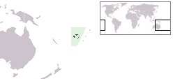
The island was first settled around 850 BC by people who were part of the Eastern Lapita cultural complex. [4] According to oral tradition, Cikobia-i-Ra was settled by Manaoneata and his son Iri-ni-buno, who came from Laucala in Cakaudrove. [1] One of Manaoneata's sons settled later on Naqelelevu. [1] Other accounts, recorded by Bruce Biggs, state that a chief called Sau Mata-i-walu spent time in Cikobia-i-Ra before discovering Naqelelevu. [1]

Cikobia-i-Ra's language is most closely related to Naqelelevu's and exchanges between the two islands and the island of Futuna have been reconstructed through linguistic analysis. [1]

Korotuku complex

At Korotuku a defensive fort was built, which contained ninety different structures, as well as burials. [4] In 1997 a team of archaeologists from Fiji and France investigated the archaeological remains on the island. [6] They identified twenty-five funerary sites on the island, most of which related to the historic period (c.1850), [7] and whose history is attested in the island's oral culture. [4] The team excavated ten interments, which included two children and eight adults, five of whom could be identified as males, two of which females. [4] A number of grave goods were found, including glass trade beads, a qato – which is an armband made of Trochus shell, a boar's tusk, a shark's tooth and a coral object which was tentatively identified as part of a tabua – a ceremonial object which accompanied a person into the afterlife. [4] It is likely that the bodies were wrapped in tapa prior to burial. [4] A later study used stable isotope analysis to examine the diets of those buried there, concluding that they ate a diet based primarily on vegetal food, with some shellfish consumption, which has been interpreted as dietary selection which may indicate those buried were part of an island elite. [7]

As part of the archaeological work instigated in 1997, Fijian colleagues undertook oral history work with the island's community to better understand the site. [8] In response, islanders began to rebuild one of the fortifications, known as Rukunikoro. [8] Years after work ended, families still tended the project, explaining that they preferred to keep tourists away, that it was for themselves, not for others. [8]

Glass beads have been excavated from graves on the island, which originated in Europe in the nineteenth century and may have been brought to the island by American whalers or European sailors, during the period of colonisation. [9]

Intangible heritage

The Archive of Māori and Pacific Sound at the University of Auckland holds recordings made on the island by Bruce Biggs in 1974. [10]

Notable people

Related Research Articles

<span class="mw-page-title-main">Geography of Fiji</span>

Fiji is a group of volcanic islands in the South Pacific, lying about 4,450 kilometres (2,765 mi) southwest of Honolulu and 1,770 km (1,100 mi) north of New Zealand. Of the 332 islands and 522 smaller islets making up the archipelago, about 106 are permanently inhabited. The total land size is 18,272 km2 (7,055 sq mi). It has the 26th largest Exclusive Economic Zone of 1,282,978 km2 (495,361 sq mi).

<span class="mw-page-title-main">Lapita culture</span> Neolithic archaeological culture in the Pacific

The Lapita culture is the name given to a Neolithic Austronesian people and their material culture, who settled Island Melanesia via a seaborne migration at around 1600 to 500 BCE. They are believed to have originated from the northern Philippines, either directly, via the Mariana Islands, or both. They were notable for their distinctive geometric designs on dentate-stamped pottery, which closely resemble the pottery recovered from the Nagsabaran archaeological site in northern Luzon. The Lapita intermarried with the Papuan populations to various degrees, and are the direct ancestors of the Austronesian peoples of Polynesia, eastern Micronesia, and Island Melanesia.

<span class="mw-page-title-main">Vanua Levu</span> Second largest island of Fiji

Vanua Levu, formerly known as Sandalwood Island, is the second largest island of Fiji. Located 64 kilometres to the north of the larger Viti Levu, the island has an area of 5,587.1 square kilometres (2,157.2 sq mi) and a population of 135,961 as of 2007.

<span class="mw-page-title-main">Viti Levu</span> Largest island in Fiji

Viti Levu is the largest island in the Republic of Fiji. It is the site of the nation's capital, Suva, and home to a large majority of Fiji's population.

Located in the central Pacific Ocean, Fiji's geography has made it both a destination and a crossroads for migrations for many centuries.

The culture of Fiji is a tapestry of native Fijian, Indian, European, Chinese, and other nationalities. Culture polity traditions, language, food costume, belief system, architecture, arts, craft, music, dance, and sports will be discussed in this article to give you an indication of Fiji's indigenous community but also the various communities which make up Fiji as a modern culture and living. The indigenous culture is an active and living part of everyday life for the majority of the population.

Macuata is one of Fiji's fourteen Provinces, and one of three based principally on the northern island of Vanua Levu, occupying the north-eastern 40 percent of the island. It has a land area of 2004 square kilometers.

The Tu'i Pulotu is believed to be the head of an ancient group of people that settled in Pulotu (Fiji) during the Lapita period. It was said that the Tui Pulotu originally came from the Fiji Islands and led the Pacific Islands from the early BC era to the first 800 years AD. Many people tried to associate Pulotu with Burotukula because of the different pronunciations within Tonga, Samoa and Fiji. And many people knows that Burotu in Fiji was the Burotukula which used to be seen near Matuku in Lau,but has no evidence of civilization on its seafloor.

<span class="mw-page-title-main">Fiji Museum</span> A museum of Fijian artifacts

The Fiji Museum is a museum in Suva, Fiji located in the capital city's botanical gardens, Thurston Gardens.

<span class="mw-page-title-main">Cyclone Daman</span> Category 4 South Pacific cyclone in 2007

Severe Tropical Cyclone Daman was the strongest cyclone of the 2007–08 South Pacific cyclone season. Cyclone Daman was the fourth tropical depression and the first severe tropical cyclone to form east of longitude 180° during the 2007–08 South Pacific cyclone season. Due to the severity of the storm, the name Daman was retired and replaced with Denia.

Vorovoro is an island in the province of Macuata in the Vanua Levu Group of northern Fiji, 40 minutes away from the town of Labasa by boat.

<span class="mw-page-title-main">Cyclone Cliff</span> Category 2 South Pacific cyclone in 2007

Tropical Cyclone Cliff was first noted as a weak tropical disturbance on April 1, 2007, within a trough of low pressure about 210 km (130 mi) to the southwest of Rotuma. Over the next couple of days the system drifted towards the southeast and Fiji, in an area of strong wind shear. During April 3, the system slightly accelerated, as it moved towards the south-southeast before the westerly wind shear around the system relaxed sufficiently to allow the depression to consolidate while it was located near Vanua Levu.

<span class="mw-page-title-main">Cyclone Tomas</span>

Severe Tropical Cyclone Tomas was the most intense tropical cyclone to strike Fiji since Cyclone Bebe in 1972. Forming out of a tropical disturbance on March 9, 2010, designated 14F by the Fiji Meteorological Service, the system gradually organized within an environment favoring intensification. By March 11, the disturbance had strengthened sufficiently to be classified as Tropical Cyclone Tomas, the eighth named storm of the 2009–10 South Pacific cyclone season. Modest intensification took place over the following few days, with the system attaining severe tropical cyclone status on March 13. On March 14, Tomas began to impact parts of Fiji while continuing to gain strength. As it passed near Vanua Levu on March 15, the cyclone attained its peak intensity with winds of 175 km/h (110 mph) and a pressure of 930 hPa (mbar) according to the FMS. At the same time, the Joint Typhoon Warning Center assessed it as a Category 4 equivalent storm with 1-minute sustained winds of 215 km/h (135 mph).

<span class="mw-page-title-main">Kanak people</span> Indigenous people of New Caledonia

The Kanaks are the indigenous Melanesian inhabitants of New Caledonia, an overseas collectivity of France in the southwest Pacific. According to the 2019 census, the Kanaks make up 41.2% of New Caledonia's total population — corresponding to around 112,000 people.

<span class="mw-page-title-main">Fiji tropical moist forests</span>

The Fiji tropical moist forests is a tropical moist forest ecoregion in Fiji and Wallis and Futuna. It covers the windward sides of Viti Levu and Vanua Levu, Fiji's largest islands, as well as the smaller Fijian islands and the three islands that make up Wallis and Futuna, an overseas territory of France.

<span class="mw-page-title-main">Cyclone Ana</span> Category 3 South Pacific cyclone of 2021

Severe Tropical Cyclone Ana was one of three tropical cyclones to impact the island nation of Fiji towards the end of January 2021. The fifth tropical disturbance, third tropical cyclone and second severe tropical cyclone of the 2020–21 South Pacific cyclone season, Ana was first noted as Tropical Disturbance 05F during January 26, while it was located about 220 km (135 mi) to the northeast of Port Vila in Vanuatu. Over the next few days, the system moved eastwards and gradually developed further, before it was declared to be a tropical cyclone and named Ana during January 29. Over the next day, the system moved south-eastwards towards Fiji before it made landfall on the island of Viti Levu. After emerging into the Pacific Ocean, the system intensified into a Category 3 severe tropical cyclone, before it rapidly degenerated into a subtropical low during February 1.

Tarisi Vunidilo is a Fijian archaeologist and curator who specialises in indigenous museology and heritage management.

<span class="mw-page-title-main">Cikobia-i-Lau</span> Island of Fiji

Cikobia-i-Lau, or Cirikalia, is an island in the Lau Islands in the north-east of Fiji. The island has historically been called Thikombia,Thimkombia-i-Lau or Farewell Island.

<span class="mw-page-title-main">Veiqia</span> Fijian female tattoo practice

Veiqia, or Weniqia, is a female tattooing practice from Fiji. Young women received veiqia at puberty, often as part of a lengthy process. The tattoos were applied by older specialist women known as daubati. Natural materials were used for the inks and to make the tools, some of which were reserved for use on high status women. The practice was prohibited under British colonial rule in the nineteenth century, but has undergone revival in the twenty-first century, led by the work of The Veiqia Project. Whilst there is an important archive of veiqia research at the Fiji Museum, western museum collections hold more artefacts relating to the practice.

The Ndakunimba Stones are the remains of a 50-foot-tall monolith carved with petroglyphs, located in Dakuniba, a remote village in Cakaudrove Province on Vanua Levu, Fiji. They comprise about 14 stone fragments of various sizes, with deeply carved angular figures.

References

  1. 1 2 3 4 5 SAND, CHRISTOPHE; VALENTIN, FREDERIQUE; BOLÉ, JACQUES; OUETCHO, ANDRÉ; BARET, DAVID; SOROVI-VUNIDILO, TARISI; MATARARABA, SEPETI (2007). "Report and Preliminary Analysis of the First Archaeological Survey of Naqelelevu Atoll, Northeast Fiji". The Journal of the Polynesian Society. 116 (4): 407–432. ISSN   0032-4000. JSTOR   20707415.
  2. "GeoNames.org". www.geonames.org. Retrieved 9 December 2021.
  3. 1 2 Clark, Geoffrey Richard; Anderson, Atholl; Vunidilo, Tarisi (2001). The Archaeology of Lapita Dispersal in Oceania: Papers from the Fourth Lapita Conference, June 2000, Canberra, Australia. Pandanus Books. ISBN   978-1-74076-010-2.
  4. 1 2 3 4 5 6 7 Clark, Geoffrey Richard; Anderson, Atholl; Vunidilo, Tarisi (2001). The Archaeology of Lapita Dispersal in Oceania: Papers from the Fourth Lapita Conference, June 2000, Canberra, Australia. Pandanus Books. ISBN   978-1-74076-010-2.
  5. 1 2 "Cikobia's women agents of change". 18 April 2021. Archived from the original on 18 April 2021. Retrieved 9 December 2021.
  6. "Cikobia-i-Ra. Archeologie d'une île fidjienne | Service du Musée de la Nouvelle-Calédonie". museenouvellecaledonie.gouv.nc. Retrieved 9 December 2021.
  7. 1 2 Valentin, F.; Bocherens, H.; Gratuze, B.; Sand, C. (2006). "Dietary patterns during the late prehistoric/historic period in Cikobia island (Fiji): insights from stable isotopes and dental pathologies". Journal of Archaeological Science. 33 (10): 1396–1410. doi:10.1016/j.jas.2006.01.012.
  8. 1 2 3 Sand, Christophe. "The input of francophone archaeological research in the Pacific." Journal of Pacific Studies 27 (2004): 1–12.
  9. Janssens, Koen H. A. (29 January 2013). Modern Methods for Analysing Archaeological and Historical Glass. John Wiley & Sons. ISBN   978-1-118-31420-3.
  10. "Performance items: Cikobia-i-Ra". Archive of Māori and Pacific Sound. Archived from the original on 9 December 2021. Retrieved 9 December 2021.