
Gavia Pass (el. 2621 m.) is a high mountain pass in the Italian Alps. It is the tenth highest paved road in the Alps.

Presanella is a mountain in the Adamello-Presanella range of the Italian Alps of northern Italy. Presanella has an elevation of 3,558 meters and is located in the Adamello Brenta National Park within the Trentino province of Italy.

Cima Rossa is a 3,161 metres high mountain in the Lepontine Alps, located on the border between the cantons of Ticino and Graubünden. On the west side it overlooks the valley of Malvaglia (Ticino) and on the east side it overlooks the valley of Calanca (Graubünden).

The Cima della Bondasca or Pizzo del Ferro centrale is a mountain in the Bregaglia Range (Alps), located on the border between Italy and Switzerland. Its summit is the triple watershed between Valle del Ferro (Italy), Val Bondasca and Val d'Albigna (Switzerland).

Cima di Castello is a mountain of the Bregaglia Range, located on the border between Italy and Switzerland. With a height of 3,379 metres (11,086 ft) above sea level, it is the second highest mountain in the Bregaglia Range. Its summit lies between the valleys of the Albigna and Forno Glacier and the valley of Val Mello.
The Cima di Broglio is a mountain of the Swiss Lepontine Alps, located east of Cevio in the canton of Ticino. It lies south of Monte Zucchero, on the range between the Valle Maggia and the Valle Verzasca.
The Poncione di Piotta is a mountain of the Swiss Lepontine Alps, located between Lavertezzo and Moleno in the canton of Ticino. It lies on the chain that separates the valley of Verzasca (west) from the Leventina valley (east).
Cima di Bri is a mountain in the Lepontine Alps, located in the Swiss canton of Ticino. It is situated between Lavertezzo and Biasca, on the range that separates the valleys of Verzasca and Leventina. With an altitude of 2,520 metres, it is the highest summit of this chain south of Passo di Gagnone.

Cima di Gagnone is a medium sized mountain in the Lepontine Alps it is located in the Swiss canton of Ticino. It is located between the valleys of Verzasca and Leventina, south of Passo di Gagnone.
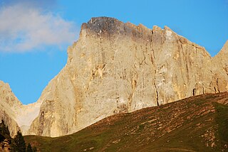
The Vezzana is the highest peak in the Pala group, a mountain range of the Dolomites, northern Italy. It is located in the northern part of the Dolomites, between the Taibon Agordino and Primiero comunes of Belluno and Trentino. It has an altitude of 3,192 metres.
The Cima Coppi is the title given to the highest peak in the yearly running of the Giro d'Italia, one of cycling's Grand Tour races. The mountain that is given this title each year awards more mountains classification points to the first rider than any of the other categorized mountains in the race.
The Cima di Biasca is a mountain of the Swiss Lepontine Alps, located southeast of Biasca in the canton of Ticino.

Zinseler is a mountain in the Sarntal Alps in South Tyrol in Italy. It has an elevation of 2,422 m and is located near Penser Joch saddle close to the city of Sterzing.

The Garda Mountains, occasionally also the Garda Hills, are an extensive mountain range of the Southern Limestone Alps in northern Italy.
Alpine skiing at the 2013 Winter Universiade was held at the Nouva Cima Uomo in Passo San Pellegrino - Moena and Alloch Piste in Pozza di Fassa from December 13 to December 20, 2013.

Cima Garlenda is a 2,141 m (7,024 ft) mountain of the Ligurian Alps, in Italy. After Monte Saccarello and Monte Frontè it is the third Ligurian summit.

Passo Garlenda or Passo di Garlenda(2021 m) is a mountain pass in the Province of Imperia (Italy). It connects Verdeggia, located in the Argentina Valley, with Monesi di Triora, located in Tanaro Valley.

Passo Frontè (2081 m) is a mountain pass in the Province of Imperia (Italy). It connects Montegrosso Pian Latte, located in the Arroscia Valley, with Monesi di Triora.
