Related Research Articles

The Antarctic Peninsula, known as O'Higgins Land in Chile and Tierra de San Martín in Argentina, and originally as Graham Land in the United Kingdom and the Palmer Peninsula in the United States, is the northernmost part of mainland Antarctica.

Alexander Island, which is also known as Alexander I Island, Alexander I Land, Alexander Land, Alexander I Archipelago, and Zemlja Alexandra I, is the largest island of Antarctica. It lies in the Bellingshausen Sea west of Palmer Land, Antarctic Peninsula from which it is separated by Marguerite Bay and George VI Sound. The George VI Ice Shelf entirely fills George VI Sound and connects Alexander Island to Palmer Land. The island partly surrounds Wilkins Sound, which lies to its west. Alexander Island is about 390 kilometres (240 mi) long in a north–south direction, 80 kilometres (50 mi) wide in the north, and 240 kilometres (150 mi) wide in the south. Alexander Island is the second-largest uninhabited island in the world, after Devon Island.
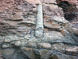
A polystrate fossil is a fossil of a single organism that extends through more than one geological stratum. The word polystrate is not a standard geological term. This term is typically found in creationist publications.

The Shackleton Range is a mountain range in Antarctica that rises to 1,875 metres (6,152 ft) and extends in an east–west direction for about 100 miles (160 km) between the Slessor and Recovery Glaciers.

Crary Mountains are a group of ice-covered volcanoes in Marie Byrd Land, Antarctica. They consist of two or three shield volcanoes, named Mount Rees, Mount Steere and Mount Frakes, which developed during the course of the Miocene and Pliocene and last erupted about 30,000-40,000 years ago. The first two volcanoes are both heavily incised by cirques, while Mount Frakes is better preserved and has a 4 kilometres (2.5 mi) wide caldera at its summit. Boyd Ridge is another part of the mountain range and lies southeast of Mount Frakes; it might be the emergent part of a platform that underlies the mountain range.

The Framnes Mountains is a group of Antarctic mountain ranges in Mac. Robertson Land, to the south of the Mawson Coast. The range is surrounded by, and largely covered by, an ice sheet.
Hodgson Lake is a perennially ice-covered freshwater lake, which is about 2 km (1.2 mi) long by about 1.5 km (0.93 mi) wide. It is located within the southern part of Alexander Island, west of Palmer Land in Antarctica, at approximately 72°S latitude and 68°W longitude. This lake has a 93.4 m (306 ft) deep water column that lies sealed beneath a 3.6 to 4.0 m thick perennial lake ice. The lake is an ultra-oligotrophic lake with very low nutrient content and very low productivity. There is no detectable life living in Hodgson Lake. The lake extends eastward into George VI Sound and the George VI Ice Shelf making it adjacent to the sound. The northern side of this lake is bounded by the Saturn Glacier, which flows east into George VI Sound. The lake lies next to and southeast of Citadel Bastion, a pre-eminent mountain on Alexander Island.

The geology of Antarctica covers the geological development of the continent through the Archean, Proterozoic and Phanerozoic eons.
The Quartz Hills is an arcuate cluster of largely ice-free hills and peaks found immediately south of Colorado Glacier along the west side of Reedy Glacier. They are part of the Transantarctic Mountains of Antarctica.
The Seal Nunataks are a group of 16 islands called nunataks emerging from the Larsen Ice Shelf east of Graham Land, Antarctic Peninsula. The Seal Nunataks have been described as separate volcanic vents of ages ranging from Miocene to Pleistocene. There are unconfirmed reports of Holocene volcanic activity.
Coal Nunatak is a flat-topped rock mass with steep cliffs facing south, standing 2 nautical miles (4 km) southwest of Corner Cliffs on the southeast corner of Alexander Island, Antarctica. Lincoln Ellsworth first noted it from the air on November 23, 1935, and mapped it from photos obtained on that flight by W.L.G. Joerg. Observed from the northwest, only the summit protrudes above the coastal ice, and it was uncertain whether this was a peak on Alexander Island or an island in George VI Sound. Its true nature was determined by the Falkland Islands Dependencies Survey (FIDS) who visited and surveyed this nunatak in 1949. So named by FIDS for exposures of thin lenses of coal occur there.
Triton Point is a rocky headland at the east end of the high ridge separating Venus Glacier and Neptune Glacier on the east coast of Alexander Island, Antarctica. Lincoln Ellsworth first observed the coast in this vicinity from the air by on 23 November 1935, and it was roughly mapped from photos obtained on that flight by W.L.G. Joerg. The British Graham Land Expedition roughly surveyed Triton Point in 1936 by the Falkland Islands Dependencies Survey more accurately defined it in 1949. The United Kingdom Antarctic Place-Names Committee named it for its association with nearby Neptune Glacier, Triton being one of the satellites of the planet Neptune, the eighth planet of the Solar System.
The Geode Nunataks are a group of small nunataks on the west side of Sibelius Glacier, immediately north of the northern extremity of the Finlandia Foothills, in northeast Alexander Island, Antarctica. They were so named by the UK Antarctic Place-Names Committee in 1977; the nunataks are composed of lava flows with abundant geodes.
Metavolcanic Mountain is a large flat-topped mountain, 2,480 metres (8,140 ft) high, located 5 nautical miles north of the Hatcher Bluffs on the east side of Reedy Glacier, Antarctica.

New England is a region in the North Eastern United States consisting of the states Rhode Island, Connecticut, Massachusetts, New Hampshire, Vermont, and Maine. Most of New England consists geologically of volcanic island arcs that accreted onto the eastern edge of the Laurentian Craton in prehistoric times. Much of the bedrock found in New England is heavily metamorphosed due to the numerous mountain building events that occurred in the region. These events culminated in the formation of Pangaea; the coastline as it exists today was created by rifting during the Jurassic and Cretaceous periods. The most recent rock layers are glacial conglomerates.
Stephenson Nunatak is a prominent, pyramid-shaped rock nunatak, rising to about 640 m, which rises 300 m above the surrounding ice at the northwest side of Kirwan Inlet in the southeast part of Alexander Island, Antarctica. Discovered and roughly surveyed in 1940-41 by Finn Ronne and Carl R. Eklund of the United States Antarctic Service. Resurveyed in 1949 by the Falkland Islands Dependencies Survey and named by the United Kingdom Antarctic Place-Names Committee for Alfred Stephenson, surveyor with the British Graham Land Expedition, who led a sledge party south into George VI Sound to about 72S in 1936. There happens to be another landform on Alexander Island which is named after Alfred Stephenson, that being Mount Stephenson, the highest point of Alexander Island rising to 2,987 m.

The geology of the Isle of Skye in Scotland is highly varied and the island's landscape reflects changes in the underlying nature of the rocks. A wide range of rock types are exposed on the island, sedimentary, metamorphic and igneous, ranging in age from the Archaean through to the Quaternary.

The geology of the Isle of Mull in Scotland is dominated by the development during the early Palaeogene period of a ‘volcanic central complex’ associated with the opening of the Atlantic Ocean. The bedrock of the larger part of the island is formed by basalt lava flows ascribed to the Mull Lava Group erupted onto a succession of Mesozoic sedimentary rocks during the Palaeocene epoch. Precambrian and Palaeozoic rocks occur at the island's margins. A number of distinct deposits and features such as raised beaches were formed during the Quaternary period.

Mount Petras is a mountain in Antarctica. It consists of volcanic rocks, most of Cretaceous age but there is also an Eocene-Oligocene volcanic system that may have been emplaced inside of thin ice. It is part of the Marie Byrd Land Volcanic Province and is its oldest volcano.

The Hudson Mountains are a mountain range in western Ellsworth Land just east of Pine Island Bay at the Walgreen Coast of the Amundsen Sea. They are of volcanic origin, consisting of low scattered mountains and nunataks that protrude through the West Antarctic Ice Sheet. The Hudson Mountains are bounded on the north by Cosgrove Ice Shelf and on the south by Pine Island Glacier. The mountains were volcanically active during the Miocene and Pliocene, but there is evidence for an eruption about two millennia ago and uncertain indications of activity in the 20th century.
References
- ↑ United States Geological Survey (nd) Citadel Bastion. Geographic Names Information System, U.S. Department of the Interior, U.S. Geological Survey, Reston, Virginia.
- ↑ Stewart, J. (2011) Antarctic An Encyclopedia McFarland & Company Inc, New York. 1776 pp. ISBN 9780786435906.
- 1 2 Cantrill, D J. (1996) Fern thickets from the Cretaceous of Alexander Island, Antarctica containing Alamatus bifarius Douglas and Aculea acicularis sp. nov. Cretaceous Research. 17(2):169–82.
- 1 2 Nichols, G.J., and D.J. Cantrill, (2002) Tectonic and climatic controls on a Mesozoic forearc basin succession, Alexander Island, Antarctica. Geological Magazine 139(3):313–330.
- ↑ Howe, J., and J.E. Francis (2005) Metamorphosed palaeosols associated with Cretaceous fossil forests, Alexander Island, Antarctica. Journal of the Geological Society. 162(6):951–957.
- 1 2 Hodgson D.A., S.J. Roberts, M.J. Bentley, J.A. Smith, J.S. Johnson, E. Verleyen, W. Vyverman, A.J. Hodson, M.J. Leng, A. Cziferszky, A.J. Fox, and D.C.W. Sanderson (2009) Exploring former subglacial Hodgson Lake, Antarctica Paper I. Quaternary Science Reviews. 28(23-24):2295–2309.
- 1 2 Johnson, J.S., J.D. Everest, P.T. Leat, N.R. Golledge, D.H. Rood, and F.M. Stuart, 2012, The deglacial history of NW Alexander Island, Antarctica, from surface exposure dating. Quaternary Research. 77(2):273–280.