Citadel of Namur

Last updated
Citadel of Namur
Citadelle de Namur (French)
Namur, Wallonia, Belgium
Namur JPG07.jpg
The Citadel of Namur, with the Meuse and the Parliament of Wallonia in the foreground
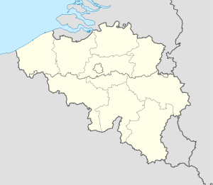
Belgium location map.svg
Red pog.svg
Citadel of Namur
Coordinates 50°27′38″N4°51′50″E / 50.4605°N 4.8640°E / 50.4605; 4.8640
TypeFort
Site information
Controlled byBelgium
Open to
the public
Yes
Site history
Built937 (937)
MaterialsStone

The Citadel of Namur (French : Citadelle de Namur) is a fortress in the Walloon capital city of Namur, at the confluence of the Sambre and Meuse rivers. It is originally from the Roman era, but has been rebuilt several times. Its current form was designed by Menno van Coehoorn, and improved upon by Vauban after the siege of 1692. It has been classified as a Wallonia Major Heritage site. Its highest point sits at 190 metres (620 ft). Together with those at Dinant, Huy and Liège, the Citadel of Namur forms part of the so-called Meuse Citadels.

Contents

The original citadel dates to 937. It achieved its present extent between 1631 and 1675, when the city was under Dutch control. This section was called "Terra Nova" to distinguish it from the smaller Médiane fort built adjacent in 1542 and ensuing years. A variety of subsidiary positions were built in the 18th century. It was disestablished as a military post in 1891, superseded by a new ring of forts around Namur that were calculated to prevent the city from being attacked with artillery. This ring became the Fortified Position of Namur in the 1930s. The citadel was used as protected space for its command post. [1]

See also

Related Research Articles

<span class="mw-page-title-main">Verdun</span> Subprefecture and commune in Grand Est, France

Verdun is a city in the Meuse department in Grand Est, northeastern France. It is an arrondissement of the department.

<span class="mw-page-title-main">Ardennes</span> Low mountain range in Belgium, Luxembourg, Germany and France

The Ardennes, also known as the Ardennes Forest or Forest of Ardennes, is a region of extensive forests, rough terrain, rolling hills and ridges primarily in Belgium and Luxembourg, extending into Germany and France.

<span class="mw-page-title-main">Dinant</span> City and municipality in Namur Province, Belgium

Dinant is a city and municipality of Wallonia located in the province of Namur, Belgium. On the shores of river Meuse, in the Ardennes, it lies 90 kilometres (56 mi) south-east of Brussels, 30 kilometres (19 mi) south-east of Charleroi and 30 kilometres (19 mi) south of the city of Namur. Dinant is situated 20 kilometres (12 mi) north of the border with France.

<span class="mw-page-title-main">Namur</span> Capital of Namur province and Wallonia, Belgium

Namur is a city and municipality in Wallonia, Belgium. It is the capital both of the province of Namur and of Wallonia, hosting the Parliament of Wallonia, the Government of Wallonia and its administration.

<span class="mw-page-title-main">County of Namur</span> State of the Holy Roman Empire (c. 981–1797)

Namur was a county of the Carolingian and later Holy Roman Empire in the Low Countries, a region in northwestern Europe. Its territories largely correspond with the present-day French-speaking Belgian arrondissement Namur together with the northwestern part of the arrondissement Dinant, which are both part of the modern province of Namur. The modern provincial boundaries are based on the French Republican department of Sambre-et-Meuse.

<span class="mw-page-title-main">Fort de Villey-le-Sec</span>

Fort de Villey-le-Sec, also known as Fort Trévise, is a fortification of the 19th century, built as part of the Séré de Rivières system of fortifications in Villey-le-Sec, France, one of the defenses of Toul. It is a unique example for its time of a defensive enclosure around a village. Conceived after the defeat of the Franco-Prussian War of 1870-71, the fort was located away from the main combat zone of World War I and has remained almost intact. The fort's preservation association has been at work since 1961 to restore and interpret the site. It has been included in the Inventory of Historic Sites and has been designated as a preserved natural area.

<span class="mw-page-title-main">Fort de Liouville</span>


The Fort de Liouville, also known as Fort Stengel, located between the communes of Saint-Agnant-sous-les-Côtes and Saint-Julien-sous-les-Côtes, near the town of Commercy in the Meuse departement of France, is one of the forts built at the end of the 19th century to defend the valley of the Meuse. The fort was located on what was then the French frontier facing the German-occupied province of Lorraine. The Fort de Liouville was located between the Fort de Gironville and the Camp des Romains.

<span class="mw-page-title-main">Fortified position of Liège</span> Line of fortifications in Belgium

The fortified position of Liège was established after the First World War by Belgium to block the traditional invasion corridor through Belgium between Germany and France. In the First World War the Belgian Army held up the Germans for a week at Liège, delaying the German invasion of France, caused Belgium to consider a similar defensive strategy. Belgium rebuilt the Liège fortifications and extended them onto the Pays de Herve closer to Germany, using the most advanced fortification technology available.

<span class="mw-page-title-main">Fortified position of Namur</span> Ring of fortifications in Belgium

The fortified position of Namur was established by Belgium after the First World War to fortify the traditional invasion corridor between Germany and France through Belgium. The position incorporated the fortress ring of Namur, originally designed by the Belgian General Henri Alexis Brialmont to deter an invasion of Belgium by France. The old fortifications consisted of nine forts built between 1888 and 1892 on either side of the Meuse, around Namur.

<span class="mw-page-title-main">Fort de Marchovelette</span> Belgian military fortification

The Fort de Marchovelette is one of nine forts built as part of the fortifications of Namur in the late 19th century in Belgium. It was built between 1888 and 1892 according to the plans of General Henri Alexis Brialmont. Contrasting with the French forts built in the same era by Raymond Adolphe Séré de Rivières, the fort was built exclusively of unreinforced concrete, a new material, rather than masonry. In 1914 the fort was heavily bombarded by German artillery in the Battle of Namur. Malonne was upgraded in the 1930s to become part of the fortified position of Namur in an attempt to forestall or slow an attack from Germany. It saw action in 1940 during the Battle of Belgium, and was captured by German forces. The fort is now used as a military and police training facility.

<span class="mw-page-title-main">Fort de Malonne</span>

The Fort de Malonne is one of nine forts built as part of the Fortifications of Namur in the late 19th century in Belgium. It was built between 1888 and 1892 according to the plans of General Henri Alexis Brialmont. Contrasting with the French forts built in the same era by Raymond Adolphe Séré de Rivières, the fort was built exclusively of unreinforced concrete, a new material, rather than masonry. In 1914 the fort was heavily bombarded by German artillery in the Battle of Namur. Malonne was upgraded in the 1930s to become part of the fortified position of Namur in an attempt to forestall or slow an attack from Germany. It saw action in 1940 during the Battle of Belgium, and was captured by German forces. The fort is now part of a nature preserve and is a habitat for bats.

<span class="mw-page-title-main">Citadel of Liège</span> Partially destroyed fortress in Liège, Belgium

The Citadel of Liège was the central fortification of the strategic Belgian city of Liège, Wallonia, until the end of the 19th century. It is located in the Sainte-Walburge neighborhood, 111 metres (364 ft) above the Meuse valley. Together with those at Dinant, Huy and Namur, the Citadel of Liège forms part of the so-called Meuse Citadels.

<span class="mw-page-title-main">Fort d'Andoy</span>

The Fort d'Andoy is one of nine forts built as part of the Fortifications of Namur in the late 19th century in Belgium. It was built between 1888 and 1892 according to the plans of General Henri Alexis Brialmont. Contrasting with the French forts built in the same era by Raymond Adolphe Séré de Rivières, the fort was built exclusively of unreinforced concrete, a new material, rather than masonry. In 1914 the fort was heavily bombarded by German artillery in the Battle of Namur. Andoy was upgraded in the 1930s to become part of the fortified position of Namur in an attempt to forestall or slow an attack from Germany. It saw action in 1940 during the Battle of Belgium, and was captured by German forces. The fort is now abandoned on private property.

The Fort de Maizeret is one of nine forts built as part of the Fortifications of Namur in the late 19th century in Belgium. It was built between 1888 and 1892 according to the plans of General Henri Alexis Brialmont. Contrasting with the French forts built in the same era by Raymond Adolphe Séré de Rivières, the fort was built exclusively of unreinforced concrete, a new material, rather than masonry. In 1914 the fort was heavily bombarded by German artillery in the Battle of Namur. Maizeret was upgraded in the 1930s to become part of the fortified position of Namur in an attempt to forestall or slow an attack from Germany. It saw action in 1940 during the Battle of Belgium, and was captured by German forces. The fort is now abandoned on private property.

<span class="mw-page-title-main">Fort de Dave</span> Fortification in Belgium

The Fort de Dave is one of nine forts built as part of the Fortifications of Namur in the late 19th century in Belgium. It was built between 1888 and 1892 according to the plans of General Henri Alexis Brialmont. Contrasting with the French forts built in the same era by Raymond Adolphe Séré de Rivières, the fort was built exclusively of unreinforced concrete, a new material, rather than masonry. In 1914 the fort was heavily bombarded by German artillery in the Battle of Namur. Dave was upgraded in the 1930s to become part of the fortified position of Namur in an attempt to forestall or slow an attack from Germany. It saw action in 1940 during the Battle of Belgium, and was captured by German forces. The fort is now abandoned on state property.

<span class="mw-page-title-main">Fort de Suarlée</span>

The Fort de Suarlée is one of nine forts built as part of the Fortifications of Namur in the late 19th century in Belgium. It was built between 1888 and 1892 according to the plans of General Henri Alexis Brialmont. Contrasting with the French forts built in the same era by Raymond Adolphe Séré de Rivières, the fort was built exclusively of unreinforced concrete, a new material, rather than masonry. In 1914 the fort was heavily bombarded by German artillery in the Battle of Namur. Suarlée was upgraded in the 1930s to become part of the fortified position of Namur in an attempt to forestall or slow an attack from Germany. It saw action in 1940 during the Battle of Belgium, and was captured by German forces. The fort is now abandoned on private property.

<span class="mw-page-title-main">Siege of Namur (1914)</span> 1914 battle of the German invasion of Belgium during WWI

The siege of Namur was a battle between Belgian and German forces around the fortified city of Namur during the First World War. Namur was defended by a ring of modern fortresses, known as the Fortified Position of Namur and guarded by the 4th Division of the Belgian Army. The purpose of the fortified Belgian cities was to delay an invasion force until troops from the states guaranteeing Belgian independence came to their aid. The French Fifth Army planned to counter-attack while the Germans were besieging Namur.

<span class="mw-page-title-main">Citadel of Huy</span> Fortress in Liège, Belgium

The Citadel of Huy or the Fort of Huy, known locally as The Castle, is a fortress located in the Walloon city of Huy in the province of Liège, Belgium. The fort occupies a high position in the town, overlooking the strategic Meuse river. Together with those at Dinant, Liège and Namur, the Citadel of Huy forms part of the so-called Meuse Citadels.

<span class="mw-page-title-main">Citadel of Dinant</span> Fortress in Dinant, Belgium

The Citadel of Dinant is a fortress located in the Walloon city of Dinant in the province of Namur, Belgium. The current fort was built in 1815 on a site which was originally fortified in 1051 when the region was ruled by the Prince-Bishopric of Liège. The citadel overlooks the city of Dinant and the strategic Meuse river which runs through the town. It is open to the public. Together with those at Huy, Liège and Namur, the Citadel of Dinant forms part of the so-called Meuse Citadels.

<span class="mw-page-title-main">Meuse Citadels</span> Group of forts along the Meuse river in Belgium

The Meuse citadels or Mosane citadels are a group of forts situated along the Meuse river in southern Belgian region of Wallonia. The citadels were originally intended to defend the Prince-Bishopric of Liège and County of Namur and were later modernized during the periods of French and Dutch rule. They include four citadels, at Namur, Liège, Huy and Dinant, all of which are partially or totally preserved.

References

  1. Puelinckx, Jean; Malchair, Luc. "Citadelle de Namur". Index des fortifications belges (in French). fortiff.be. Archived from the original on 31 July 2017. Retrieved 20 August 2012.