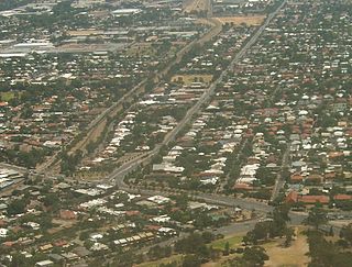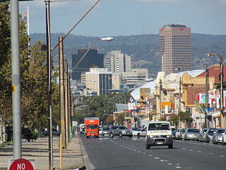
Prospect is the seat of the City of Prospect and an inner northern suburb of greater Adelaide. It is located 5 km (3.1 mi) north of Adelaide's centre.

Enfield is a suburb in Adelaide, Australia. The suburb is about a 10-minute drive north from Adelaide's Central Business District. The suburb is bordered by Gepps Cross, Blair Athol and Clearview at the Northern end, and Prospect, Sefton Park and Broadview at the Southern end.
Sefton Park is a suburb about 6 km north east of the Adelaide CBD, South Australia and lies in both the City of Port Adelaide Enfield and the City of Prospect. It borders the suburbs Enfield, Nailsworth, Prospect and Broadview. Sefton Park is a minor shopping district of Adelaide and is also one of Adelaide's smallest suburbs.
Frewville is a small suburb in the South Australian city of Adelaide. It is three kilometres south-east of Adelaide's central business district (CBD).

Veale Gardens is part of the Adelaide Parklands throughout and surrounding the City of Adelaide. It is located in the South Parklands surrounded by Greenhill and Peacock Roads, South Terrace, and Sir Lewis Cohen Avenue. The gardens can be entered by entrances on South Terrace.

Plympton Park is a western suburb of Adelaide 8 km from the CBD, in the state of South Australia, Australia and falls under the City of Marion. The post code for Plympton Park is 5038. It is adjacent to Park Holme, Plympton, South Plympton, and Morphettville. It is bordered to the east by Marion road, to the west by Park Terrace, to the south by Taranna Avenue and to the north by the Glenelg Tramline.

Woodville Gardens is a north-western suburb of Adelaide 9 km from the CBD, in the state of South Australia, Australia and falls under the City of Port Adelaide Enfield. It is adjacent to Woodville North, Mansfield Park, Ferryden Park, and Kilkenny. The post code for Woodville Gardens is 5012. It is bounded to the south by First Avenue, and to the east by Liberty Grove, and to the west by Hanson Road.

Croydon Park is a north-western suburb of Adelaide 7 km from the CBD, in the state of South Australia, Australia and is within the City of Port Adelaide Enfield. It is adjacent to Dudley Park, Devon Park, Renown Park, Regency Park, Ferryden Park Kilkenny, and West Croydon. The post code for Croydon Park is 5008. It is bounded to the south by Lamont Street and Torrens Road, to the north by Regency Road and in the east and west by Harrison Road and Goodall Avenue respectively. Croydon Park is predominantly a residential suburb, with a warehousing presence on the northern edges near Regency Road.

Port Road is a major road in Adelaide, South Australia connecting the Adelaide city centre with Port Adelaide. It is 12 km (7.5 mi) long, and has a very wide median strip, giving a total width of approximately 70 m.
Salisbury East is a suburb of Adelaide, South Australia, located 20 kilometres north of the Adelaide CBD. The residential part of the suburb is in the local government area (LGA) of the City of Salisbury, however the eastern part of the Cobbler Creek Recreation Park is in the boundaries of the City of Tea Tree Gully.

Adelaide city centre is the innermost locality of Greater Adelaide, the capital city of South Australia. It is known by locals simply as "The City" or "Town" to distinguish it from Greater Adelaide and from the City of Adelaide. The locality is split into two key geographical distinctions: the city "square mile", bordered by North, East, South and West Terraces; and the section of the parklands south of the River Torrens which separates the built up part of the city from the surrounding suburbs and North Adelaide.

Gouger Street is a main street in the centre of Adelaide, South Australia. It was named after Robert Gouger, first Colonial Secretary of South Australia. Gouger Street is known for its high-end international restaurants and cafes. Cuisines found along Gouger Street include Italian, French, Argentinian, Malaysian, Vietnamese, Chinese and Thai. Many of the restaurants on Gouger Street have won awards; some of the better known ones are Star of Siam, La Porchetta (Italian) and Chi on Gouger.

Halifax Street is a street in the south-eastern sector of the centre of Adelaide, South Australia. It runs east–west between East Terrace and King William Street, crossing Hutt Street and Pulteney Street and passing through Hurtle Square. It was named after Sir Charles Wood, British Member of Parliament for Halifax.

The Kensington Oval is located on 344 The Parade, Kensington, South Australia. Now used primarily for cricket in South Australia, the venue was once Adelaide's premier athletics facility and known as Olympic Sports Field.

Oakden is a suburb of Adelaide, South Australia, located to the north-east of the Central Business District. It was established as a housing estate named Regent Gardens in 1992 and is located on former Department of Agriculture land.

Gilles Street is a street in the south-eastern sector of the centre of Adelaide, South Australia. It runs east-west between East Terrace and King William Street, crossing Hutt Street and Pulteney Street. It was named after Osmond Gilles, an early treasurer of the colony of South Australia on 23 May 1837.

Hutt Street is a main road on the eastern boundary of the central business district (CBD) of Adelaide, South Australia. It runs north-south, from Pirie Street, and can be considered a branch of East Terrace. It runs to South Terrace, where it becomes Hutt Road.

East Terrace marks the eastern edge of the city centre of Adelaide, the capital city of South Australia. It is one of the main north-south thoroughfares through the east side of the city. Although the terrace essentially runs north-south between North Terrace and South Terrace, unlike Adelaide's other three terraces, its path is far from a straight line; travelling the entire length of East Terrace requires turning at right angles at most intersections. After crossing South Terrace, the street continues through the parklands as Beaumont Road, but unlike other roads through the parklands it is not a thoroughfare; there is a break in the middle of it.

Grote Street is a major street in the CBD of the centre of Adelaide, South Australia. It runs in an east-west direction, as a continuation of Wakefield Street where it crosses Victoria Square. It concludes at West Terrace; the road which continues is Sir Donald Bradman Drive. The Grote Street–Sir Donald Bradman Drive route is the most direct method of travelling from the CBD to the Adelaide Airport.


