Related Research Articles

Morelos, officially the Free and Sovereign State of Morelos, is one of the 32 states which comprise the Federal Entities of Mexico. It is divided into 36 municipalities and its capital city is Cuernavaca.

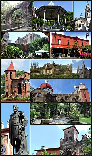
Cuernavaca is the capital and largest city of the state of Morelos in Mexico. Along with Chalcaltzingo, it is likely one of the origins of the Mesoamerican civilization. Olmec works of art, currently displayed in the Museum of Anthropology in Mexico City were found in the Gualupita III archeological site.

Cuautla, officially La heroica e histórica Cuautla, Morelos or H. H. Cuautla, Morelos, is a city and municipality in the Mexican state of Morelos, about 104 kilometers south of Mexico City. In the 2010 census the city population was 154,358. The municipality covers 153.651 km2 (59.325 sq mi). Cuautla is the third most populous city in the state, after Cuernavaca and Jiutepec. The city was founded on April 4, 1829. The 2020 population figures were 187,118 inhabitants for the municipality and 157,336 inhabitants for the city of Cuatula.
Huitzilac is a city in the Mexican state of Morelos. It stands at 19°01′42″N99°16′02″W and at an altitude of 2,561 m (8,402 ft) above sea level.
Jiutepec is a city and its surrounding municipality in the Mexican state of Morelos.
Jonacatepec de Leondro Valle is a city in the Mexican state of Morelos. The city serves as the municipal seat for the surrounding municipality of the same name. The municipality reported 15,690 inhabitants in the year 2015 census.

Miacatlán is a city and municipal seat of the municipality of Miacatlán in the Mexican state of Morelos. It stands at 18°46′20″N99°21′17″W.

Temixco is the fourth-largest city in the Mexican state of Morelos. It stands at 18°51′N99°14′W in the west-northwest part of the state.
Xochitepec is a municipio (municipality) of the state of Morelos, in central Mexico. Xochitepec is also the name of its principal township and seat of the municipal government. It is located approximately 13 km (8.1 mi) to the south of the capital of Morelos, Cuernavaca, on the southern outskirts of that city's greater metropolitan area.

Yautepec is a municipality located in the north-central part of the Mexican state of Morelos. The municipal seat is the city of Yautepec de Zaragoza. It stands at 18°53′N99°04′W.

Morelos is a state in South Central Mexico that is currently divided into 36 municipalities. According to the 2020 Mexican Census, it is the twenty-third most populated state with 1,971,520 inhabitants and the third smallest by land area spanning 4,878.9 square kilometres (1,883.8 sq mi).

Tijuana Municipality is a municipality in the Mexican state of Baja California. Its municipal seat is located in the city of Tijuana. According to the 2020 census, the municipality had a population of 1,922,523. Luis Arturo González Cruz of the MORENA is the current municipal president. The municipality comprises the largest part of the Tijuana metropolitan area.

Ciudad Satélite, commonly known as Satélite, is an upper-middle and upper class neighborhood located 14KM northwest from Mexico City's Historic Center, in Naucalpan, State of Mexico, on the western part of Greater Mexico City. Officially, the name corresponds exclusively to the homonym neighbourhood, Ciudad Satélite, founded circa 1957. But over time, its surrounding area, including upper-middle class neighbourhoods like Lomas Verdes, Echegaray, Paseos del Bosque or San Mateo, alongside adjacent municipalities Atizapán de Zaragoza and Tlalnepantla de Baz, has also become collectively known as "Satélite", due to its prominence as both an economically and socially dynamic area.

Polanco is a neighborhood in the Miguel Hidalgo borough of Mexico City. Polanco is an affluent colonia, noted for its luxury shopping along Presidente Masaryk Avenue, the most expensive street in Mexico, as well as for the numerous prominent cultural institutions located within the neighborhood.

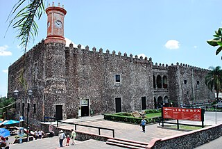
The Palace of Cortés in Cuernavaca, Mexico, built between 1523 and 1528, is the oldest conserved colonial-era civil structure in the continental Americas. The architecture is a blend between Gothic and Mudéjar, typical of the early 16th century colonial architecture. The building began as a fortified residence for conqueror Hernán Cortés and his aristocratic second wife, Doña Juana Zúñiga. It was built in 1526, over a Tlahuica Aztec tribute collection center, which was destroyed by the Spanish during the Conquest. Cortés replaced it with a personal residence to assert authority over the newly conquered peoples. As Cortés's residence, it reached its height in the 1530s, but the family eventually abandoned it due to on-going legal troubles. In the 18th century, colonial authorities had the structure renovated and used it as a barracks and jail. During the Mexican War of Independence, it held prisoners such as José María Morelos y Pavón. After the war, it became the seat of government for the state of Morelos until the late 20th century, when the state government moved out and the structure was renovated and converted into the current Museo Regional Cuauhnahuac, or regional museum, with exhibits on the history of Morelos.

Ecatepec, officially Ecatepec de Morelos, is a municipality in the central Mexican state of Mexico, and is situated in the north part of the greater Mexico City urban area. The municipal seat is San Cristóbal Ecatepec.
Acapantzingo is a barrio in the southeastern part of the City of Cuernavaca, Morelos, Mexico, 2 km from the city center. The Nahuatl name means on the slope of the reeds. It is bound by the Río Chalchihuapan on the west, Colonia Atlacumulco, Jiutepec to the east and south, Colonia Palmira to the south, and Calle Cuauhatemoc to the north.
The Cuernavaca Municipality is one of 36 municipalities in the State of Morelos, Mexico. Located in the northwest of the state, it consists of the City of Cuernavaca, which is the state and municipal capital, as well as other, smaller towns. The population is 378,476 (2020).
References
- 1 2 http://parquesindustrialesmorelos.com/parques-industriales/ciudad-industrial-del-valle-de-cuernavaca-civac/ Archived 2018-12-14 at the Wayback Machine Dec 11, 2018
- ↑ https://www.vivemx.com/col/civac.htm Dec 11, 2018