
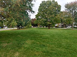
The Glebe is a neighbourhood in Ottawa, Ontario, Canada. It is located just south of Downtown Ottawa in the Capital Ward. As of 2016, the neighbourhood had a population of 13,055.

Carling Avenue is a major east–west arterial road in the west end of Ottawa, Ontario, Canada. It runs from March Road in Kanata to Bronson Avenue in the Glebe. The road is named for John Carling, founder of Carling Brewery and Conservative MP and Senator, Postmaster General and Minister of Agriculture.
Ottawa West was a federal and provincial electoral district in Ontario, Canada, that was represented in the House of Commons of Canada from 1935 to 1997 and in the Legislative Assembly of Ontario from 1908 to 1926 and from 1955 to 1999. It covered the western part of the Ottawa area.

Hintonburg is a neighbourhood in Kitchissippi Ward in Ottawa, Ontario, Canada, located west of the Downtown core. It is a historically working-class, predominantly residential neighbourhood, with a commercial strip located along Wellington Street West. It is home to the Parkdale Farmer's Market, located along Parkdale Avenue, just north of Wellington. It is considered to be one of Ottawa's most "hipster" neighbourhoods.

Lindenlea is a neighbourhood in Rideau-Rockcliffe Ward in Ottawa, Ontario, Canada, northeast of Downtown. It is bordered by Maple Lane to the north, Acacia Avenue to the east, Beechwood Avenue to the south and Springfield Road to the west.
Glabar Park is a neighbourhood in Bay Ward, in the west end of Ottawa, Ontario, Canada. It is bounded on the west by Woodroffe Avenue north by Carling Avenue, south by The Queensway and on the east by Maitland Avenue. The population at the 2011 census was about 2,806.

Lincoln Heights is a neighbourhood in the Britannia area of Bay Ward in the west end of Ottawa, Ontario, Canada. It is defined by its community association as being bounded to the south by the north side of Regina Lane, to the north by the Ottawa River, to the west by the east side of Croydon Avenue, and to the east by the Kichi Zibi Mikan. According to the Canada 2016 Census, the population of the neighbourhood is 1,630. The greater Lincoln Heights area can be defined as extending as far west as Greenview Avenue and as far south as Carling Avenue, which overlaps with neighbouring Britannia Village.

Crystal Beach is a neighbourhood in Ottawa, Ontario, Canada. It is located in the west end of Ottawa, in Bay Ward. The neighbourhood is triangular in shape, and its boundaries can broadly be described as Carling Avenue to the northeast, Moodie Drive to the west, and Corkstown Road to the south. It is. According to the Canada 2011 Census, the total population of the neighbourhood was 2,416.

Carlington is a neighbourhood located in River Ward in the west-end of Ottawa, Ontario, Canada.

Findlay Creek is a suburban neighbourhood in Riverside South-Findlay Creek Ward in the south end of Ottawa, Ontario, Canada. According to the 2021 Canadian Census, the population of the community was 14,089 and there were 4,395 dwellings.
Parkdale Avenue is an arterial road located west of downtown Ottawa, Ontario, Canada. It runs in a north-south direction between the Kichi Zibi Mikan and Carling Avenue in the Hintonburg and Civic Hospital neighbourhoods. It is an extremely busy road providing access to Tunney's Pasture, the Parkdale Market, the Ottawa Civic Hospital, and the Central Experimental Farm. Furthermore, it has direct connections to other major east-west arteries such as Scott Street, Wellington Street West, Gladstone Avenue, and Highway 417.

Fisher Heights is a neighbourhood located in the far northeast corner of the former City of Nepean in Ottawa, Ontario, Canada. It is located in Knoxdale-Merivale Ward. The area is located south of the Experimental Farm and approximately 8 km away from downtown Ottawa.

Carleton Heights is a neighbourhood in River Ward in Ottawa, Ontario, Canada. According to the Carleton Heights and Area Community Association, the neighbourhood is bounded on the north by the Central Experimental Farm, on the east by the Rideau River, on the south by the junction of Prince of Wales Drive and Fisher Avenue and on the west by Fisher Avenue. The neighbourhood is sometimes referred to as Hog's Back after the nearby falls. The total population of the neighbourhood is 7,586 according to the Canada 2016 Census.
Ellwood is a neighbourhood and former railway point in River Ward, in the south end of Ottawa, Ontario, Canada. It is bounded by Walkley Road on the north, the Transitway on the west, Albion Road on the east, and Ledbury Park on the south. The population of this area is approximately 2908.
Bayshore is a neighbourhood in Bay Ward in the west end of Ottawa, Ontario, Canada. Prior to amalgamation in 2001, the neighbourhood was in the City of Nepean. It is bounded east by row houses off Bayshore Drive, to the north Carling Avenue, to the west Holly Acres Drive and the Lakeview neighbourhood, and to the south Ontario Highway 417. The main street in Bayshore is Woodridge Crescent, while the Bayshore Station is the major bus transit station.
McKellar Heights is a small neighbourhood located in Kitchissippi Ward, in the west end of Ottawa, Ontario, Canada. The neighbourhood is generally triangular in shape, and is generally bounded on the north by Westboro, on the west by Glabar Park, and on the south by Carlington. The population as of the Canada 2016 Census was 575.
Laurentian View is a sub-neighbourhood of Westboro, Ottawa, Ontario, Canada. It is bounded west by Tweedsmuir, north to Richmond Road, east to Hilson and south by Carling Avenue. While the name still appears on maps, it fell out of use to describe the area in the 1970s, as the area is now found completely with in the boundaries of the Hampton-Iona neighbourhood.

Cyrville is a neighbourhood in Beacon Hill-Cyrville Ward in the east-end of Ottawa, Ontario, Canada. The area is located within the former City of Gloucester, and is roughly bounded on the north, west and south by the former Gloucester City limit, and on the east by the Aviation Parkway and Highway 417. Once a francophone farming village, the area now a mix of residential and industrial land, being home to the Cyrville Industrial Area. It has been described as a "tangle of freeways and utility corridors". It has a population of 4513, 280 of which live south of the Queensway.
Uplands, also known as Elizabeth Park or Airport-Uplands is a neighbourhood in Gloucester-Southgate Ward in the south end of Ottawa, Ontario, Canada. It is located in the federal and provincial districts of Ottawa South, in the former city of Gloucester. It is bordered by the Hunt Club Road to the north, Uplands Drive to the east, and the Macdonald-Cartier International Airport to the south and west. The neighbourhood is adjacent to the military community living at CFB Uplands, which was a large air force base in the 1960s and which still contains residential housing for military members.

Belltown is a neighbourhood in the Britannia area of Bay Ward, in the west end of Ottawa. It is bounded on the east by Britannia Park, on the north by the Ottawa River, on the west by Andrew Haydon Park and the south by Carling Avenue. Prior to Ottawa's amalgamation in 2001, the neighbourhood spanned the Ottawa-Nepean municipal boundary. The neighbourhood's population is 2089, with 294 people living in the Nepean portion.


