Grafton is a city in the Northern Rivers region of the Australian state of New South Wales. It is located on the Clarence River, on a floodplain, approximately 608 kilometres (378 mi) by road north-northeast of the state capital Sydney.

Clarence Valley Council is a local government area in the Northern Rivers region of New South Wales, Australia.
Revillagigedo Island is an island in the Alexander Archipelago in Ketchikan Gateway Borough of the southeastern region of the U.S. state of Alaska. Running about 89 km (50 mi) north-south and 48 km (35 mi) east-west, it is 2,754.835 km2 (1,063.65 mi2) in area, making it the 12th largest island in the United States and the 170th largest island in the world. Its center is located near 55°38′03″N131°17′51″W.

Clarence Island is the easternmost island in the South Shetland Islands, off the coast of Antarctica. It is claimed by Argentina as part of Argentine Antarctica, by Britain as part of the British Antarctic Territory, and by Chile as part of the Chilean Antarctic Territory. The name dates back to at least 1820 and is now established in international usage, except for Russia, where it has been known as Shishkova Island since its discovery by the First Russian Antarctic Expedition in 1821.

James Ross Strait, an arm of the Arctic Ocean, is a channel between King William Island and the Boothia Peninsula in the Canadian territory of Nunavut. 180 km (110 mi) long, and 48 km (30 mi) to 64 km (40 mi) wide, it connects M'Clintock Channel to the Rae Strait to the south. Islands in the channel include the Clarence Islands, Tennent Islands, Beverley Island, and Matty Island.

The Clarence River is a river situated in the Northern Rivers district of New South Wales, Australia. It rises on the eastern slopes of the Great Dividing Range, in the Border Ranges west of Bonalbo, near Rivertree at the junction of Koreelah Creek and Maryland River, on the watershed that marks the border between New South Wales and Queensland. It flows generally south, south east and north east, and is joined by twenty-four tributaries including Tooloom Creek and the Mann, Nymboida, Cataract, Orara, Coldstream, Timbarra, and Esk rivers. It descends 256 metres (840 ft) over the course of its 394-kilometre (245 mi) length and empties into the Coral Sea in the South Pacific Ocean, between Iluka and Yamba.

Maclean is a town in Clarence Valley local government area in the Northern Rivers region of New South Wales, Australia. It is on the Clarence River and near the Pacific Highway. At the 2021 census, Maclean had a population of 2,778, total urban area including Townsend and Gulmarrad is more than 8,304.

In June 1962, inmates Clarence Anglin, John Anglin, and Frank Morris escaped from Alcatraz Federal Penitentiary, a maximum-security prison located on Alcatraz Island in San Francisco Bay, California, United States. Late on the night of June 11 or early morning of June 12, the three men tucked papier-mâché model heads resembling their own likenesses into their beds, broke out of the main prison building via ventilation ducts and an unguarded utility corridor, and departed the island aboard an improvised inflatable raft to an uncertain fate. A fourth conspirator, Allen West, failed in his escape attempt and remained on the island.

The Harwood Bridge is a two-lane steel truss bridge which carried the Pacific Highway over the Clarence River in the Northern Rivers region of New South Wales, Australia from 1966 until 2019, when it was replaced by a four-lane 1.5-kilometre-long (4,921 ft) concrete bridge, located 20 metres (66 ft) to its east. The Harwood Bridge has been retained to provide access to Harwood Island.

Clarence River Light, also known as Yamba Light or Clarence Head Light, is an active lighthouse located on Pilot Hill, a hill in Wooli Park, Yamba, New South Wales, Australia, south of the entrance of Clarence River. The current lighthouse was built in 1955, replacing a previous lighthouse built in 1880. It serves as the rear range light for two different ranges.

Cape Bowles is a cape forming the southern extremity of Clarence Island in the South Shetland Islands of Antarctica. It was named in 1820 by Edward Bransfield, Master, Royal Navy, while exploring the islands in the brig Williams.

Escarpada Point, also known as Craggy Point, is the rocky, rugged south-west point of Clarence Island in the South Shetland Islands of Antarctica. The descriptive name was given in the course of Argentine government visits in 1953–1954.

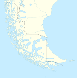
The Cockburn Channel is a channel that separates the Brecknock Peninsula, which is the westernmost projection of the Isla Grande de Tierra del Fuego, from Clarence Island, Capitán Aracena Island and other minor islands in Chile. It is located at 54°20′S71°30′W and extends 40 miles (64 km) east from the open Pacific Ocean to Magdalena Channel. The channel is part of a major waterway connecting the Strait of Magellan to the Beagle Channel: Magdalena Channel, Cockburn Channel, Brednock Pass, Ballenero Channel, Beagle Channel.

Fur Seal Point, sometimes referred to as Fur Seal Beach, is a cape midway along the eastern coast of Clarence Island, the easternmost of the South Shetland Islands of Antarctica. Just off the headland lies the small Sugarloaf Island.
Bárbara Channel is one of the three channels which connects Magellan Strait with the Pacific Ocean. It is located between the Santa Inés Island and the Clarence Island and ends at the Otway Bay, having the same entrance into the Pacific as Cockburn Channel, runs in a north direction along the west side of Clarence Island.

Tongass Narrows is a Y-shaped channel, part of Southeast Alaska's Inside Passage. The waterway forms part of the Alaska Marine Highway and as such, is used by charter, commercial fishing, and recreational vessels, as well as commercial freight barges and tanks, kayaks and passenger ferries. A proposal to build the Gravina Island Bridge across the Tongass Narrows was shelved due to a national-level controversy over the "bridge to nowhere".
Sugarloaf Island is a conspicuous small island which lies close to the east side of Clarence Island, midway between Cape Lloyd and Cape Bowles, in the South Shetland Islands, Antarctica. It lies 3.2 km north of Lebed Point, on the northern side of the entrance to Istros Bay. The name was in use by American and British sealers as early as 1822 and is now well established.
Garden Island is a tied island 2 kilometres (1.2 mi) from Clarence Point, near the mouth of the Tamar River in Tasmania. It is accessed by a dirt road off Bevic Road, which runs between West Tamar Highway, Kelso and Clarence Point Road.

Vernon Islands, also known as the Potinga Islands, is an island group in the Northern Territory of Australia located in the Clarence Strait about 55 kilometres (34 mi) north-east of the territory capital of Darwin. The group consists of three islands which were first sighted by Europeans in 1818 on a British navy ship under the command of Phillip Parker King. The group were part of the subject of a successful aboriginal land claim which was resolved after 40 years in 2018 when the Tiwi people received title. All three islands host navigation aids which assist vessels passing through the Clarence Strait. It and some adjoining seabed have had protected area status since 1974 and which has been known as the Vernon Islands Conservation Reserve since 1979. Since 2007, the island group has been located in the locality of Vernon Islands.