Clark County is a county located in the U.S. state of Nevada. As of the 2020 census, the population was 2,265,461. Most of the county population resides in the Las Vegas Census County Divisions, which hold 2,196,623 people as of the 2020 Census, across 435 square miles (1,130 km2). It is by far the most populous county in Nevada, and the 11th most populous county in the United States. It covers 7% of the state's land area but holds 73% of the state's population, making Nevada the most centralized state in the United States.

Lake and Peninsula Borough is a borough in the state of Alaska. As of the 2020 census, the population was 1,476, down from 1,631 in 2010. The borough seat of King Salmon is located in neighboring Bristol Bay Borough, although is not the seat of that borough. The most populous community in the borough is the census-designated place of Port Alsworth. With an average of 0.017 inhabitants per square kilometre, the Lake and Peninsula Borough is the second least densely populated organized county-equivalent in the United States; only the unorganized Yukon-Koyukuk Census Area has a lower density.

Yankton County is a county in the U.S. state of South Dakota. As of the 2020 census, the population was 23,310. Its county seat is Yankton. Yankton County comprises the Yankton, SD Micropolitan Statistical Area.

Clark County is a county in the U.S. state of South Dakota. As of the 2020 census, the population was 3,837. Its county seat is Clark. The county was created in 1873 and organized in 1881. It was named for Newton Clark, a Dakota Territory legislator in 1873.

Bon Homme County is a county in the U.S. state of South Dakota. As of the 2020 census, the population was 7,003. Its county seat is Tyndall.

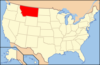
Lewis and Clark County is a county located in the U.S. state of Montana. As of the 2020 census, the population was 70,973. Its county seat is Helena, the state capital. The numerical designation for Lewis and Clark County is 5. The county was established on June 2, 1865, as one of the nine original counties of the Territory of Montana named Edgerton County in honor of Sidney Edgerton, first Governor of the Territory of Montana, and was renamed Lewis and Clark County on March 1, 1868, in honor of explorers Meriwether Lewis and William Clark.

Arkadelphia is a city in Clark County, Arkansas, United States. As of the 2020 census, the population was 10,380. The city is the county seat of Clark County. It is situated at the foothills of the Ouachita Mountains. Two universities, Henderson State University and Ouachita Baptist University, are located here. Arkadelphia was incorporated in 1857.
Clark Township is a township in Aitkin County, Minnesota, United States. The population was 169 as of the 2010 census.

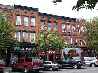
Cooperstown is a village in and the county seat of Otsego County, New York, United States. Most of the village lies within the town of Otsego, but some of the eastern part is in the town of Middlefield. Located at the foot of Otsego Lake in the Central New York Region, Cooperstown is approximately 60 miles southwest of Albany, 67 mi (108 km) southeast of Syracuse and 145 mi (233 km) northwest of New York City. The population of the village was 1,794 as of the 2020 census.

The Portland metropolitan area is a metro area with its core in the U.S. states of Oregon and Washington. It has 5 principal cities the largest being Portland, Oregon. The U.S. Office of Management and Budget (OMB) identifies it as the Portland–Vancouver–Hillsboro, OR–WA Metropolitan Statistical Area, a metropolitan statistical area used by the United States Census Bureau (USCB) and other entities. The OMB defines the area as comprising Clackamas, Columbia, Multnomah, Washington, and Yamhill Counties in Oregon, and Clark and Skamania Counties in Washington. The area had a population of 2,512,859 at the 2020 census, an increase of over 12% since 2010.
Wisconsin's 7th congressional district is a congressional district of the United States House of Representatives in northwestern and central Wisconsin; it is the largest congressional district in the state geographically, covering 20 counties, for a total of 18,787 sq mi. The district contains the following counties: Ashland, Barron, Bayfield, Burnett, St. Croix, Chippewa (partial), Clark, Douglas, Florence, Forest, Iron, Jackson (partial), Juneau (partial), Langlade, Lincoln, Marathon, Monroe (partial), Oneida, Polk, Price, Rusk, Sawyer, Taylor, Vilas, Washburn, and Wood (partial).

Clark Township is one of eleven townships in Montgomery County, Indiana, United States. As of the 2010 census, its population was 1,841 and it contained 812 housing units.

The following is an alphabetical list of articles related to the U.S. state of Montana.

Lewis and Clark State Park is a public recreation area occupying 189 acres (76 ha) on the south shore of 365-acre (148 ha) Lewis and Clark Lake in Buchanan County, Missouri. The state park features camping, picnicking, and fishing.

Poyntelle is a village that is located in Preston Township, Wayne County, Pennsylvania, United States, in the Lake Region of the Poconos.
Lewis and Clark State Park is a public recreation area occupying 525 acres (212 ha) on the north shore of the upper reaches of Lake Sakakawea 18 miles (29 km) east of Williston in Williams County, North Dakota. The state park offers fishing, boating, camping, and picnicking.

Lewis and Clark State Park is a state park in the US state of Iowa consisting of 176 acres (71 ha) located in Monona County. The park features camping, picnicking, boating, swimming, and fishing on 250-acre (100 ha) Blue Lake. It has 95 electric camp sites and has a full size replica of a keelboat of the type used by the Lewis and Clark Expedition when they stopped in this area in 1804 on their way up the Missouri River.


