
Broome County is a county in the U.S. state of New York. As of the 2020 United States census, the county had a population of 198,683. Its county seat is Binghamton. The county was named for John Broome, the state's lieutenant governor when Broome County was created. The county is part of the Southern Tier region of the state.

Lumberland is a town in Sullivan County, New York, United States. The population was 2,243 at the 2020 census. The town is a rural community in the southwestern part of the county.

Dresden is a town in northern Washington County, New York, United States. It is part of the Glens Falls Metropolitan Statistical Area. The town population was 677 at the 2000 census.

Walton is a town in Delaware County, New York, United States. The population was 5,270 at the 2020 census. The town is in the west-central part of the county and contains the village of Walton. The town claims to be the "Scarecrow Capital of the World."

Sandy Creek is a town in Oswego County, New York, United States. The population was 3,939 at the time of the 2010 census. The name is derived from a creek in the area.

Clark Reservation State Park is a state park in Onondaga County, New York. The park is in Jamesville, NY, in the Town of DeWitt, south of Syracuse. It was the site of a large waterfall formed by melting glacial ice at the end of the last Ice Age; the plunge basin at the base of the old falls is now a small lake. James Macfarlane described the area in 1879, "On approaching the lake from the turnpike on the south side, the tourist is startled at finding himself, without any notice, on the brink of a yawning gulf, precisely like that of the Niagara River below the Falls, and nearly as deep." Clark Reservation is also noted for its many ferns; it harbors the largest population in the U.S. of American hart's tongue, which is so rare that it was declared endangered in the U.S. in 1989.
Assunpink Creek is a 22.9-mile-long (36.9 km) tributary of the Delaware River in western New Jersey in the United States. The name Assunpink is from the Lenape Ahsën'pink, meaning "stony, watery place".
The Upper Delaware Scenic and Recreational River is a unit of the National Park Service designated under the National Wild and Scenic Rivers System. It stretches along 73.4 miles (118.1 km) of the Delaware River between Hancock, New York, and Sparrowbush, New York. It includes parts of Delaware County, Orange County, and Sullivan County in New York, as well as Pike County and Wayne County in Pennsylvania. Most of the land in this unit is privately owned; the federal government only owns about 30 acres (12 ha).

Poyntelle is a village that is located in Preston Township, Wayne County, Pennsylvania, United States, in the Lake Region of the Poconos.
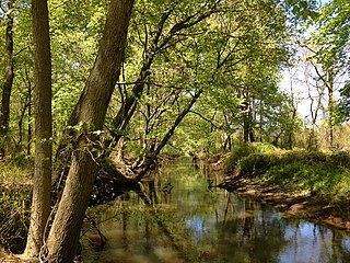
Cold Spring Creek is a river in Delaware County, New York. It originates from Clarks Pond and flows south before converging with the West Branch Delaware River in Stilesville.
Delaware Lake is a small lake north of Long Eddy in Delaware County, New York. It drains south via an unnamed creek which flows into Hoolihan Brook. It was once referred to as Perch Pond
Trask Pond is a small lake southwest of Rock Rift in Delaware County, New York. It drains south via an unnamed creek that flows into Read Creek, which flows into the East Branch Delaware River. Merrick Pond is located west and Rock Rift Mountain is located east of Trask Pond.
Teed Pond is a small lake located north-northeast of the hamlet of Loomis in Delaware County, New York. It drains south via Loomis Brook which flows into the Cannonsville Reservoir.
Beales Pond is a small lake located south of the hamlet of Masonville in Delaware County, New York. Beales Pond drains south via East Branch Cold Spring Creek which flows into Cold Spring Creek, which flows into the West Branch Delaware River.
Busfield Pond is a small lake located north of Hancock in Delaware County, New York. Busfield Pond drains south via an unnamed creek that flows into Sands Creek.
Hathaway Pond is a small lake located west-southwest of the hamlet of Rock Rift in Delaware County, New York. Hathaway Pond drains south via an unnamed creek that flows into Sands Creek. Russell Lake is located west of Hathaway Pond.
Sand Pond is a small lake located south of the hamlet of French Woods in Delaware County, New York. The pond is also directly adjacent to French Woods Festival Of The Performing Arts. Sand Pond drains south via an unnamed creek that flows into Bouchoux Brook. Pierce Pond is located north of Sand Pond.

The New York–Pennsylvania Joint Interstate Bridge Commission, or simply the Joint Interstate Bridge Commission, is an interstate agency jointly owned by the states of New York and Pennsylvania. The commission was formed in 1919 by the two states to manage the crossings of the Delaware River that connected them. It currently maintains and operates 10 toll-free bridges from the New Jersey–Pennsylvania state line to the end of Pennsylvania and New York's shared border along the Delaware River.
