Clearwater River (Quebec)

Last updated

The Clearwater River (in French: Rivière à l'Eau Claire) is a river flowing on the east shore of Lake Guillaume-Delisle (formerly designated "Richmond Gulf"), which empties into the Hudson Bay. The "Clearwater River" is located in Nunavik, in the west of the Labrador peninsula, in the administrative region of Nord-du-Québec, in Quebec, in Canada. This river drains Clearwater Lake into Lac Guillaume-Delisle.

Richmond Gulf lake

Richmond Gulf is a large triangular-shaped inland bay located on east side of Hudson Bay just above 56th parallel north in Quebec, Canada.

Hudson Bay A large body of saltwater in northeastern Canada

Hudson Bay is a large body of saltwater in northeastern Canada with a surface area of 1,230,000 km2 (470,000 sq mi). It drains a very large area, about 3,861,400 km2 (1,490,900 sq mi), that includes parts of southeastern Nunavut, Saskatchewan, most of Manitoba, Ontario, Quebec and indirectly through smaller passages of water to parts of North Dakota, South Dakota, Minnesota, and Montana. Hudson Bay's southern arm is called James Bay.

Nunavik Proposed autonomous area in Quebec, Canada

Nunavik comprises the northern third of the province of Quebec, Canada in Kativik, part of the Nord-du-Québec region. Covering a land area of 443,684.71 km2 (171,307.62 sq mi) north of the 55th parallel, it is the homeland of the Inuit of Quebec. Almost all of the 12,090 inhabitants of the region, of whom 90% are Inuit, live in fourteen northern villages on the coast of Nunavik and in the Cree reserved land (TC) of Whapmagoostui, near the northern village of Kuujjuarapik.

Contents

Geography

The Clearwater River rises in Clearwater Lake (Lac à l'Eau Claire (Nord-du-Québec)). It flows west for about 70 km and empties into Lake Guillaume-Delisle. This body of water, more properly a gulf, is connected to Hudson Bay on its west side via a narrow channel about 5 km long called "Le Goulet", meaning narrows or bottleneck.

Clearwater Lakes lake in northern Quebec

The Lac à l'Eau Claire, also called the Clearwater Lakes in English, is a calque of Wiyâšâkamî in Northern East Cree and Allait Qasigialingat by the Inuit, are a pair of annular lakes on the Canadian Shield in Quebec, Canada, near Hudson Bay.

The watershed of the river covers 4766 km2. [1]

The gulf and Clearwater Lake are part of the Lakes Guillaume-Delisle-and-Lac à l'Eau Claire National Park. Covering an area of 15,549 km2, [2] the park was officially created in 2012, following an announcement by the Minister of Environment, Wildlife and Parks in Quebec.

Related Research Articles

Labrador Peninsula large peninsula in eastern Canada

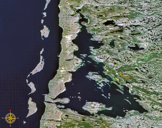
The Labrador Peninsula is a large peninsula in eastern Canada. It is bounded by the Hudson Bay to the west, the Hudson Strait to the north, the Labrador Sea to the east, and the Gulf of Saint Lawrence to the southeast. The peninsula includes the region of Labrador, which is part of the province of Newfoundland and Labrador, and the regions of Saguenay–Lac-Saint-Jean, Côte-Nord, and Nord-du-Québec, which are in the province of Quebec. It has an area of 1,400,000 km2 (541,000 sq mi).

Ashuapmushuan River tributary of Lake Saint-Jean, Saguenay-Lac Saint-Jean, Quebec, Canada

The Ashuapmushuan River is a river in the Saguenay–Lac-Saint-Jean region of the Canadian provinces of Quebec. It starts at the outlet of Lake Ashuapmushuan, and flows first in a north-easterly direction for about 30 kilometres (19 mi) whereafter it continues south-east to Saint-Félicien. There it drains into Lac Saint-Jean of which it is the third largest tributary after the Peribonka and Mistassini Rivers. The river is 181 kilometres (112 mi) long but its source is 266 kilometres (165 mi) from its mouth.

Eau Claire is the name of a number of locations and features in North America. The name is pronounced as if it were spelled "O'Clare".

Rivière du Loup (Bas-Saint-Laurent) river in Bas-Saint-Laurent, Quebec, Canada

The Rivière du Loup is a river in eastern Quebec, Canada, which empties on the south shore of Saint Lawrence River at the city of Rivière-du-Loup, which is part of the regional county municipality (RCM) Rivière-du-Loup, in the administrative region of Bas-Saint-Laurent.

Umiujaq Northern village municipality in Quebec, Canada

Umiujaq is a northern village near the eastern shore of Hudson Bay in Nunavik in northern Quebec, Canada. The village was established in 1986 by Inuit from Kuujjuarapik, 160 km to the south, who decided to relocate away from the area affected by the James Bay Hydro-electric Project. The population in the Canada 2016 Census was 442.

Lake Nemiscau lake in Canada

Lake Nemiscau is a freshwater lake, located in the municipality of Eeyou Istchee James Bay, in the administrative region of Nord-du-Québec, in north-western Quebec, in Canada. The lake Nemiscau is crossed by Rupert River.

Little Whale River river flowing into East coast of Hudsons Bay, in Nunavik, administrative region of Nord-du-Québec, in Quebec, in Canada

The Little Whale River is a river in Nunavik, Quebec, Canada. With an area of 15,900 square kilometres (6,100 sq mi), it is ranked as the 35th largest river basin in Quebec.

The West Branch Little Black River is a short river in Quebec and northern Maine.

Tursujuq National Park

Tursujuq National Park is a National Park of Quebec, Canada. Its creation was announced by the Province of Quebec on December 14, 2012, and officially established on July 18, 2013. Located on the east side of Hudson Bay near the Inuit village of Umiujaq, the park is one of North America's largest, with an area of 26,100 km2. It will be managed by the Kativik Regional Government, which emcompasses most of the Nunavik region of Quebec.

Povungnituk River river in Canada

The Rivière de Puvirnituq is a river in Kativik, Nord-du-Québec, Quebec, Canada. The river flows 389 kilometres (242 mi) from its source at an unnamed lake to Hudson Bay at the village of Puvirnituq. Its watershed encompasses 28,500 square kilometres (11,000 sq mi). The name of the river comes from the Inuktitut "smells like rotten meat."

Nastapoka River tributary of East shore of Hudsons Bay, in administrative region of Nord-du-Québec, in Quebec, in Canada

The Nastapoka River is a tributary of East coast of Hudson Bay, flowing in the administrative region of Nord-du-Québec, in Quebec, Canada. This river is one of the most important river of Nord-du-Québec, the 39th of Quebec because its watershed of 13,400 kilometres (8,326.37 mi).

Lacs des Loups Marins Canadian lake

Lacs des Loups Marins is a lake in the north of the province of Quebec in Canada. It is located about 150 km east of Hudson Bay and about 20 km northeast of Lac à l'Eau Claire.

Nemenjiche Lake Nemenjiche River Head Lake, Obatomagau Lakes Slope, Northern Quebec, Canada

Lake Nemenjiche is a freshwater body of the southern part of Eeyou Istchee Baie-James, in the administrative region of Nord-du-Québec, in the province of Quebec, Canada.

Eau Jaune Lake Lake Eeyou Istchee James Bay (Quebec, Canada)

The Eau Jaune Lake is a freshwater body of the Eeyou Istchee Baie-James, in Jamésie, in the administrative region of Nord-du-Québec, province of Quebec, in Canada. This lake extends entirely into the townships of Brongniart and Rasles.

La Dauversière Lake head lake of the Obatagamau River (Chibougamau, Waswanipi, Bell and Nottaway), Northern Quebec, Canada

The La Dauversière Lake is a freshwater body integrated into a set of lakes designated "Obatogamau Lakes, in the territory of Eeyou Istchee James Bay (municipality), in the administrative region of Nord-du-Québec, province of Quebec, in Canada. This lake extends entirely in the township of La Dauversière.

Chevrier Lake (Obatogamau River) lake (Chibougamau slope, Waswanipi and Nottaway), in Eeyou Istchee Baie-James (Quebec, Canada)

The Chevrier Lake is a freshwater body integrated into a set of lakes designated "Obatogamau Lakes", in the Eeyou Istchee James Bay (municipality) area, in the area of Nord-du-Québec, in the province of Quebec, Canada. This lake extends into the townships of Queylus, La Dauversière, Fancamp and Haüy.

References

  1. Project Tursujuq National Park (PDF; 6.4 MB) Archived November 10, 2013, at the Wayback Machine .
  2. Lakes Guillaume-Delisle-and-Lake à-l'Eau Claire National Park Archived May 13, 2008, at the Wayback Machine .

See also

Coordinates: 56°10′27.23″N75°27′39.49″W / 56.1742306°N 75.4609694°W / 56.1742306; -75.4609694

Geographic coordinate system Coordinate system

A geographic coordinate system is a coordinate system that enables every location on Earth to be specified by a set of numbers, letters or symbols. The coordinates are often chosen such that one of the numbers represents a vertical position and two or three of the numbers represent a horizontal position; alternatively, a geographic position may be expressed in a combined three-dimensional Cartesian vector. A common choice of coordinates is latitude, longitude and elevation. To specify a location on a plane requires a map projection.