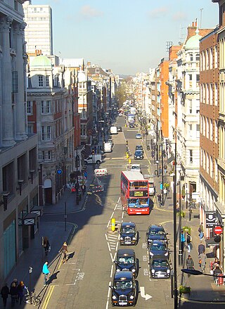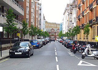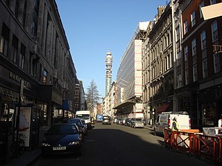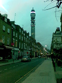
The City of Westminster is a London borough with city status in Greater London, England. It is the site of the United Kingdom's Houses of Parliament and much of the British government. It contains a large part of central London, including most of the West End, such as the major shopping areas around Oxford Street, Regent Street, Piccadilly and Bond Street, and the entertainment district of Soho. Many London landmarks are within the borough, including Buckingham Palace, Westminster Abbey, Whitehall, Westminster Cathedral, 10 Downing Street, and Trafalgar Square.

Paddington is an area in the City of Westminster, in central London, England. A medieval parish then a metropolitan borough of the County of London, it was integrated with Westminster and Greater London in 1965. Paddington station, designed by the engineer Isambard Kingdom Brunel opened in 1847. It is also the site of St Mary's Hospital and the former Paddington Green Police Station.

St John's Wood is a district in the City of Westminster, London, England, about 2.5 miles (4 km) northwest of Charing Cross. Historically the northern part of the ancient parish and Metropolitan Borough of Marylebone, it extends from Regent's Park and Primrose Hill in the east to Edgware Road in the west, with the Swiss Cottage area of Hampstead to the north and Lisson Grove to the south.
Somers Town is an inner-city district in North West London. It has been strongly influenced by the three mainline north London railway termini: Euston (1838), St Pancras (1868) and King's Cross (1852), together with the Midland Railway Somers Town Goods Depot (1887) next to St Pancras, where the British Library now stands. It was named after Charles Cocks, 1st Baron Somers (1725–1806). The area was originally granted by William III to John Somers (1651–1716), Lord Chancellor and Baron Somers of Evesham.

Fitzrovia is a district of central London, England, near the West End. The eastern part of the area is in the London Borough of Camden, and the western in the City of Westminster. It has its roots in the Manor of Tottenham Court, and was urbanised in the 18th century. Its name was coined in the late 1930s by Tom Driberg.

The Metropolitan Borough of St Marylebone was a metropolitan borough of the County of London from 1900 to 1965. It was based directly on the previously existing civil parish of St Marylebone, Middlesex, which was incorporated into the Metropolitan Board of Works area in 1855, retaining a parish vestry, and then became part of the County of London in 1889.

Swiss Cottage is an area of Hampstead in the London Borough of Camden, England. It is centred on the junction of Avenue Road and Finchley Road and includes Swiss Cottage tube station. Swiss Cottage lies 3.25 miles (5.23 km) north-northwest of Charing Cross. The area was named after a public house in the centre of it, known as "Ye Olde Swiss Cottage".

Great Portland Street is a road in the West End of London which links Oxford Street with the A501 Marylebone Road. A commercial street, it divides Fitzrovia, to the east, from Marylebone to the west. It delineates areas with contrasting identities, the west at strongest in grandiose Portland Place and Harley Street, the east at strongest in artists' and independent businesses of Fitzrovia.

Great Titchfield Street is a street in the West End of London. It runs north from Oxford Street to Greenwell Street, just short of the busy A501 Marylebone Road and Euston Road. It lies within the informally designated London area of Fitzrovia. In administrative terms it is in the City of Westminster. It lies within their designated East Marylebone Conservation Area in the former Metropolitan Borough of St Marylebone.

Charlotte Street is a street in Fitzrovia, historically part of the parish and borough of St Pancras, in central London. It has been described, together with its northern and southern extensions, as the spine of Fitzrovia.

Marylebone is an area in London, England and is located in the City of Westminster. It is in Central London and part of the West End. Oxford Street forms its southern boundary.

Hallam Street is a road situated in the Parish of St Marylebone and London's West End. In administrative terms, it lies within the City of Westminster's West End Ward as well as the Harley Street Conservation Area. Formerly named both Charlotte Street and Duke Street, it was renamed in the early 1900s after Henry Hallam (1777–1859), a noted historian who had been a local resident, and his son Arthur Henry Hallam (1811–1833), poet and the subject of Tennyson's elegy In Memoriam.

Bolsover Street is in the Parish of St Marylebone in London's West End. In administrative terms it lies within the City of Westminster's West End Ward and is partly in the Harley Street Conservation Area whilst also sitting on the edges of the Regents Park and East Marylebone Conservation Areas.

The Cleveland Street Workhouse is a Georgian property in Cleveland Street, Marylebone, built between 1775 and 1778 for the care of the sick and poor of the parish of St Paul Covent Garden under the Old Poor Law. From 1836, it became the workhouse of the Strand Union of parishes. The building remained in operation until 2005 after witnessing the complex evolution of the healthcare system in England. After functioning as a workhouse, the building became a workhouse infirmary before being acquired by the Middlesex Hospital and finally falling under the NHS. In the last century it was known as the Middlesex Hospital Annexe and the Outpatient Department. It closed to the public in 2005 and it has since been vacated. On 14 March 2011 the entire building became Grade II Listed. Development of the site began in 2019 by current owner University College London Hospitals (UCLH) Charity as a mixed-use development including residential, commercial and open space, but construction has been held up by the necessity to remove human remains stemming from the use of the area around the workhouse as a parish burial ground between 1780 and 1853. There has also been controversy about the amount of social housing to be included in the development.

Berners Street is a thoroughfare located to the north of Oxford Street in the City of Westminster in the West End of London, originally developed as a residential street in the mid-18th century by property developer William Berners, and later devoted to larger commercial and semi-industrial buildings or mansion blocks of flats. It has associations with Charles Dickens, and was the location of makers of musical instruments including pianos and harps, as well as furniture and film-makers.

Weymouth Street lies in the Marylebone district of the City of Westminster and connects Marylebone High Street with Great Portland Street. The area was developed in the late 18th century by Henrietta Cavendish Holles and her husband Edward Harley, 2nd Earl of Oxford. This part of Marylebone was noted to part of Manor of Tyburn and dates back to the year 1086.

Greenwell Street, formerly Buckingham Street, is located in the East Marylebone district of the City of Westminster in London. It was built in the late eighteenth century and runs between Bolsover Street in the east and Cleveland Street in the west. Great Titchfield Street joins it on its south side. On the south side is the grade II listed George and Dragon public house (c.1850) and the site of the home of the sculptor John Flaxman, the location of which is marked by a plaque.

Homer Street is a quiet one-way street in the Marylebone neighbourhood of the City of Westminster, London. It runs from Old Marylebone Road in the north to Crawford Street in the south. The street is part of the Marylebone Ward of Westminster City Council. Its postcode is W1H.

Margaret Street is a street that straddles the Marylebone and Fitzrovia areas of the City of Westminster in the West End of London, running from Cavendish Square to Wells Street via Regent Street (A4201), Great Portland Street, and Great Titchfield Street. It is north of and parallel to the major shopping street, Oxford Street. John Prince's Street runs between Margaret Street and Oxford Street.


